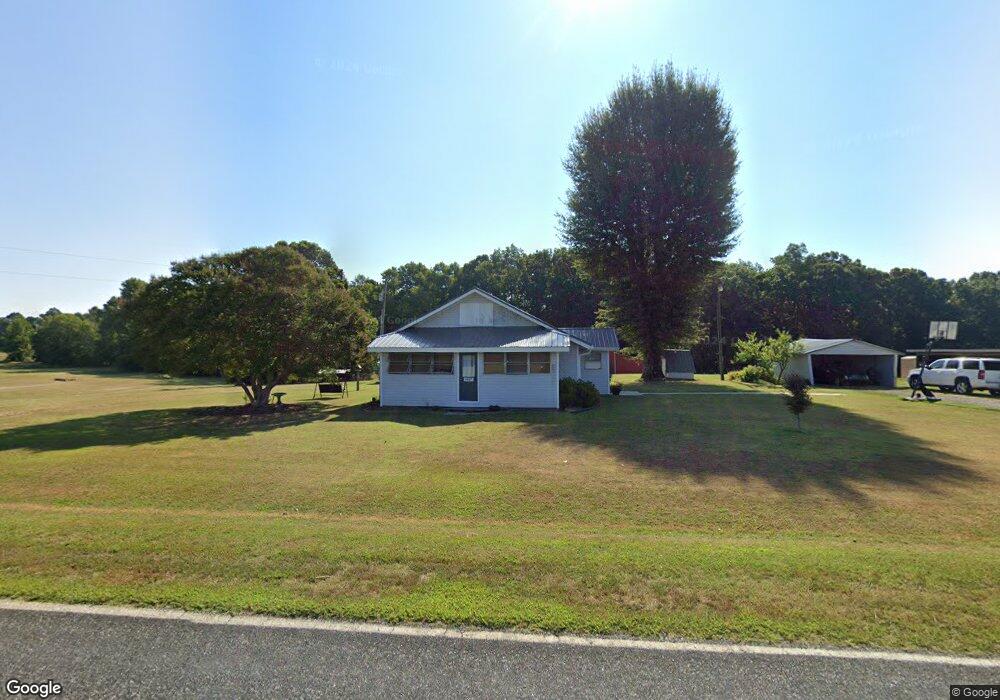
2037 Johnstown Rd Lincolnton, NC 28092
Estimated Value: $302,000 - $513,000
3
Beds
1
Bath
1,390
Sq Ft
$273/Sq Ft
Est. Value
About This Home
This home is located at 2037 Johnstown Rd, Lincolnton, NC 28092 and is currently estimated at $379,333, approximately $272 per square foot. 2037 Johnstown Rd is a home with nearby schools including Norris S. Childers Elementary School, West Lincoln Middle, and West Lincoln High School.
Ownership History
Date
Name
Owned For
Owner Type
Purchase Details
Closed on
Jan 25, 2018
Sold by
Scronce Bobby Gene
Bought by
Richard Sharrian S
Current Estimated Value
Home Financials for this Owner
Home Financials are based on the most recent Mortgage that was taken out on this home.
Original Mortgage
$431,678
Outstanding Balance
$365,040
Interest Rate
3.93%
Mortgage Type
Unknown
Estimated Equity
$14,293
Purchase Details
Closed on
Nov 24, 2004
Bought by
Scronce Bobby G and Geraldine Scronce
Create a Home Valuation Report for This Property
The Home Valuation Report is an in-depth analysis detailing your home's value as well as a comparison with similar homes in the area
Home Values in the Area
Average Home Value in this Area
Purchase History
| Date | Buyer | Sale Price | Title Company |
|---|---|---|---|
| Richard Sharrian S | -- | None Available | |
| Scronce Bobby G | $220,000 | -- |
Source: Public Records
Mortgage History
| Date | Status | Borrower | Loan Amount |
|---|---|---|---|
| Open | Richard Sharrian S | $431,678 |
Source: Public Records
Tax History Compared to Growth
Tax History
| Year | Tax Paid | Tax Assessment Tax Assessment Total Assessment is a certain percentage of the fair market value that is determined by local assessors to be the total taxable value of land and additions on the property. | Land | Improvement |
|---|---|---|---|---|
| 2025 | $2,004 | $552,659 | $350,885 | $201,774 |
| 2024 | $1,964 | $552,659 | $350,885 | $201,774 |
| 2023 | $1,954 | $552,659 | $350,885 | $201,774 |
| 2022 | $1,515 | $347,383 | $228,886 | $118,497 |
| 2021 | $1,515 | $347,383 | $228,886 | $118,497 |
| 2020 | $1,253 | $347,383 | $228,886 | $118,497 |
| 2019 | $1,253 | $347,383 | $228,886 | $118,497 |
| 2018 | $1,266 | $282,063 | $185,442 | $96,621 |
| 2017 | $1,064 | $282,063 | $185,442 | $96,621 |
| 2016 | $1,064 | $282,063 | $185,442 | $96,621 |
| 2015 | $1,211 | $282,063 | $185,442 | $96,621 |
| 2014 | -- | $299,070 | $197,072 | $101,998 |
Source: Public Records
Map
Nearby Homes
- 2124 Shoal Rd
- 5740 Crouse Rd
- 2488 Shoal Rd
- 5199 Helms End of Trail
- 00 Flay Rd
- 4850 Gideon Dr
- 5118 Flay Rd
- 4832 Gideon Dr
- 000 Leonards Fork Church Rd
- 00 N Carolina 182
- 2449 Leonhardt Rd
- 1357 Malden Ct
- 1000 Creekside Dr
- 1564 Saddlewood Rd
- 2006 Kollege Ln
- 00 Star Ln Unit 1
- 1084 Lyndsey Brook Ct
- 3103 Richview Dr
- 1074 Lyndsey Brook Ct
- 00 McCurry Farm Ln Unit F1 & F2
- 2014 Johnstown Rd
- 1962 Johnstown Rd
- 2122 Johnstown Rd
- 1958 Johnstown Rd
- 1940 Johnstown Rd
- 1952 Shoal Rd
- 2151 Johnstown Rd
- 1950 Johnstown Rd
- 2163 Johnstown Rd
- 1920 Johnstown Rd
- 2014 Shoal Rd
- 2078 Shoal Rd
- 2158 Johnstown Rd
- 2034 Shoal Rd
- 1901 Shoal Rd
- 4093 Highway 182
- 4105 Highway 182
- 4077 Highway 182
- 4119 Highway 182
- 1981 Shoal Rd