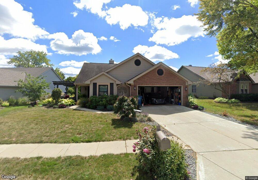
2037 Suda Dr Indianapolis, IN 46280
Downtown Carmel NeighborhoodEstimated Value: $345,000 - $404,000
2
Beds
2
Baths
1,489
Sq Ft
$254/Sq Ft
Est. Value
About This Home
This home is located at 2037 Suda Dr, Indianapolis, IN 46280 and is currently estimated at $378,670, approximately $254 per square foot. 2037 Suda Dr is a home located in Hamilton County with nearby schools including Forest Dale Elementary School, Carmel Middle School, and Carmel High School.
Ownership History
Date
Name
Owned For
Owner Type
Purchase Details
Closed on
Dec 3, 2019
Sold by
Meimberg Donna D and The Estate Ofjay Meimberg
Bought by
Wilson Phyllis Lynn and The Wilson Revocable Living Trust
Current Estimated Value
Purchase Details
Closed on
Dec 8, 2016
Sold by
Meimberg Jay and Meimberg Julie
Bought by
Meimberg Jay
Home Financials for this Owner
Home Financials are based on the most recent Mortgage that was taken out on this home.
Original Mortgage
$185,940
Interest Rate
4.2%
Mortgage Type
VA
Purchase Details
Closed on
Nov 18, 2005
Sold by
Leveque Barbara F
Bought by
Meimberg Jay and Meimberg Julie
Home Financials for this Owner
Home Financials are based on the most recent Mortgage that was taken out on this home.
Original Mortgage
$193,171
Interest Rate
6.17%
Mortgage Type
VA
Purchase Details
Closed on
Feb 4, 2005
Sold by
Brown Shirley M
Bought by
Brown Shirley M and Shirley M Brown Revocable Living Trust
Create a Home Valuation Report for This Property
The Home Valuation Report is an in-depth analysis detailing your home's value as well as a comparison with similar homes in the area
Home Values in the Area
Average Home Value in this Area
Purchase History
| Date | Buyer | Sale Price | Title Company |
|---|---|---|---|
| Wilson Phyllis Lynn | -- | None Available | |
| Meimberg Jay | -- | Service Link | |
| Meimberg Jay | -- | -- | |
| Brown Shirley M | -- | -- |
Source: Public Records
Mortgage History
| Date | Status | Borrower | Loan Amount |
|---|---|---|---|
| Previous Owner | Meimberg Jay | $185,940 | |
| Previous Owner | Meimberg Jay | $193,171 |
Source: Public Records
Tax History Compared to Growth
Tax History
| Year | Tax Paid | Tax Assessment Tax Assessment Total Assessment is a certain percentage of the fair market value that is determined by local assessors to be the total taxable value of land and additions on the property. | Land | Improvement |
|---|---|---|---|---|
| 2024 | $2,675 | $297,500 | $91,400 | $206,100 |
| 2022 | $2,675 | $244,500 | $66,400 | $178,100 |
| 2021 | $2,053 | $204,200 | $66,400 | $137,800 |
| 2020 | $2,083 | $202,900 | $46,800 | $156,100 |
| 2019 | $1,814 | $191,200 | $46,700 | $144,500 |
| 2018 | $1,695 | $183,200 | $46,700 | $136,500 |
| 2017 | $1,635 | $176,500 | $46,700 | $129,800 |
| 2016 | $1,621 | $176,500 | $46,700 | $129,800 |
| 2014 | $1,411 | $165,300 | $46,700 | $118,600 |
| 2013 | $1,411 | $168,400 | $46,700 | $121,700 |
Source: Public Records
Map
Nearby Homes
- 9868 Morningstar Ln
- 9858 Morningstar Ln
- 9876 Woodbriar Ln
- 9864 Northern Lights Ln
- 1512 Evenstar Blvd
- 10307 Orchard Park Dr S
- 10465 Woodlawn Dr
- 2894 Brooks Bend Dr
- 9732 San Marco Pass
- 9634 Maple Dr
- 10155 Orchard Park Dr W
- 1232 Shadow Ridge Rd
- 2516 Colony Ct
- 9704 Rialto Trail
- 1184 Shadow Ridge Rd
- 1160 Shadow Ridge Rd
- 9784 Herons Cove
- 10398 Ethel St
- 9790 Herons Cove
- 1120 Falcon Ridge