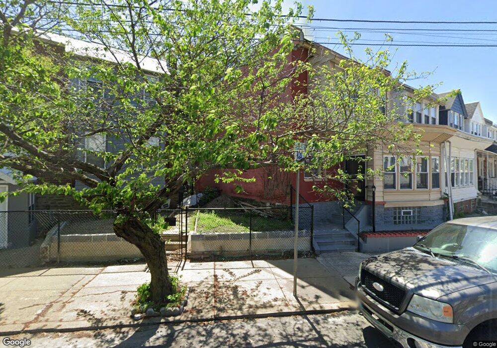
2038 65th Ave Philadelphia, PA 19138
East Germantown NeighborhoodEstimated Value: $179,000 - $217,705
3
Beds
1
Bath
1,420
Sq Ft
$139/Sq Ft
Est. Value
About This Home
This home is located at 2038 65th Ave, Philadelphia, PA 19138 and is currently estimated at $196,676, approximately $138 per square foot. 2038 65th Ave is a home located in Philadelphia County with nearby schools including Prince Hall School, Gen. Louis Wagner Middle School, and Martin Luther King High School.
Ownership History
Date
Name
Owned For
Owner Type
Purchase Details
Closed on
Apr 12, 2007
Sold by
Clarke Alphanso and Clarke Dorothy
Bought by
Clarke Colin C and Clarke Sharon P
Current Estimated Value
Home Financials for this Owner
Home Financials are based on the most recent Mortgage that was taken out on this home.
Original Mortgage
$68,850
Outstanding Balance
$41,560
Interest Rate
6.21%
Mortgage Type
Purchase Money Mortgage
Estimated Equity
$155,116
Create a Home Valuation Report for This Property
The Home Valuation Report is an in-depth analysis detailing your home's value as well as a comparison with similar homes in the area
Home Values in the Area
Average Home Value in this Area
Purchase History
| Date | Buyer | Sale Price | Title Company |
|---|---|---|---|
| Clarke Colin C | $76,500 | None Available |
Source: Public Records
Mortgage History
| Date | Status | Borrower | Loan Amount |
|---|---|---|---|
| Open | Clarke Colin C | $68,850 |
Source: Public Records
Tax History Compared to Growth
Tax History
| Year | Tax Paid | Tax Assessment Tax Assessment Total Assessment is a certain percentage of the fair market value that is determined by local assessors to be the total taxable value of land and additions on the property. | Land | Improvement |
|---|---|---|---|---|
| 2026 | $1,872 | $173,400 | $34,680 | $138,720 |
| 2025 | $1,872 | $173,400 | $34,680 | $138,720 |
| 2024 | $1,872 | $173,400 | $34,680 | $138,720 |
| 2023 | $1,872 | $133,700 | $26,740 | $106,960 |
| 2022 | $1,354 | $133,700 | $26,740 | $106,960 |
| 2021 | $1,354 | $0 | $0 | $0 |
| 2020 | $1,354 | $0 | $0 | $0 |
| 2019 | $1,414 | $0 | $0 | $0 |
| 2018 | $1,321 | $0 | $0 | $0 |
| 2017 | $1,321 | $0 | $0 | $0 |
| 2016 | $1,321 | $0 | $0 | $0 |
| 2015 | $1,379 | $0 | $0 | $0 |
| 2014 | -- | $102,900 | $7,748 | $95,152 |
| 2012 | -- | $12,896 | $2,575 | $10,321 |
Source: Public Records
Map
Nearby Homes
- 1914 W 65th Ave
- 6420 N Woodstock St
- 6419 Limekiln Pike
- 6436 N 20th St
- 2012 E Chelten Ave
- 6534 N Lambert St
- 6558 Limekiln Pike
- 6329 N Woodstock St
- 2022 66th Ave
- 1916 Colonial St
- 6321 N 21st St
- 6600 N Opal St
- 6436 Ogontz Ave
- 1955 Medary Ave
- 2105 Stenton Ave
- 6518 Ogontz Ave
- 2115 Stenton Ave
- 6603 N 21st St
- 2120 66th Ave
- 2125 Stenton Ave
- 2040 65th Ave
- 6442 Limekiln Pike
- 2042 65th Ave
- 2042 W 65th Ave
- 6440 Limekiln Pike
- 2044 65th Ave
- 6438 Limekiln Pike
- 2046 65th Ave
- 6436 Limekiln Pike
- 2048 65th Ave
- 6434 Limekiln Pike
- 6433 N Woodstock St
- 2050 65th Ave
- 6432 Limekiln Pike
- 6431 N Woodstock St
- 2012 W 65th Ave
- 6500 Limekiln Pike
- 6430 Limekiln Pike
- 6429 N Woodstock St
- 6427 N Woodstock St