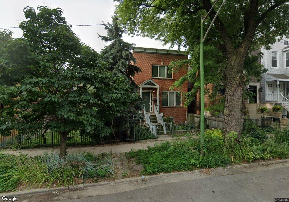
2039 W Moffat St Chicago, IL 60647
Bucktown NeighborhoodEstimated Value: $1,136,000 - $1,551,000
3
Beds
3
Baths
1,704
Sq Ft
$764/Sq Ft
Est. Value
About This Home
This home is located at 2039 W Moffat St, Chicago, IL 60647 and is currently estimated at $1,302,317, approximately $764 per square foot. 2039 W Moffat St is a home located in Cook County with nearby schools including Pulaski Intl School of Chicago, Wells Community Academy High School, and CICS - Bucktown Campus.
Ownership History
Date
Name
Owned For
Owner Type
Purchase Details
Closed on
Dec 19, 2003
Sold by
Bergant Eva M
Bought by
Bergant Eva M and Janousky Sherri
Current Estimated Value
Purchase Details
Closed on
Jun 3, 2003
Sold by
Cole Taylor Bank
Bought by
Bergant Eva M and Janousky Sherri
Purchase Details
Closed on
Aug 20, 1996
Sold by
Bergant Eva M and Janousky Sherri R
Bought by
Corus Bank and Trust #3428
Home Financials for this Owner
Home Financials are based on the most recent Mortgage that was taken out on this home.
Original Mortgage
$228,000
Interest Rate
7.62%
Purchase Details
Closed on
Aug 15, 1996
Sold by
Kaniff Patrick
Bought by
Bergant Eva M and Janousky Sherri R
Home Financials for this Owner
Home Financials are based on the most recent Mortgage that was taken out on this home.
Original Mortgage
$228,000
Interest Rate
7.62%
Purchase Details
Closed on
Oct 21, 1994
Sold by
Thorne Mary Jane
Bought by
Kaniff Patrick
Create a Home Valuation Report for This Property
The Home Valuation Report is an in-depth analysis detailing your home's value as well as a comparison with similar homes in the area
Home Values in the Area
Average Home Value in this Area
Purchase History
| Date | Buyer | Sale Price | Title Company |
|---|---|---|---|
| Bergant Eva M | -- | -- | |
| Bergant Eva M | -- | -- | |
| Corus Bank | -- | -- | |
| Bergant Eva M | $285,000 | -- | |
| Kaniff Patrick | $55,000 | Lawyers Title Insurance Corp |
Source: Public Records
Mortgage History
| Date | Status | Borrower | Loan Amount |
|---|---|---|---|
| Previous Owner | Bergant Eva M | $228,000 |
Source: Public Records
Tax History Compared to Growth
Tax History
| Year | Tax Paid | Tax Assessment Tax Assessment Total Assessment is a certain percentage of the fair market value that is determined by local assessors to be the total taxable value of land and additions on the property. | Land | Improvement |
|---|---|---|---|---|
| 2024 | $16,238 | $88,000 | $20,880 | $67,120 |
| 2023 | $15,805 | $80,000 | $16,800 | $63,200 |
| 2022 | $15,805 | $80,000 | $16,800 | $63,200 |
| 2021 | $15,468 | $80,000 | $16,800 | $63,200 |
| 2020 | $14,472 | $67,833 | $10,920 | $56,913 |
| 2019 | $14,176 | $73,732 | $10,920 | $62,812 |
| 2018 | $13,886 | $73,732 | $10,920 | $62,812 |
| 2017 | $10,439 | $51,870 | $9,600 | $42,270 |
| 2016 | $9,889 | $51,870 | $9,600 | $42,270 |
| 2015 | $9,024 | $51,870 | $9,600 | $42,270 |
| 2014 | $8,573 | $48,776 | $8,400 | $40,376 |
| 2013 | $8,393 | $48,776 | $8,400 | $40,376 |
Source: Public Records
Map
Nearby Homes
- 1951 W Cortland St Unit 3
- 2111 W Churchill St Unit 105
- 1925 N Damen Ave Unit 1
- 2032 W Homer St
- 1931 N Damen Ave Unit 2S
- 2035 W Saint Paul Ave
- 1867 N Leavitt St
- 1732 N Winchester Ave
- 1701 N Damen Ave Unit 107
- 2135 W Armitage Ave
- 1804 N Leavitt St
- 1936 W Armitage Ave Unit 3E
- 1832 N Wilmot Ave Unit A
- 2138 W Caton St
- 1835 N Milwaukee Ave Unit 301
- 2201 W Wabansia Ave Unit 11
- 1724 N Winnebago Ave Unit B
- 1951 W Dickens Ave
- 2219 W Wabansia Ave Unit 3
- 2113 W Concord Place
- 2041 W Moffat St
- 2037 W Moffat St
- 2043 W Moffat St
- 2033 W Moffat St Unit 1
- 2045 W Moffat St
- 2031 W Moffat St Unit 1
- 2031 W Moffat St
- 2031 W Moffat St Unit 4
- 2031 W Moffat St Unit 2
- 2031 W Moffat St Unit 3
- 2031 W Moffat St
- 2031 W Moffat St Unit 2 EA
- 2047 W Moffat St
- 2029 W Moffat St
- 2034 W Churchill St
- 2040 W Churchill St
- 2040 W Churchill St Unit 1
- 2027 W Moffat St
- 2032 W Churchill St
- 2042 W Churchill St