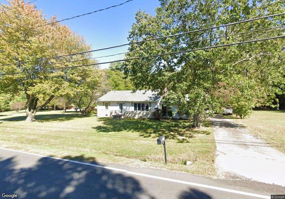
204 Ashland St Archdale, NC 27263
Estimated Value: $175,000 - $225,000
--
Bed
1
Bath
1,240
Sq Ft
$152/Sq Ft
Est. Value
About This Home
This home is located at 204 Ashland St, Archdale, NC 27263 and is currently estimated at $188,814, approximately $152 per square foot. 204 Ashland St is a home located in Randolph County with nearby schools including Archdale Elementary School, Wheatmore Middle School, and Trinity High School.
Ownership History
Date
Name
Owned For
Owner Type
Purchase Details
Closed on
Apr 28, 2016
Sold by
Smith Lois C and The Lois Smith Living Trust
Bought by
Michael Linda S and Michael James H
Current Estimated Value
Home Financials for this Owner
Home Financials are based on the most recent Mortgage that was taken out on this home.
Original Mortgage
$60,000
Outstanding Balance
$47,744
Interest Rate
3.73%
Mortgage Type
New Conventional
Estimated Equity
$141,070
Purchase Details
Closed on
Oct 31, 2007
Sold by
Smith Lois C
Bought by
Smith Lois C
Create a Home Valuation Report for This Property
The Home Valuation Report is an in-depth analysis detailing your home's value as well as a comparison with similar homes in the area
Home Values in the Area
Average Home Value in this Area
Purchase History
| Date | Buyer | Sale Price | Title Company |
|---|---|---|---|
| Michael Linda S | $75,000 | None Available | |
| Smith Lois C | -- | None Available | |
| Smith Lois C | -- | None Available |
Source: Public Records
Mortgage History
| Date | Status | Borrower | Loan Amount |
|---|---|---|---|
| Open | Michael Linda S | $60,000 |
Source: Public Records
Tax History Compared to Growth
Tax History
| Year | Tax Paid | Tax Assessment Tax Assessment Total Assessment is a certain percentage of the fair market value that is determined by local assessors to be the total taxable value of land and additions on the property. | Land | Improvement |
|---|---|---|---|---|
| 2025 | $1,365 | $130,460 | $41,430 | $89,030 |
| 2024 | $1,352 | $130,460 | $41,430 | $89,030 |
| 2023 | $1,355 | $130,460 | $41,430 | $89,030 |
| 2022 | $1,150 | $95,940 | $35,320 | $60,620 |
| 2021 | $1,139 | $95,940 | $35,320 | $60,620 |
| 2020 | $1,113 | $95,940 | $35,320 | $60,620 |
| 2019 | $1,113 | $95,940 | $35,320 | $60,620 |
| 2018 | $1,032 | $86,860 | $34,400 | $52,460 |
| 2016 | $1,076 | $86,859 | $34,400 | $52,459 |
| 2015 | $1,078 | $92,424 | $34,400 | $58,024 |
| 2014 | -- | $92,424 | $34,400 | $58,024 |
Source: Public Records
Map
Nearby Homes
- 10812, 10822, 10828 N Main St
- 0 Interstate Dr
- 118 Rand Blvd
- 510 Aldridge Rd
- 204 Aldridge Ln
- 10844 N Main St
- 512 Dale St
- 1206 Byron Ln
- 0 Sprucewood Ct
- 104 Autumn Hill Ct
- 108 Sprucewood Ct
- 1846 Sechrest Cir
- 0-A Us Highway 311
- 3706 Archdale Rd
- 3511 Archdale Rd
- 3820 David St
- 3827 Wood Ave
- 1020 Westbrook Ct
- 2616 R1 Ingram Rd
- 1843 Weant Rd
- 205 Ashland St
- 203 Ashland St
- 207 Ashland St
- 145 Pinecrest Dr
- 126 Ashland St
- 127 Ashland St
- 139 Pinecrest Dr
- 208 Ashland St
- 122 Ashland St
- 137 Pinecrest Dr
- 138 Pinecrest Dr
- 125 Ashland St
- 213 Ashland St
- 118 Ashland St
- 129 Pinecrest Dr
- 129 1/2 Pinecrest Dr
- 121 Ashland St
- 134 Pinecrest Dr
- 119 Ashland St
- 212 Ashland St