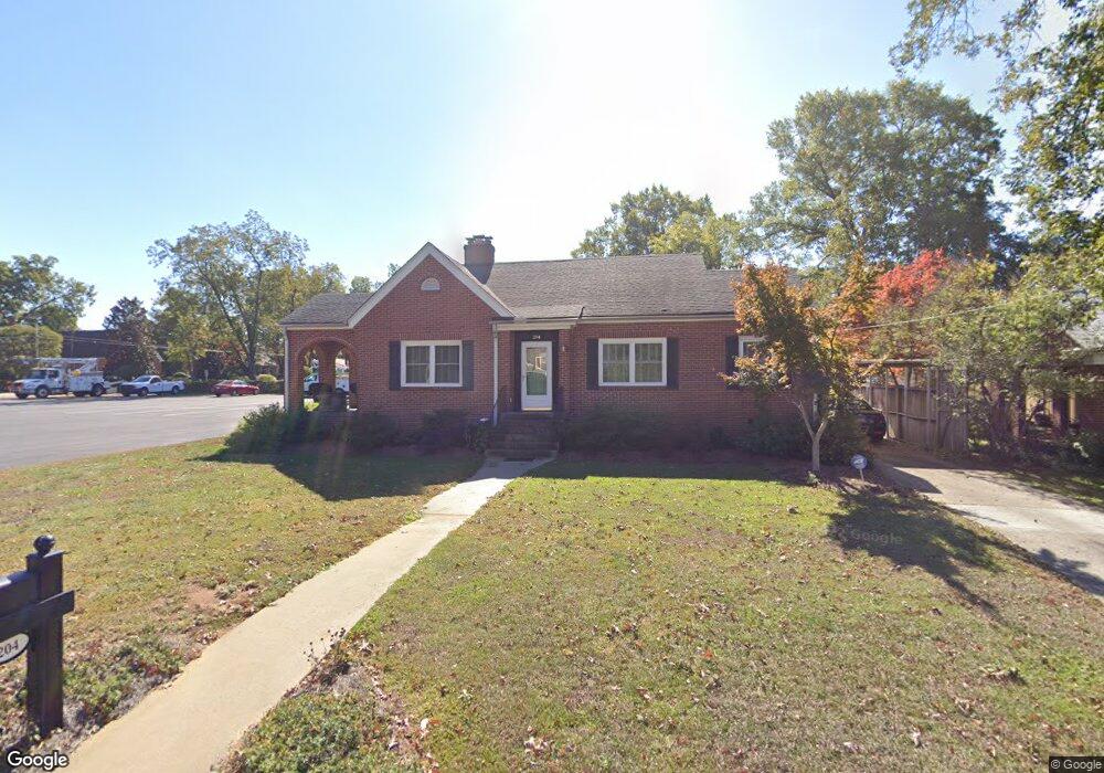
204 Broad St Anderson, SC 29621
Estimated Value: $170,000 - $216,000
2
Beds
1
Bath
1,200
Sq Ft
$163/Sq Ft
Est. Value
About This Home
This home is located at 204 Broad St, Anderson, SC 29621 and is currently estimated at $195,154, approximately $162 per square foot. 204 Broad St is a home located in Anderson County with nearby schools including Concord Elementary School, McCants Middle School, and T.L. Hanna High School.
Ownership History
Date
Name
Owned For
Owner Type
Purchase Details
Closed on
Jun 10, 2011
Sold by
Wiley Richard Brent
Bought by
Poore Donna B
Current Estimated Value
Home Financials for this Owner
Home Financials are based on the most recent Mortgage that was taken out on this home.
Original Mortgage
$105,730
Outstanding Balance
$73,433
Interest Rate
4.79%
Mortgage Type
New Conventional
Estimated Equity
$121,721
Purchase Details
Closed on
Jun 27, 2008
Sold by
Kendall Wilson David and Kendall Susan Lois
Bought by
Wiley Richard Brent
Home Financials for this Owner
Home Financials are based on the most recent Mortgage that was taken out on this home.
Original Mortgage
$99,317
Interest Rate
5.97%
Mortgage Type
FHA
Purchase Details
Closed on
Jul 20, 2007
Sold by
Cooper Paul and Cooper Debbie
Bought by
Kendall Wilson David and Kendall Susan Lois
Create a Home Valuation Report for This Property
The Home Valuation Report is an in-depth analysis detailing your home's value as well as a comparison with similar homes in the area
Home Values in the Area
Average Home Value in this Area
Purchase History
| Date | Buyer | Sale Price | Title Company |
|---|---|---|---|
| Poore Donna B | $109,000 | -- | |
| Wiley Richard Brent | $103,000 | -- | |
| Kendall Wilson David | $95,000 | Attorney |
Source: Public Records
Mortgage History
| Date | Status | Borrower | Loan Amount |
|---|---|---|---|
| Open | Poore Donna B | $105,730 | |
| Previous Owner | Wiley Richard Brent | $99,317 |
Source: Public Records
Tax History Compared to Growth
Tax History
| Year | Tax Paid | Tax Assessment Tax Assessment Total Assessment is a certain percentage of the fair market value that is determined by local assessors to be the total taxable value of land and additions on the property. | Land | Improvement |
|---|---|---|---|---|
| 2024 | $2,012 | $4,620 | $770 | $3,850 |
| 2023 | $2,012 | $4,620 | $770 | $3,850 |
| 2022 | $1,047 | $4,620 | $770 | $3,850 |
| 2021 | $998 | $4,200 | $770 | $3,430 |
| 2020 | $995 | $4,200 | $770 | $3,430 |
| 2019 | $995 | $4,200 | $770 | $3,430 |
| 2018 | $1,004 | $4,200 | $770 | $3,430 |
| 2017 | -- | $4,200 | $770 | $3,430 |
| 2016 | $1,038 | $4,300 | $840 | $3,460 |
| 2015 | $1,049 | $4,300 | $840 | $3,460 |
| 2014 | $1,044 | $4,300 | $840 | $3,460 |
Source: Public Records
Map
Nearby Homes
- 211 Cater St
- 208 Cater St
- 0 High Shoals Rd
- 705 E Mauldin St
- 401 Berkshire Hill
- 406 Moultrie Square
- 220 Moultrie Square
- 1014 Tribble St
- 1008 Tribble St
- 504 Piedmont Ave
- 228 Santorini Way
- 1212 W End Ave
- 1105 W End Ave
- 2010 Boulevard Heights
- 707 Windsor Dr
- 607 Piedmont Ave
- 703 E Calhoun St
- 1102 Greenacres
- 2014 College Ave
- 1808 Edgewood Ave
- 202 Broad St
- 205 Peachtree St
- 200 Broad St
- 207 Peachtree St
- 203 Peachtree St
- 205 E Broad St
- 205 Broad St
- 205 Broad St
- 209 Peachtree St
- 201 Peachtree St
- 205 Broad Stree 205 Broad St
- 205 Broad St
- 203 Broad St
- 201 Broad St
- 300 Broad St
- 209 Broad St
- 108 E Broad St
- 108 Broad St
- 109 Peachtree St
- 109 Broad St