Estimated Value: $739,735 - $918,000
4
Beds
2
Baths
2,248
Sq Ft
$357/Sq Ft
Est. Value
About This Home
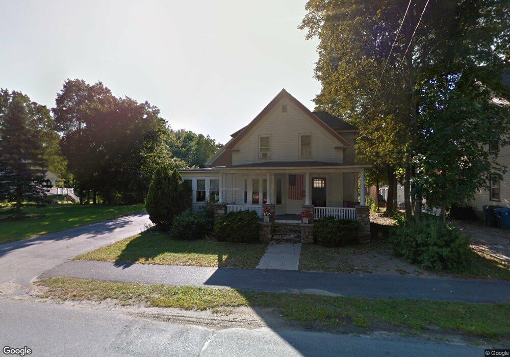
This home is located at 204 Central St, Acton, MA 01720 and is currently estimated at $801,934, approximately $356 per square foot. 204 Central St is a home located in Middlesex County with nearby schools including Acton-Boxborough Regional High School.
Ownership History
Date
Name
Owned For
Owner Type
Purchase Details
Closed on
Dec 30, 1991
Sold by
Keith Paul D and Keith Nancy L
Bought by
Keith Nancy L
Current Estimated Value
Home Financials for this Owner
Home Financials are based on the most recent Mortgage that was taken out on this home.
Original Mortgage
$55,000
Interest Rate
8.62%
Mortgage Type
Purchase Money Mortgage
Create a Home Valuation Report for This Property
The Home Valuation Report is an in-depth analysis detailing your home's value as well as a comparison with similar homes in the area
Home Values in the Area
Average Home Value in this Area
Purchase History
| Date | Buyer | Sale Price | Title Company |
|---|---|---|---|
| Keith Nancy L | $40,000 | -- |
Source: Public Records
Mortgage History
| Date | Status | Borrower | Loan Amount |
|---|---|---|---|
| Closed | Keith Nancy L | $100,000 | |
| Closed | Keith Nancy L | $65,000 | |
| Closed | Keith Nancy L | $55,000 |
Source: Public Records
Tax History
| Year | Tax Paid | Tax Assessment Tax Assessment Total Assessment is a certain percentage of the fair market value that is determined by local assessors to be the total taxable value of land and additions on the property. | Land | Improvement |
|---|---|---|---|---|
| 2025 | $10,338 | $602,800 | $289,200 | $313,600 |
| 2024 | $10,050 | $602,900 | $289,200 | $313,700 |
| 2023 | $9,935 | $565,800 | $263,100 | $302,700 |
| 2022 | $9,601 | $493,600 | $228,700 | $264,900 |
| 2021 | $9,292 | $459,300 | $211,700 | $247,600 |
| 2020 | $8,927 | $464,000 | $211,700 | $252,300 |
| 2019 | $8,465 | $437,000 | $211,700 | $225,300 |
| 2018 | $8,378 | $432,300 | $211,700 | $220,600 |
| 2017 | $8,089 | $424,400 | $211,700 | $212,700 |
| 2016 | $8,100 | $421,200 | $211,700 | $209,500 |
| 2015 | $7,906 | $415,000 | $211,700 | $203,300 |
| 2014 | $7,764 | $399,200 | $211,700 | $187,500 |
Source: Public Records
Map
Nearby Homes
- 92 Willow St Unit 3
- 92 Willow St Unit 2
- 90 Willow St Unit 1
- 631 Massachusetts Ave Unit 631
- 235 Arlington St
- 20 Joseph Reed Ln
- 6 Beacon Ct
- 246 Main St Unit 2
- 184 Main St Unit 3
- 7 Kelley Rd
- 5 Perkins Ln
- 25 Nylander Way
- 79 Charter Rd
- 131 Main St
- 129 Main St Unit 129
- 280 W Acton Rd
- 4 Littlefield Rd
- 247 W Acton Rd
- 40 High St
- 18 Hayward Rd
Your Personal Tour Guide
Ask me questions while you tour the home.