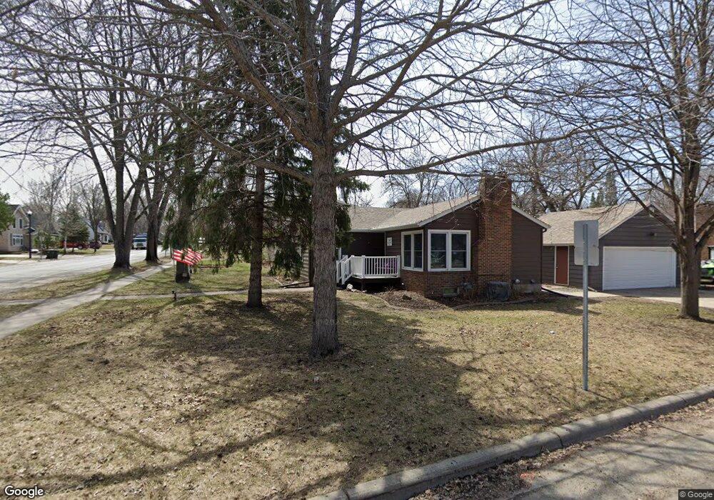
204 Dale St SW Hutchinson, MN 55350
Estimated Value: $239,000 - $290,000
3
Beds
2
Baths
1,118
Sq Ft
$235/Sq Ft
Est. Value
About This Home
This home is located at 204 Dale St SW, Hutchinson, MN 55350 and is currently estimated at $262,173, approximately $234 per square foot. 204 Dale St SW is a home located in McLeod County with nearby schools including Hutchinson West Elementary School, Hutchinson Park Elementary School, and Hutchinson Middle School.
Ownership History
Date
Name
Owned For
Owner Type
Purchase Details
Closed on
Apr 12, 2019
Sold by
Schroeder Isaiah J and Schroeder Melanie A
Bought by
Schroeder Isaiah J and Schroeder Melanie A
Current Estimated Value
Purchase Details
Closed on
Apr 19, 2013
Sold by
Elder Julie M
Bought by
Schroeder Isaiah J
Home Financials for this Owner
Home Financials are based on the most recent Mortgage that was taken out on this home.
Original Mortgage
$142,800
Interest Rate
3.51%
Mortgage Type
Purchase Money Mortgage
Create a Home Valuation Report for This Property
The Home Valuation Report is an in-depth analysis detailing your home's value as well as a comparison with similar homes in the area
Home Values in the Area
Average Home Value in this Area
Purchase History
| Date | Buyer | Sale Price | Title Company |
|---|---|---|---|
| Schroeder Isaiah J | -- | Mcleod County Abstract & Tit | |
| Schroeder Isaiah J | -- | Stewart Title Of Mn Inc Bloo |
Source: Public Records
Mortgage History
| Date | Status | Borrower | Loan Amount |
|---|---|---|---|
| Previous Owner | Schroeder Isaiah J | $142,800 |
Source: Public Records
Tax History Compared to Growth
Tax History
| Year | Tax Paid | Tax Assessment Tax Assessment Total Assessment is a certain percentage of the fair market value that is determined by local assessors to be the total taxable value of land and additions on the property. | Land | Improvement |
|---|---|---|---|---|
| 2024 | $2,828 | $219,500 | $40,500 | $179,000 |
| 2023 | $2,824 | $212,200 | $40,500 | $171,700 |
| 2022 | $2,602 | $204,700 | $38,400 | $166,300 |
| 2021 | $2,412 | $173,800 | $33,600 | $140,200 |
| 2020 | $2,342 | $156,300 | $30,500 | $125,800 |
| 2019 | $2,118 | $149,100 | $30,500 | $118,600 |
| 2018 | $1,896 | $0 | $0 | $0 |
| 2017 | $1,762 | $0 | $0 | $0 |
| 2016 | $1,658 | $0 | $0 | $0 |
| 2015 | $1,492 | $0 | $0 | $0 |
| 2014 | -- | $0 | $0 | $0 |
Source: Public Records
Map
Nearby Homes
- 966 Osgood Ave SW
- 545 4th Ave SW
- 530 Lincoln Ave SW
- 126 Lynn Rd SW
- 230 Lynn Rd SW
- 642 Juul Rd SW
- 667 Madson Ave SW
- 595 Milwaukee Ave SW
- 310 & 312 4th Ave SW
- 570 Lynn Rd SW
- 702 Southview Ct SW
- 1020 Roberts Rd SW
- 724 Southview Dr SW
- 735 Sunset St SW
- 616 Brown St SW
- 569 Glen St SW
- 490 California St NW
- 135 4th Ave SE
- 525 Golf Course Rd NW
- 805 Franklin St SW
- 214 Dale St SW
- 214 214 Dale-Street-sw
- 820 2nd Ave SW
- 817 817 2nd-Avenue-sw
- 226 Dale St SW
- 215 215 Dale-Street-sw
- 205 205 Dale St SW
- 815 2nd Ave SW
- 815 815 2nd Ave SW
- 830 2nd Ave SW
- 801 2nd Ave SW
- 205 Dale St SW
- 215 Dale St SW
- 215 215 Dale-Street-
- 240 240 Dale St SW
- 240 Dale St SW
- 815 Lewis Ave SW
- 775 775 2nd Ave SW
- 225 Dale St SW
- 225 Dale St SW