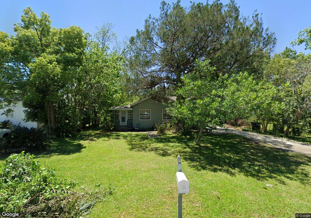
204 E Weed St Unit E Saint Marys, GA 31558
Estimated Value: $265,000 - $368,000
3
Beds
2
Baths
1,525
Sq Ft
$218/Sq Ft
Est. Value
About This Home
This home is located at 204 E Weed St Unit E, Saint Marys, GA 31558 and is currently estimated at $332,763, approximately $218 per square foot. 204 E Weed St Unit E is a home located in Camden County with nearby schools including Saint Marys Elementary School, Saint Marys Middle School, and Camden County High School.
Ownership History
Date
Name
Owned For
Owner Type
Purchase Details
Closed on
Jun 20, 2016
Sold by
Mcdowell Arthur R
Bought by
Levine Laurie Mcdowell
Current Estimated Value
Home Financials for this Owner
Home Financials are based on the most recent Mortgage that was taken out on this home.
Original Mortgage
$90,000
Outstanding Balance
$7,661
Interest Rate
2.81%
Estimated Equity
$325,102
Purchase Details
Closed on
Feb 21, 2012
Sold by
Mcdowell Arthur R
Bought by
Mcdowell Arthur R
Purchase Details
Closed on
Aug 7, 2006
Sold by
Not Provided
Bought by
Mcdowell Elsie Mae M
Create a Home Valuation Report for This Property
The Home Valuation Report is an in-depth analysis detailing your home's value as well as a comparison with similar homes in the area
Home Values in the Area
Average Home Value in this Area
Purchase History
| Date | Buyer | Sale Price | Title Company |
|---|---|---|---|
| Levine Laurie Mcdowell | $100,000 | -- | |
| Mcdowell Arthur R | -- | -- | |
| Mcdowell Elsie Mae M | -- | -- |
Source: Public Records
Mortgage History
| Date | Status | Borrower | Loan Amount |
|---|---|---|---|
| Open | Levine Laurie Mcdowell | $90,000 |
Source: Public Records
Tax History Compared to Growth
Tax History
| Year | Tax Paid | Tax Assessment Tax Assessment Total Assessment is a certain percentage of the fair market value that is determined by local assessors to be the total taxable value of land and additions on the property. | Land | Improvement |
|---|---|---|---|---|
| 2024 | $1,889 | $86,560 | $28,800 | $57,760 |
| 2023 | $1,958 | $86,560 | $28,800 | $57,760 |
| 2022 | $1,191 | $76,017 | $28,800 | $47,217 |
| 2021 | $1,627 | $52,626 | $21,600 | $31,026 |
| 2020 | $1,616 | $50,834 | $21,600 | $29,234 |
| 2019 | $1,616 | $50,834 | $21,600 | $29,234 |
| 2018 | $1,489 | $50,626 | $21,600 | $29,026 |
| 2016 | $1,407 | $46,992 | $21,600 | $25,392 |
| 2015 | $1,362 | $46,992 | $21,600 | $25,392 |
| 2014 | $1,177 | $40,768 | $21,600 | $19,168 |
Source: Public Records
Map
Nearby Homes
- 209 Osborne St
- 314 Osborne St
- 404 Ready St
- 304 E Dillingham St
- 207 W Weed St
- 0 Dillingham St
- 0 Weed and Seagrove Corner Unit 20169735
- 507 Norris St
- 102 Bartlett St
- 601 Norris St
- 805 Norris St
- 0 Norris St Unit 10466508
- 600 W Conyers St
- 0 Alexander St W Unit 1646929
- 706 W Bealey St
- 0 Wheeler St Unit 10597452
- 602 W Alexander St
- 706 W Conyers St
- 707 Mahan St
- 501 W Hall St