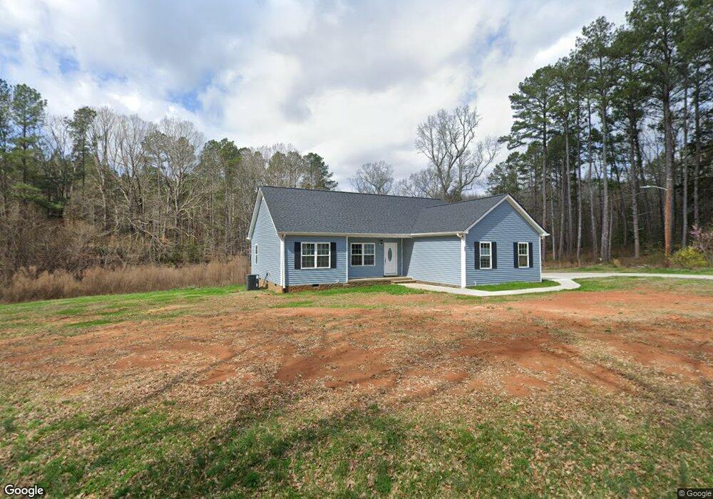
204 Fagg Rd Anderson, SC 29621
Estimated Value: $170,000 - $350,000
3
Beds
--
Bath
1,493
Sq Ft
$186/Sq Ft
Est. Value
About This Home
This home is located at 204 Fagg Rd, Anderson, SC 29621 and is currently estimated at $277,489, approximately $185 per square foot. 204 Fagg Rd is a home with nearby schools including Belton Honea Path High School.
Ownership History
Date
Name
Owned For
Owner Type
Purchase Details
Closed on
Sep 13, 2024
Sold by
Gollihugh Elizabeth Delores
Bought by
Gollihugh Elizabeth Delores and Heggood Stephanie Lauren
Current Estimated Value
Purchase Details
Closed on
Nov 23, 2022
Sold by
Deleon Marjorie Deanne
Bought by
Heggood Stephen L
Purchase Details
Closed on
Nov 22, 2022
Sold by
Fisher Smith Mary Jane
Bought by
Deleon Marjorie Deanne and Williams Laurie Jane
Purchase Details
Closed on
May 6, 2011
Sold by
Hicks Margaret G
Bought by
Smith Mary Jane
Home Financials for this Owner
Home Financials are based on the most recent Mortgage that was taken out on this home.
Original Mortgage
$50,540
Interest Rate
4.5%
Mortgage Type
FHA
Create a Home Valuation Report for This Property
The Home Valuation Report is an in-depth analysis detailing your home's value as well as a comparison with similar homes in the area
Home Values in the Area
Average Home Value in this Area
Purchase History
| Date | Buyer | Sale Price | Title Company |
|---|---|---|---|
| Gollihugh Elizabeth Delores | -- | None Listed On Document | |
| Gollihugh Elizabeth Delores | -- | None Listed On Document | |
| Heggood Stephen L | -- | -- | |
| Heggood Stephen L | -- | None Listed On Document | |
| Deleon Marjorie Deanne | -- | -- | |
| Deleon Marjorie Deanne | -- | None Listed On Document | |
| Smith Mary Jane | $55,600 | -- |
Source: Public Records
Mortgage History
| Date | Status | Borrower | Loan Amount |
|---|---|---|---|
| Previous Owner | Smith Mary Jane | $50,540 |
Source: Public Records
Tax History Compared to Growth
Tax History
| Year | Tax Paid | Tax Assessment Tax Assessment Total Assessment is a certain percentage of the fair market value that is determined by local assessors to be the total taxable value of land and additions on the property. | Land | Improvement |
|---|---|---|---|---|
| 2024 | $822 | $8,590 | $950 | $7,640 |
| 2023 | $822 | $8,590 | $950 | $7,640 |
| 2022 | $4,448 | $12,900 | $1,430 | $11,470 |
| 2021 | $448 | $1,300 | $1,110 | $190 |
| 2020 | $40 | $2,250 | $740 | $1,510 |
| 2019 | $69 | $2,250 | $740 | $1,510 |
| 2018 | $70 | $2,250 | $740 | $1,510 |
| 2017 | -- | $2,250 | $740 | $1,510 |
| 2016 | $62 | $2,180 | $630 | $1,550 |
| 2015 | $64 | $2,180 | $630 | $1,550 |
| 2014 | $65 | $2,180 | $630 | $1,550 |
Source: Public Records
Map
Nearby Homes
- 217 Long Branch Rd
- 7 Long Branch Rd
- 151 Hannah Cir
- 1332 Honey Creek Rd
- 0 Roosevelt Thompson Rd
- 104 Hart Rd
- 117 Long Needle Way
- 113 P-14-64
- 114 Beech Ln
- 2604 Broadway Lake Rd
- 00 Robertson Rd
- 1418 Grove Rd
- 517 Mayfield School Rd
- 203 Branford St
- 203 Branford St Unit SUN0130
- 228 Boseman Rd
- 1104 Henry Thomas Rd
- 1617 Due West (Lot 1) Hwy
- 1617 Due West (Lot 3) Hwy
- 1617 Due West (Lot 2) Hwy
- 250 Fagg Rd
- 300 Fagg Rd
- 531 Rice Cemetery Rd
- 105 Hawkins Rd
- 632 Rice Cemetery Rd
- 421 Rice Cemetery Rd
- 208 Hawkins Rd
- 400 Rice Cemetery Rd
- 1021 Tillotson Rd
- 406 Fagg Rd
- 307 Hawkins Rd
- 306 Hawkins Rd
- 1033 Tillotson Rd
- 510 Howard McGee Rd
- 0 Rice Cemetery Rd Unit 20018688
- Tract B Rice Cemetery Rd
- 00 Rice Cemetery Rd Unit 5.73 Acres
- 1010 Tillotson Rd
- 1011 Tillotson Rd
- 514 Howard McGee Rd