Estimated Value: $286,284 - $336,000
4
Beds
2
Baths
2,215
Sq Ft
$139/Sq Ft
Est. Value
About This Home
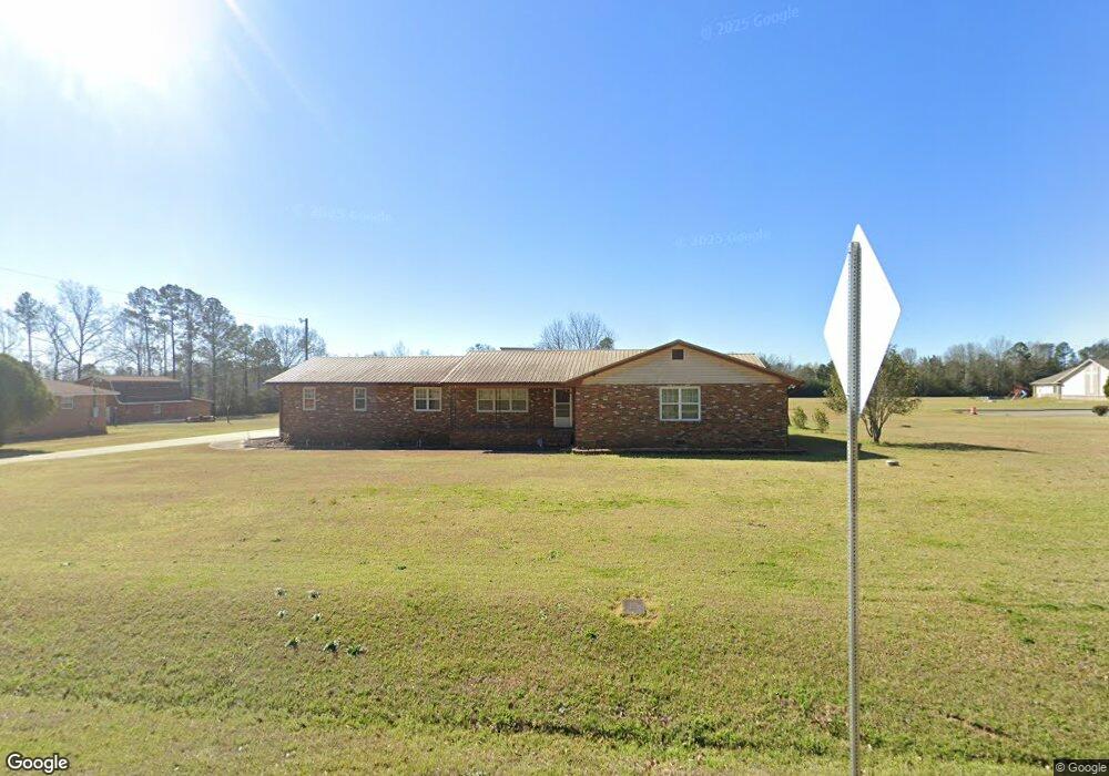
This home is located at 204 Langston Rd, Perry, GA 31069 and is currently estimated at $308,571, approximately $139 per square foot. 204 Langston Rd is a home located in Houston County with nearby schools including Langston Road Elementary School, Perry Middle School, and Perry High School.
Ownership History
Date
Name
Owned For
Owner Type
Purchase Details
Closed on
Aug 22, 2002
Sold by
Copeland Diane
Bought by
Copeland Clarence L
Current Estimated Value
Purchase Details
Closed on
May 18, 1981
Sold by
Copeland Marie A
Bought by
Copeland Clarence L
Purchase Details
Closed on
Nov 21, 1977
Sold by
Copeland Clarence L
Bought by
Copeland Clarence L and Copeland Marie A
Purchase Details
Closed on
Aug 31, 1977
Sold by
Copeland Clarence L and Copeland Marie A
Bought by
Copeland Clarence L
Purchase Details
Closed on
Sep 23, 1976
Sold by
Thomas Ella Mae and Killens Collins
Bought by
Copeland Clarence L
Create a Home Valuation Report for This Property
The Home Valuation Report is an in-depth analysis detailing your home's value as well as a comparison with similar homes in the area
Home Values in the Area
Average Home Value in this Area
Purchase History
| Date | Buyer | Sale Price | Title Company |
|---|---|---|---|
| Copeland Clarence L | -- | -- | |
| Copeland Clarence L | -- | -- | |
| Copeland Clarence L | -- | -- | |
| Copeland Clarence L | -- | -- | |
| Copeland Clarence L | -- | -- |
Source: Public Records
Tax History Compared to Growth
Tax History
| Year | Tax Paid | Tax Assessment Tax Assessment Total Assessment is a certain percentage of the fair market value that is determined by local assessors to be the total taxable value of land and additions on the property. | Land | Improvement |
|---|---|---|---|---|
| 2024 | -- | $73,160 | $15,720 | $57,440 |
| 2023 | $0 | $62,040 | $14,480 | $47,560 |
| 2022 | $1,379 | $57,040 | $14,480 | $42,560 |
| 2021 | $848 | $44,000 | $6,880 | $37,120 |
| 2020 | $843 | $43,640 | $6,520 | $37,120 |
| 2019 | $843 | $43,640 | $6,520 | $37,120 |
| 2018 | $843 | $43,640 | $6,520 | $37,120 |
| 2017 | $844 | $43,640 | $6,520 | $37,120 |
| 2016 | $845 | $43,640 | $6,520 | $37,120 |
| 2015 | $848 | $43,640 | $6,520 | $37,120 |
| 2014 | -- | $43,640 | $6,520 | $37,120 |
| 2013 | -- | $43,640 | $6,520 | $37,120 |
Source: Public Records
Map
Nearby Homes
- Gloria Plan at Lake Forest
- Delilah Plan at Lake Forest
- Lowell Plan at Lake Forest
- Camden Plan at Lake Forest
- Cannaberra Plan at Lake Forest
- Aspen Plan at Lake Forest
- Benton Plan at Lake Forest
- Birch Plan at Lake Forest
- Hawthorne Plan at Lake Forest
- Dogwood Plan at Lake Forest
- Ashley Plan at Lake Forest
- Hunter Plan at Lake Forest
- 407 Dog Fennel Ln
- 103 Wayland Cir
- 108 E River Cane Run
- 126 W River Cane Run
- 108 Dog Fennel Ln
- 133 W River Cane Run
- 215 Goldenrod Trail
- 104 Black Birch Rd Unit 84G
- 202 Langston Rd
- 200 Langston Rd
- 103 Waxmyrtle Way
- 103 Waxmyrtle Way Unit 49
- 100 Waxmyrtle Way Unit 1
- 107 Wax Myrtle Way Unit 47
- 6 Wax Myrtle Way
- 104 Waxmyrtle Way Unit 2
- 106 Silverside Dr
- 105 Wax Myrtle Way Unit 48
- 106 Wax Myrtle Way Unit 41
- 106 Wax Myrtle Way Unit 3
- 105 Red Cedar Run Unit 3F
- 105 Red Cedar Run
- 107 Red Cedar Run Unit Lot 4F
- 107 Red Cedar Run
- 107 Red Cedar Run Unit 4F
- 109 Waxmyrtle Way Unit 46
- 101 Blue Dunn Cir
- 313 Dog Fennel Ln Unit 352