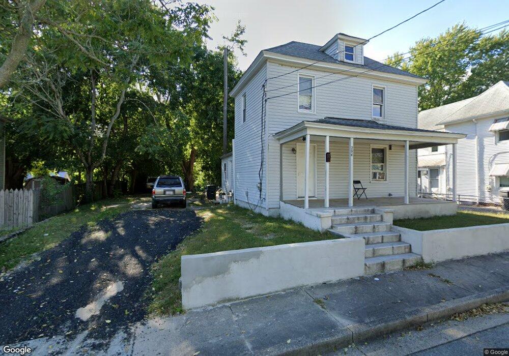
204 Linwood Ave Salisbury, MD 21804
Church Street-Doverdale NeighborhoodEstimated Value: $101,000 - $164,000
--
Bed
1
Bath
1,120
Sq Ft
$122/Sq Ft
Est. Value
About This Home
This home is located at 204 Linwood Ave, Salisbury, MD 21804 and is currently estimated at $136,127, approximately $121 per square foot. 204 Linwood Ave is a home located in Wicomico County with nearby schools including Beaver Run Elementary School, East Salisbury Elementary School, and Wicomico Middle School.
Ownership History
Date
Name
Owned For
Owner Type
Purchase Details
Closed on
Jul 10, 2020
Sold by
Snyder Mel
Bought by
Gomez Agustin G
Current Estimated Value
Purchase Details
Closed on
Jul 14, 1998
Sold by
Sec Of Housing & Urban Dev
Bought by
Snyder Mel
Purchase Details
Closed on
Dec 29, 1997
Sold by
Venables Richard D
Bought by
Sec Of Housing & Urban Dev
Purchase Details
Closed on
Mar 1, 1996
Sold by
Mccoy Lori Ann
Bought by
Venables Richard D
Create a Home Valuation Report for This Property
The Home Valuation Report is an in-depth analysis detailing your home's value as well as a comparison with similar homes in the area
Home Values in the Area
Average Home Value in this Area
Purchase History
| Date | Buyer | Sale Price | Title Company |
|---|---|---|---|
| Gomez Agustin G | $35,000 | None Available | |
| Snyder Mel | $23,010 | -- | |
| Sec Of Housing & Urban Dev | $36,200 | -- | |
| Venables Richard D | $22,000 | -- |
Source: Public Records
Mortgage History
| Date | Status | Borrower | Loan Amount |
|---|---|---|---|
| Closed | Venables Richard D | -- |
Source: Public Records
Tax History Compared to Growth
Tax History
| Year | Tax Paid | Tax Assessment Tax Assessment Total Assessment is a certain percentage of the fair market value that is determined by local assessors to be the total taxable value of land and additions on the property. | Land | Improvement |
|---|---|---|---|---|
| 2025 | $672 | $75,267 | $0 | $0 |
| 2024 | $672 | $70,100 | $9,100 | $61,000 |
| 2023 | $613 | $61,967 | $0 | $0 |
| 2022 | $549 | $53,833 | $0 | $0 |
| 2021 | $500 | $45,700 | $9,100 | $36,600 |
| 2020 | $0 | $44,367 | $0 | $0 |
| 2019 | $450 | $43,033 | $0 | $0 |
| 2018 | $868 | $41,700 | $9,100 | $32,600 |
| 2017 | $778 | $39,733 | $0 | $0 |
| 2016 | -- | $37,767 | $0 | $0 |
| 2015 | $932 | $35,800 | $0 | $0 |
| 2014 | $932 | $35,800 | $0 | $0 |
Source: Public Records
Map
Nearby Homes
- 201 Marshall St
- 309 Marshall St
- 322 Naylor St
- 211 Truitt St
- 131 Truitt St
- 204 Holland Ave
- 124 Priscilla St
- 1012 Phillips Ave
- 411 Dover St
- 309 Gay St
- 304 Poplar Hill Ave
- 430 Priscilla St
- 923 Preston St
- 309 Park Heights Ave
- 722 S Park Dr
- 909 Johnson St
- 304 Brooklyn Ave
- LOT D4 International Dr
- 313 W London Ave
- 1313 Westchester St
- 206 Linwood Ave
- 202 Linwood Ave
- 208 Linwood Ave
- 200 Linwood Ave
- 210 Linwood Ave
- 204 Naylor St
- 206 Naylor St
- 202 Naylor St
- 208 Naylor St
- 711 E Isabella St
- 212 Linwood Ave
- 735 E Isabella St
- 210 Naylor St
- 709 E Isabella St
- 813 Grier Ave
- 200 Naylor St
- 212 Naylor St
- 207 Naylor St
- 213 Davis St
- 213 Davis St