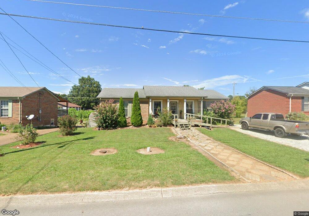
204 Rw Gordon Dr Springfield, TN 37172
Estimated Value: $234,184 - $307,000
--
Bed
2
Baths
1,326
Sq Ft
$207/Sq Ft
Est. Value
About This Home
This home is located at 204 Rw Gordon Dr, Springfield, TN 37172 and is currently estimated at $274,546, approximately $207 per square foot. 204 Rw Gordon Dr is a home located in Robertson County with nearby schools including Coopertown Elementary School, Coopertown Middle School, and Springfield High School.
Ownership History
Date
Name
Owned For
Owner Type
Purchase Details
Closed on
Mar 28, 2006
Sold by
Ferando Patino N
Bought by
Melara Francisco G
Current Estimated Value
Home Financials for this Owner
Home Financials are based on the most recent Mortgage that was taken out on this home.
Original Mortgage
$119,622
Outstanding Balance
$66,958
Interest Rate
6.2%
Estimated Equity
$207,588
Purchase Details
Closed on
Mar 1, 2000
Sold by
Moon Deborah D
Bought by
Ferando Patino N
Purchase Details
Closed on
Nov 27, 1993
Bought by
Moon Deborah D
Create a Home Valuation Report for This Property
The Home Valuation Report is an in-depth analysis detailing your home's value as well as a comparison with similar homes in the area
Home Values in the Area
Average Home Value in this Area
Purchase History
| Date | Buyer | Sale Price | Title Company |
|---|---|---|---|
| Melara Francisco G | $121,500 | -- | |
| Ferando Patino N | $95,000 | -- | |
| Moon Deborah D | $20,000 | -- |
Source: Public Records
Mortgage History
| Date | Status | Borrower | Loan Amount |
|---|---|---|---|
| Open | Moon Deborah D | $119,622 |
Source: Public Records
Tax History Compared to Growth
Tax History
| Year | Tax Paid | Tax Assessment Tax Assessment Total Assessment is a certain percentage of the fair market value that is determined by local assessors to be the total taxable value of land and additions on the property. | Land | Improvement |
|---|---|---|---|---|
| 2025 | -- | $53,250 | $0 | $0 |
| 2024 | -- | $53,250 | $13,750 | $39,500 |
| 2023 | $1,335 | $53,250 | $13,750 | $39,500 |
| 2022 | $1,328 | $36,400 | $6,200 | $30,200 |
| 2021 | $1,328 | $36,400 | $6,200 | $30,200 |
| 2020 | $1,328 | $36,400 | $6,200 | $30,200 |
| 2019 | $39,938 | $36,400 | $6,200 | $30,200 |
| 2018 | $1,328 | $36,400 | $6,200 | $30,200 |
| 2017 | $1,161 | $27,100 | $5,250 | $21,850 |
| 2016 | $1,161 | $27,100 | $5,250 | $21,850 |
| 2015 | $1,127 | $27,100 | $5,250 | $21,850 |
| 2014 | $1,127 | $27,100 | $5,250 | $21,850 |
Source: Public Records
Map
Nearby Homes
- 1503 5th Ave W
- 5058 New Chapel Rd
- 5148 Highway 49 W
- 413 Dorris Ave
- 7373 New Chapel Rd
- 7107 New Chapel Rd
- 1189 Goose Dr
- 1161 Goose Dr
- 1137 Goose Dr
- 1100 Goose Dr
- 588 19th Ave W
- 698 19th Ave W
- 2060 Beverly Ct
- 506 15th Ave W
- 2086 Beverly Ct
- 2067 Bessie St
- 3545 Jim Gower Rd
- 2130 Bessie St
- 1 Bessie St
- 0 Bessie St
- 202 Rw Gordon Dr
- 206 Rw Gordon Dr
- 200 Rw Gordon Dr
- 208 Rw Gordon Dr
- 2501 Westgate Dr
- 2502 Westgate Dr
- 203 Rw Gordon Dr
- 2503 Westgate Dr
- 2301 Westgate Dr
- 2302 Westgate Dr
- 2303 Westgate Dr
- 2304 Westgate Dr
- 2504 Westgate Dr
- 205 Rw Gordon Dr
- 2305 Westgate Dr
- 201 Rw Gordon Dr
- 2005 Westgate Dr
- 2003 Westgate Dr
- 2001 Westgate Dr
- 2505 Westgate Dr