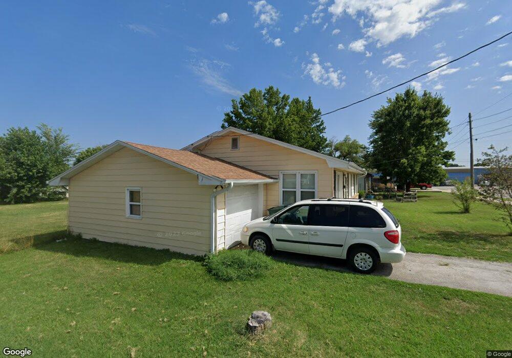
204 S Locust St Marshfield, MO 65706
Estimated Value: $120,555 - $176,000
Studio
--
Bath
1,204
Sq Ft
$128/Sq Ft
Est. Value
About This Home
This home is located at 204 S Locust St, Marshfield, MO 65706 and is currently estimated at $154,639, approximately $128 per square foot. 204 S Locust St is a home located in Webster County with nearby schools including Edwin P. Hubble Elementary School, Shook Elementary School, and Daniel Webster Elementary School.
Ownership History
Date
Name
Owned For
Owner Type
Purchase Details
Closed on
Oct 8, 2024
Sold by
The Revocable Living Trust and Revocable Living Trust Agreement Of Juli
Bought by
L & H Enterprises Llc
Current Estimated Value
Purchase Details
Closed on
Aug 15, 2024
Sold by
Cruise Terry L and Cruise Connie S
Bought by
Revocable Living Trust Agreement Of Alan Lamb and Revocable Living Trust Agreement Of Julie Her
Create a Home Valuation Report for This Property
The Home Valuation Report is an in-depth analysis detailing your home's value as well as a comparison with similar homes in the area
Home Values in the Area
Average Home Value in this Area
Purchase History
| Date | Buyer | Sale Price | Title Company |
|---|---|---|---|
| L & H Enterprises Llc | -- | None Listed On Document | |
| Revocable Living Trust Agreement Of Alan Lamb | -- | None Listed On Document |
Source: Public Records
Tax History
| Year | Tax Paid | Tax Assessment Tax Assessment Total Assessment is a certain percentage of the fair market value that is determined by local assessors to be the total taxable value of land and additions on the property. | Land | Improvement |
|---|---|---|---|---|
| 2024 | $545 | $9,410 | $0 | $0 |
| 2023 | $530 | $9,410 | $0 | $0 |
| 2022 | $530 | $9,410 | $0 | $0 |
| 2021 | $530 | $9,410 | $0 | $0 |
| 2020 | $475 | $8,610 | $0 | $0 |
| 2019 | $450 | $8,610 | $0 | $0 |
| 2018 | $451 | $8,610 | $0 | $0 |
| 2017 | $400 | $8,530 | $0 | $0 |
| 2016 | $373 | $7,890 | $0 | $0 |
| 2015 | $369 | $7,890 | $0 | $0 |
| 2012 | -- | $7,890 | $0 | $0 |
Source: Public Records
Map
Nearby Homes
- 705 E Washington St
- 112 N Vine St
- 438 E Madison St
- 314 E Jackson St
- 720 E Burford St
- 753 S Elm St
- 537 S Walnut St
- 504 E Burford St
- 259 E Jefferson St
- 520 S Pine St
- 252 Commercial St
- 831 E Burford St
- 529 E Mcvay St
- 721 E Bedford St
- 256 E 2nd St
- 542 N Locust St
- 529 S Clay St
- Tbd S Marshall St
- 424 N Clay St
- 318 W Jackson St
- 216 S Locust St
- 617 E Jackson St
- 616 E Madison St
- 619 E Jackson St
- 622 E Madison St
- 538 E Madison St
- 639 E Jackson St
- 602 E Washington St
- 610 E Washington St
- 630 E Madison St
- 115 S Locust St
- 631 E Jackson St
- 540 E Washington St
- 534 E Madison St
- 630 E Washington St
- 533 E Jackson St
- 533 E Madison St
- 636 E Washington St
- 603 E Washington St
- 528 E Washington St
Your Personal Tour Guide
Ask me questions while you tour the home.