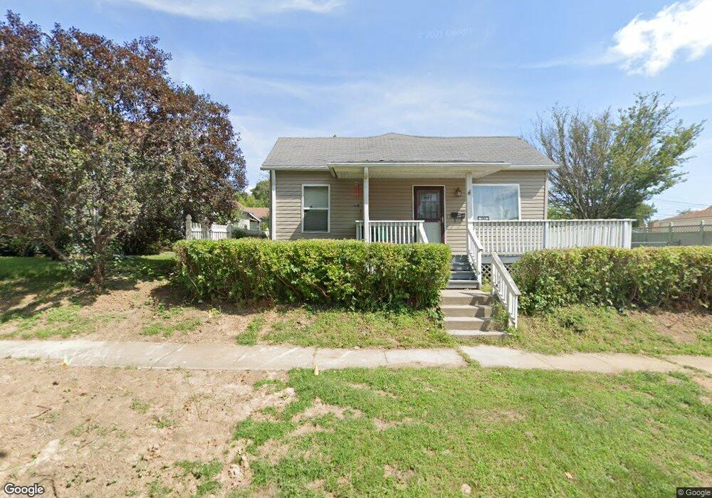
204 S Starr Ave Burlington, IA 52601
Estimated Value: $83,563 - $152,000
2
Beds
1
Bath
1,232
Sq Ft
$86/Sq Ft
Est. Value
About This Home
This home is located at 204 S Starr Ave, Burlington, IA 52601 and is currently estimated at $106,141, approximately $86 per square foot. 204 S Starr Ave is a home located in Des Moines County with nearby schools including Burlington Community High School, Burlington Notre Dame Catholic Elementary School, and Burlington Christian School.
Ownership History
Date
Name
Owned For
Owner Type
Purchase Details
Closed on
Oct 12, 2021
Sold by
Garmoe Bonnie C
Bought by
Garmoe Lyle E
Current Estimated Value
Purchase Details
Closed on
Jul 11, 2008
Sold by
Anderson Patricia A and Bright Charles W
Bought by
Garmoe Lyle E and Garmoe Bonnie C
Home Financials for this Owner
Home Financials are based on the most recent Mortgage that was taken out on this home.
Original Mortgage
$83,341
Outstanding Balance
$54,551
Interest Rate
6.36%
Mortgage Type
FHA
Estimated Equity
$51,590
Create a Home Valuation Report for This Property
The Home Valuation Report is an in-depth analysis detailing your home's value as well as a comparison with similar homes in the area
Home Values in the Area
Average Home Value in this Area
Purchase History
| Date | Buyer | Sale Price | Title Company |
|---|---|---|---|
| Garmoe Lyle E | -- | None Available | |
| Garmoe Lyle E | $86,000 | None Available |
Source: Public Records
Mortgage History
| Date | Status | Borrower | Loan Amount |
|---|---|---|---|
| Open | Garmoe Lyle E | $83,341 |
Source: Public Records
Tax History Compared to Growth
Tax History
| Year | Tax Paid | Tax Assessment Tax Assessment Total Assessment is a certain percentage of the fair market value that is determined by local assessors to be the total taxable value of land and additions on the property. | Land | Improvement |
|---|---|---|---|---|
| 2025 | $900 | $74,000 | $9,500 | $64,500 |
| 2024 | $900 | $70,300 | $9,500 | $60,800 |
| 2023 | $1,134 | $70,300 | $9,500 | $60,800 |
| 2022 | $1,150 | $65,400 | $9,500 | $55,900 |
| 2021 | $1,150 | $65,400 | $9,500 | $55,900 |
| 2020 | $1,228 | $65,400 | $9,500 | $55,900 |
| 2019 | $1,118 | $65,400 | $9,500 | $55,900 |
| 2018 | $1,116 | $57,100 | $10,900 | $46,200 |
| 2017 | $1,088 | $54,700 | $0 | $0 |
| 2016 | $1,046 | $54,700 | $0 | $0 |
| 2015 | $1,046 | $54,700 | $0 | $0 |
| 2014 | $1,060 | $59,000 | $0 | $0 |
Source: Public Records
Map
Nearby Homes
- 1615 Smith St
- 410 S Starr Ave
- 1612 Smith St
- 420 S Plane St
- 418 S Leebrick St
- 415 S Garfield Ave
- 218 S Gunnison St
- 526 S Plane St
- 513 Hagemann Ave
- 100 S Marshall St
- 410 S Marshall St
- 1432 Cleveland Ave
- 320 N Plane St
- 2204 Williams St
- 310 Curran St
- 123 Shields St
- 2600 Amelia St
- 2503 Clearview Dr
- 809 S Starr Ave
- 817 S Plane St
- 210 S Starr Ave
- 200 S Starr Ave
- 212 S Starr Ave
- 205 S Adams St
- 207 S Adams St
- 201 S Adams St
- 1820 Division St
- 213 S Adams St
- 207 S Starr Ave
- 209 S Starr Ave
- 219 S Adams St
- 219 S Adams St
- 201 S Starr Ave
- 128 S Starr Ave
- 215 S Starr Ave
- 122 S Starr Ave
- 119 S Adams St
- 119 S Adams St
- 125 S Starr Ave
- 1719 Smith St