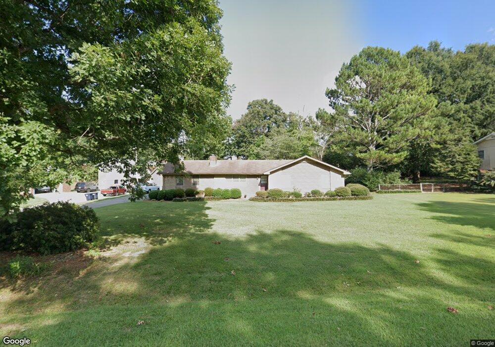
204 Shallowford Rd Dalton, GA 30721
Estimated Value: $268,323 - $293,000
--
Bed
2
Baths
1,588
Sq Ft
$179/Sq Ft
Est. Value
About This Home
This home is located at 204 Shallowford Rd, Dalton, GA 30721 and is currently estimated at $284,581, approximately $179 per square foot. 204 Shallowford Rd is a home located in Whitfield County with nearby schools including Pleasant Grove Elementary School, New Hope Middle School, and Northwest Whitfield County High School.
Ownership History
Date
Name
Owned For
Owner Type
Purchase Details
Closed on
Dec 12, 2005
Sold by
Suford Dexter J
Bought by
Davis Gerald Q
Current Estimated Value
Create a Home Valuation Report for This Property
The Home Valuation Report is an in-depth analysis detailing your home's value as well as a comparison with similar homes in the area
Home Values in the Area
Average Home Value in this Area
Purchase History
| Date | Buyer | Sale Price | Title Company |
|---|---|---|---|
| Davis Gerald Q | $130,000 | -- |
Source: Public Records
Tax History Compared to Growth
Tax History
| Year | Tax Paid | Tax Assessment Tax Assessment Total Assessment is a certain percentage of the fair market value that is determined by local assessors to be the total taxable value of land and additions on the property. | Land | Improvement |
|---|---|---|---|---|
| 2024 | $486 | $98,263 | $15,600 | $82,663 |
| 2023 | $486 | $65,291 | $10,600 | $54,691 |
| 2022 | $343 | $51,926 | $10,600 | $41,326 |
| 2021 | $343 | $51,926 | $10,600 | $41,326 |
| 2020 | $375 | $51,926 | $10,600 | $41,326 |
| 2019 | $391 | $51,926 | $10,600 | $41,326 |
| 2018 | $357 | $48,028 | $10,600 | $37,428 |
| 2017 | $602 | $48,028 | $10,600 | $37,428 |
| 2016 | $529 | $46,745 | $7,350 | $39,395 |
| 2014 | $436 | $46,745 | $7,350 | $39,395 |
| 2013 | -- | $46,744 | $7,350 | $39,394 |
Source: Public Records
Map
Nearby Homes
- 192 Carly Dr
- 522 Westbrook Rd
- 2502 E Hillview Dr
- 117 Pleasant Hill Dr
- 112 Albertson Dr
- 2615 Cleveland Hwy
- 0 TRACT 5 2nd St
- 486 Haig Mill Rd
- 106 Albertson Dr
- The Braselton II Plan at The Andros
- The Manchester II Plan at The Andros
- The Buford II Plan at The Andros
- The Ellison II Plan at The Andros
- The Norwood II Plan at The Andros
- The Reynolds Plan at The Andros
- The Maddux II Plan at The Andros
- The Ryman Plan at The Andros
- The Rutledge Plan at The Andros
- 407 Quillian Rd
- 126 Andros Dr Unit 22D
- 202 Shallowford Rd
- 206 Shallowford Rd
- 203 Sharondale Dr
- 203 Shallowford Rd
- 203 Shallowford Rd
- 207 Sharondale Dr
- 205 Shallowford Rd
- 201 Shallowford Rd
- 105 Tonya Dr
- 111 Tonya Dr
- 123 Shallowford Rd
- 115 Tonya Dr
- 210 Shallowford Rd
- 207 Shallowford Rd
- 121 Shallowford Rd
- 328 Mill Trace
- 328 Mill Trace Unit 328A
- 316 Ricky Dr
- 318 Ricky Dr
- 314 Ricky Dr