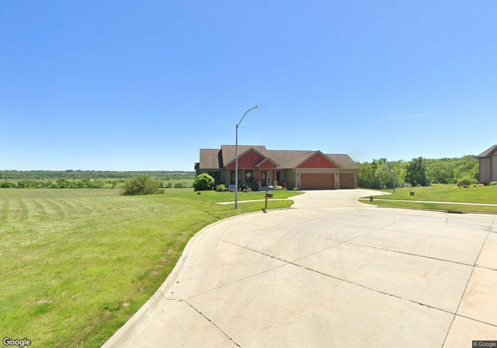
2040 Normandy Dr Carlisle, IA 50047
Avon Lake NeighborhoodEstimated Value: $497,000 - $576,823
4
Beds
5
Baths
2,191
Sq Ft
$244/Sq Ft
Est. Value
About This Home
This home is located at 2040 Normandy Dr, Carlisle, IA 50047 and is currently estimated at $535,456, approximately $244 per square foot. 2040 Normandy Dr is a home with nearby schools including Carlisle Elementary School, Hartford Upper Elementary School, and Carlisle Middle School.
Ownership History
Date
Name
Owned For
Owner Type
Purchase Details
Closed on
Jun 10, 2013
Sold by
Bartholomew & Randleman Lc
Bought by
Amos Bryce J and Amos Sherry L
Current Estimated Value
Home Financials for this Owner
Home Financials are based on the most recent Mortgage that was taken out on this home.
Original Mortgage
$414,000
Interest Rate
3.43%
Mortgage Type
New Conventional
Create a Home Valuation Report for This Property
The Home Valuation Report is an in-depth analysis detailing your home's value as well as a comparison with similar homes in the area
Home Values in the Area
Average Home Value in this Area
Purchase History
| Date | Buyer | Sale Price | Title Company |
|---|---|---|---|
| Amos Bryce J | $80,000 | None Available |
Source: Public Records
Mortgage History
| Date | Status | Borrower | Loan Amount |
|---|---|---|---|
| Closed | Amos Bryce J | $414,000 |
Source: Public Records
Tax History Compared to Growth
Tax History
| Year | Tax Paid | Tax Assessment Tax Assessment Total Assessment is a certain percentage of the fair market value that is determined by local assessors to be the total taxable value of land and additions on the property. | Land | Improvement |
|---|---|---|---|---|
| 2024 | $8,560 | $546,300 | $78,400 | $467,900 |
| 2023 | $8,754 | $546,300 | $78,400 | $467,900 |
| 2022 | $7,840 | $404,800 | $78,400 | $326,400 |
| 2021 | $7,566 | $367,900 | $78,400 | $289,500 |
| 2020 | $7,566 | $338,500 | $80,000 | $258,500 |
| 2019 | $6,476 | $449,200 | $80,000 | $369,200 |
| 2018 | $5,586 | $288,000 | $0 | $0 |
| 2017 | $5,586 | $0 | $0 | $0 |
| 2016 | $4,034 | $180,700 | $0 | $0 |
| 2015 | $4,034 | $0 | $0 | $0 |
| 2014 | $3,204 | $700 | $0 | $0 |
Source: Public Records
Map
Nearby Homes
- 1270 Hardin Dr
- 800 Linden St
- 805 Linden St
- 1000 Juniper Dr
- 715 Linden St
- 705 Linden St
- Cedar Plan at Danamere Farms - Danamere
- Chariton Plan at Danamere Farms - Danamere
- Fraser Plan at Danamere Farms - Danamere
- Fostoria Plan at Danamere Farms - Danamere
- Lansing Plan at Danamere Farms - Danamere
- Hampton Plan at Danamere Farms - Danamere
- Emerson Plan at Danamere Farms - Danamere
- Jasmine Plan at Danamere Farms - Danamere
- Melrose Plan at Danamere Farms - Danamere
- Forrester Plan at Danamere Farms - Danamere
- Scranton Plan at Danamere Farms - Danamere
- 1215 Meadow View Dr
- 675 S 8th St
- 1020 Bellflower Dr
- 2035 Normandy Dr
- 2020 Normandy Dr
- 2025 Normandy Dr
- 2015 Normandy Dr
- 1310 Veterans Memorial Dr
- 2010 Normandy Dr
- 1330 Veterans Memorial Dr
- 1320 Veterans Memorial Dr
- 1300 Veterans Memorial Dr
- 1250 Veterans Memorial Dr
- 2005 Normandy Dr
- 1240 Veterans Memorial Dr
- 1230 Veterans Memorial Dr
- 2000 Normandy Dr
- 1925 Normandy Dr
- 1220 Veterans Memorial Dr
- 1340 Veterans Memorial Dr
- 1315 Veterans Memorial Dr
- 1210 Veterans Memorial Dr
- 1325 Veterans Memorial Dr