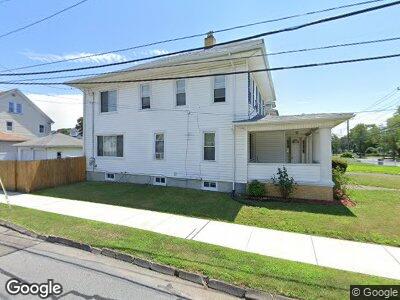
2040 Park Ave Bridgeport, CT 06604
Brooklawn-Saint Vincent NeighborhoodEstimated Value: $413,000 - $613,000
5
Beds
3
Baths
2,996
Sq Ft
$168/Sq Ft
Est. Value
About This Home
This home is located at 2040 Park Ave, Bridgeport, CT 06604 and is currently estimated at $502,909, approximately $167 per square foot. 2040 Park Ave is a home located in Fairfield County with nearby schools including Madison School, Central High School, and Catholic Academy of Bridgeport-St. Raphael Academy.
Ownership History
Date
Name
Owned For
Owner Type
Purchase Details
Closed on
Sep 2, 1994
Sold by
Huynh Quoc and Huynh Thanhnhan
Bought by
Tran Kevin
Current Estimated Value
Home Financials for this Owner
Home Financials are based on the most recent Mortgage that was taken out on this home.
Original Mortgage
$30,000
Interest Rate
8.44%
Mortgage Type
Unknown
Create a Home Valuation Report for This Property
The Home Valuation Report is an in-depth analysis detailing your home's value as well as a comparison with similar homes in the area
Home Values in the Area
Average Home Value in this Area
Purchase History
| Date | Buyer | Sale Price | Title Company |
|---|---|---|---|
| Tran Kevin | $105,000 | -- | |
| Tran Kevin | $105,000 | -- |
Source: Public Records
Mortgage History
| Date | Status | Borrower | Loan Amount |
|---|---|---|---|
| Closed | Tran Kevin | $30,000 |
Source: Public Records
Tax History Compared to Growth
Tax History
| Year | Tax Paid | Tax Assessment Tax Assessment Total Assessment is a certain percentage of the fair market value that is determined by local assessors to be the total taxable value of land and additions on the property. | Land | Improvement |
|---|---|---|---|---|
| 2024 | $8,258 | $190,054 | $63,734 | $126,320 |
| 2023 | $8,258 | $190,054 | $63,734 | $126,320 |
| 2022 | $8,258 | $190,054 | $63,734 | $126,320 |
| 2021 | $8,258 | $190,054 | $63,734 | $126,320 |
| 2020 | $8,629 | $159,830 | $39,890 | $119,940 |
| 2019 | $8,629 | $159,830 | $39,890 | $119,940 |
| 2018 | $8,690 | $159,830 | $39,890 | $119,940 |
| 2017 | $8,690 | $159,830 | $39,890 | $119,940 |
| 2016 | $8,690 | $159,830 | $39,890 | $119,940 |
| 2015 | $9,161 | $217,090 | $50,580 | $166,510 |
| 2014 | $9,161 | $217,090 | $50,580 | $166,510 |
Source: Public Records
Map
Nearby Homes
- 128 Bancroft Ave
- 1391 North Ave Unit 1393
- 88 Pierce Ave
- 191 Oak St
- 325 Lincoln Blvd
- 501 Pequonnock St
- 560 Garfield Ave Unit 562
- 64-66 Maplewood Ave
- 522 Garfield Ave
- 1356 Wood Ave
- 439 Charles St Unit 443
- 84 Hillside Ave
- 141 Arcadia Ave
- 127 Jones Ave
- 799 Capitol Ave Unit 801
- 45 Sampson St
- 390 Charles St Unit 211
- 390 Charles St Unit 216
- 92 Alice St
- 230-234 Federal St
- 2040 Park Ave
- 2030 Park Ave
- 2020 Park Ave
- 34 Bancroft Ave
- 2060 Park Ave
- 2078 Park Ave Unit 2082
- 2010 Park Ave
- 31 Chalmers Ave
- 31 Bancroft Ave
- 42 Bancroft Ave
- 42 Bancroft Ave Unit 2nd/3rd Flr
- 39 Bancroft Ave
- 45 Chalmers Ave
- 52 Bancroft Ave
- 2045 Park Ave
- 2057 Park Ave
- 59 Chalmers Ave
- 51 Bancroft Ave
- 64 Bancroft Ave
- 2081 Park Ave