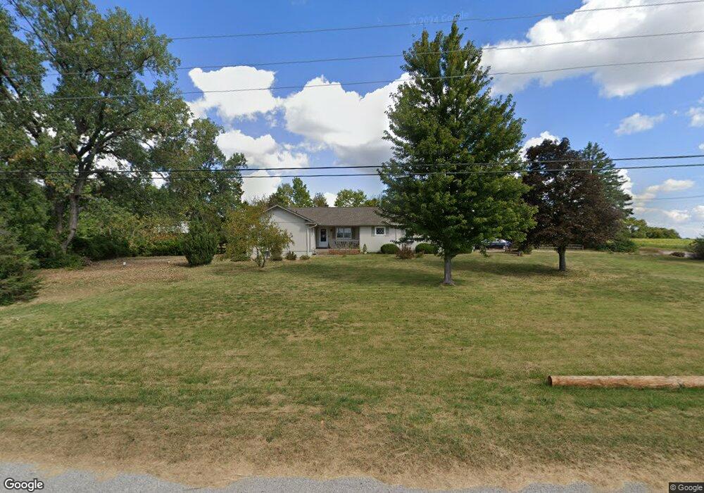
2041 SW Pryor Rd Lees Summit, MO 64082
Estimated Value: $341,000 - $438,000
3
Beds
2
Baths
1,624
Sq Ft
$248/Sq Ft
Est. Value
About This Home
This home is located at 2041 SW Pryor Rd, Lees Summit, MO 64082 and is currently estimated at $402,001, approximately $247 per square foot. 2041 SW Pryor Rd is a home located in Jackson County with nearby schools including Hawthorn Hill Elementary School, Summit Lakes Middle School, and Lee's Summit West High School.
Ownership History
Date
Name
Owned For
Owner Type
Purchase Details
Closed on
Jan 14, 2003
Sold by
Fairchild Richard C and Fairchild Linda L
Bought by
Fairchild Richard C and Fairchild Linda L
Current Estimated Value
Home Financials for this Owner
Home Financials are based on the most recent Mortgage that was taken out on this home.
Original Mortgage
$81,500
Interest Rate
5.62%
Mortgage Type
Purchase Money Mortgage
Create a Home Valuation Report for This Property
The Home Valuation Report is an in-depth analysis detailing your home's value as well as a comparison with similar homes in the area
Home Values in the Area
Average Home Value in this Area
Purchase History
| Date | Buyer | Sale Price | Title Company |
|---|---|---|---|
| Fairchild Richard C | -- | Old Republic Title Co Of Ks |
Source: Public Records
Mortgage History
| Date | Status | Borrower | Loan Amount |
|---|---|---|---|
| Closed | Fairchild Richard C | $81,500 |
Source: Public Records
Tax History Compared to Growth
Tax History
| Year | Tax Paid | Tax Assessment Tax Assessment Total Assessment is a certain percentage of the fair market value that is determined by local assessors to be the total taxable value of land and additions on the property. | Land | Improvement |
|---|---|---|---|---|
| 2025 | $2,717 | $40,826 | $9,774 | $31,052 |
| 2024 | $2,697 | $37,627 | $3,523 | $34,104 |
| 2023 | $2,697 | $37,627 | $3,523 | $34,104 |
| 2022 | $2,473 | $30,638 | $2,128 | $28,510 |
| 2021 | $2,524 | $30,638 | $2,128 | $28,510 |
| 2020 | $2,432 | $29,225 | $2,128 | $27,097 |
| 2019 | $2,365 | $29,225 | $2,128 | $27,097 |
| 2018 | $2,246 | $25,756 | $2,128 | $23,628 |
| 2017 | $2,246 | $25,756 | $2,128 | $23,628 |
| 2016 | $2,214 | $25,130 | $2,128 | $23,002 |
| 2014 | $2,258 | $25,119 | $2,117 | $23,002 |
Source: Public Records
Map
Nearby Homes
- 2313 SW Woodhaven Ct
- 2417 SW Woodhaven Ln
- 2220 SW Hawk View Rd
- 2301 SW Post Oak Ct
- 2040 SW Wheatfield Ct
- 2108 SW Wheatfield Ct
- 2328 SW Feather Ridge Rd
- 2132 SW Wheatfield Ct
- 2340 SW Feather Ridge Rd
- 2341 SW River Trail Rd
- 2357 SW Current Ct
- 2615 SW Firefly Ln
- 2110 SW Hook Farm Dr
- 2618 SW Firefly Ln
- 2622 SW Farm Field Rd
- 2619 SW Firefly Ln
- 2623 SW Tracker Ln
- 2352 SW River Spring Rd
- 2344 SW Switchback Ct
- 2627 SW Tracker Ln
- 2091-2097 SW Timbertrace Ln
- 2097 SW Timbertrace Ln
- 2100 SW Timbertrace Ln
- 2211 SW Burning Wood Ln
- 2201-2207 SW Burning Wood Ln
- 2217 SW Burningwood Ln Unit 2 1
- 2221 SW Burning Wood Ln
- 2110 SW Timbertrace Ln
- 2110-2116 SW Timbertrace Ln
- 2111 SW Burningwood Ln
- 0 Burningwood
- 2090 SW Timbertrace Ln
- 2231 SW Burning Wood Ln
- 2200-2206 SW Burning Wood Ln
- 2210 Burningwood
- 2121 SW Timbertrace Ln
- 2210-2216 SW Burning Wood Ln
- 2120 SW Timbertrace Ln
- 2220 Burningwood
- 2230-2236 SW Burning Wood Ln