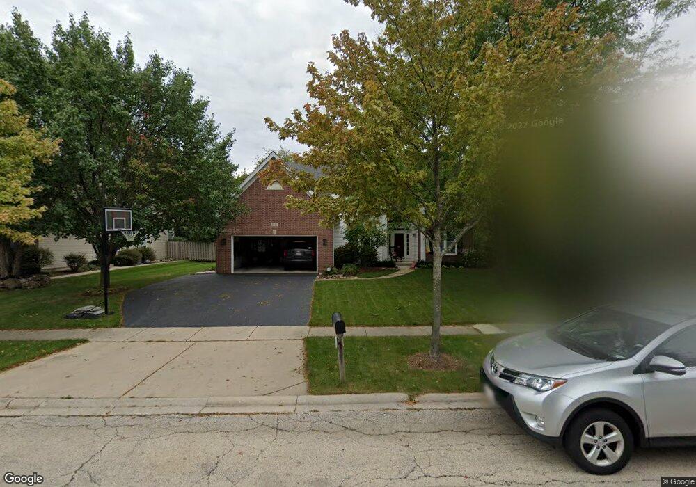
2041 Tunbridge Trail Algonquin, IL 60102
Estimated Value: $546,000 - $645,000
4
Beds
3
Baths
2,958
Sq Ft
$197/Sq Ft
Est. Value
About This Home
This home is located at 2041 Tunbridge Trail, Algonquin, IL 60102 and is currently estimated at $581,695, approximately $196 per square foot. 2041 Tunbridge Trail is a home located in McHenry County with nearby schools including Westfield Community School, Kenneth E Neubert Elementary School, and Harry D Jacobs High School.
Ownership History
Date
Name
Owned For
Owner Type
Purchase Details
Closed on
Oct 11, 2019
Sold by
Schmieder James T and Johnson Christine M
Bought by
Suchodolski Krzysztof and Suchodolski Marzena
Current Estimated Value
Home Financials for this Owner
Home Financials are based on the most recent Mortgage that was taken out on this home.
Original Mortgage
$255,000
Outstanding Balance
$221,410
Interest Rate
3.5%
Mortgage Type
New Conventional
Estimated Equity
$360,285
Purchase Details
Closed on
Jun 28, 1995
Sold by
Legacy Fine Custom Homes Co
Bought by
Schmieder James A and Schmieder Mary F
Home Financials for this Owner
Home Financials are based on the most recent Mortgage that was taken out on this home.
Original Mortgage
$145,000
Interest Rate
7.88%
Create a Home Valuation Report for This Property
The Home Valuation Report is an in-depth analysis detailing your home's value as well as a comparison with similar homes in the area
Purchase History
| Date | Buyer | Sale Price | Title Company |
|---|---|---|---|
| Suchodolski Krzysztof | $320,000 | Baird & Warner Ttl Svcs Inc | |
| Schmieder James A | $262,500 | -- | |
| Legacy Fine Custom Homes Inc | $65,000 | -- |
Source: Public Records
Mortgage History
| Date | Status | Borrower | Loan Amount |
|---|---|---|---|
| Open | Suchodolski Krzysztof | $255,000 | |
| Previous Owner | Schmieder James A | $145,000 |
Source: Public Records
Tax History
| Year | Tax Paid | Tax Assessment Tax Assessment Total Assessment is a certain percentage of the fair market value that is determined by local assessors to be the total taxable value of land and additions on the property. | Land | Improvement |
|---|---|---|---|---|
| 2024 | $13,324 | $178,323 | $32,925 | $145,398 |
| 2023 | $12,681 | $159,487 | $29,447 | $130,040 |
| 2022 | $9,664 | $118,686 | $36,540 | $82,146 |
| 2021 | $9,279 | $110,570 | $34,041 | $76,529 |
| 2020 | $9,038 | $106,656 | $32,836 | $73,820 |
| 2019 | $9,820 | $117,940 | $31,428 | $86,512 |
| 2018 | $9,336 | $108,952 | $29,033 | $79,919 |
| 2017 | $9,126 | $102,640 | $27,351 | $75,289 |
| 2016 | $8,967 | $96,267 | $25,653 | $70,614 |
| 2013 | -- | $95,039 | $23,931 | $71,108 |
Source: Public Records
Map
Nearby Homes
- 2051 Carlisle St
- 20 Peach Tree Ct Unit 4153
- 18 Peach Tree Ct Unit 4154
- 2069 Peach Tree Ln Unit 4116
- 1157 Sawmill Ln
- 760 Regal Ln
- 1900 Waverly Ln
- 2380 Dawson Ln Unit 165
- 1820 Crofton Dr
- 1002 Interloch Ct Unit 152
- 681 Majestic Dr
- 2612 Loren Ln Unit 293
- 1181 Glenmont St
- 700 Fairfield Ln
- 1920 Jester Ln
- 1030 Glenmont St
- 895 Eineke Blvd
- 1221 Glenmont St
- 1 N Hubbard St
- SWC Talaga and Algonquin Rd
- 2041 Tunbridge Trail
- 2031 Tunbridge Trail
- 2051 Tunbridge Trail
- 2070 Carlisle St
- 2070 Carlisle St
- 2090 Carlisle St
- 2090 Carlisle St
- 2050 Carlisle St
- 2021 Tunbridge Trail
- 2061 Tunbridge Trail
- 2060 Tunbridge Trail
- 2070 Tunbridge Trail
- 2110 Carlisle St
- 2050 Tunbridge Trail
- 2030 Carlisle St
- 2011 Tunbridge Trail
- 2071 Tunbridge Trail
- 2080 Tunbridge Trail
- 2040 Tunbridge Trail
- 1370 Carlisle St
Your Personal Tour Guide
Ask me questions while you tour the home.