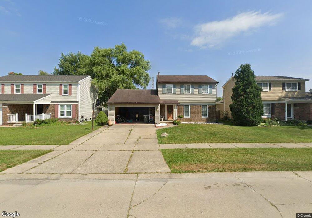
2041 W Roundtable Dr Canton, MI 48188
Estimated Value: $380,364 - $425,000
3
Beds
2
Baths
2,037
Sq Ft
$197/Sq Ft
Est. Value
About This Home
This home is located at 2041 W Roundtable Dr, Canton, MI 48188 and is currently estimated at $400,841, approximately $196 per square foot. 2041 W Roundtable Dr is a home located in Wayne County with nearby schools including Bentley Elementary School, Canton High School, and Salem High School.
Ownership History
Date
Name
Owned For
Owner Type
Purchase Details
Closed on
Nov 17, 2020
Sold by
Singh Alambir and Singh Inderbir
Bought by
Singh Inderbir and Kaur Tajinder
Current Estimated Value
Home Financials for this Owner
Home Financials are based on the most recent Mortgage that was taken out on this home.
Original Mortgage
$104,000
Outstanding Balance
$92,545
Interest Rate
2.8%
Mortgage Type
New Conventional
Estimated Equity
$308,296
Purchase Details
Closed on
Jun 30, 2010
Sold by
Mayes Laura A
Bought by
Singh Alambir and Singh Inderbir
Purchase Details
Closed on
Jun 24, 2010
Sold by
Mayes Timothy M
Bought by
Mayes Laura A
Purchase Details
Closed on
Apr 28, 1995
Sold by
Krzeminski Helen F
Bought by
Mayes Timothy M and Mayes Laura
Create a Home Valuation Report for This Property
The Home Valuation Report is an in-depth analysis detailing your home's value as well as a comparison with similar homes in the area
Home Values in the Area
Average Home Value in this Area
Purchase History
| Date | Buyer | Sale Price | Title Company |
|---|---|---|---|
| Singh Inderbir | -- | First American Title Ins Co | |
| Singh Alambir | $152,000 | None Available | |
| Mayes Laura A | -- | Fidelity National Title | |
| Mayes Timothy M | $115,000 | -- |
Source: Public Records
Mortgage History
| Date | Status | Borrower | Loan Amount |
|---|---|---|---|
| Open | Singh Inderbir | $104,000 |
Source: Public Records
Tax History
| Year | Tax Paid | Tax Assessment Tax Assessment Total Assessment is a certain percentage of the fair market value that is determined by local assessors to be the total taxable value of land and additions on the property. | Land | Improvement |
|---|---|---|---|---|
| 2025 | $1,665 | $183,300 | $0 | $0 |
| 2024 | $1,617 | $173,800 | $0 | $0 |
| 2023 | $1,542 | $159,800 | $0 | $0 |
| 2022 | $3,463 | $141,900 | $0 | $0 |
| 2021 | $3,358 | $131,800 | $0 | $0 |
| 2020 | $3,309 | $131,200 | $0 | $0 |
| 2019 | $3,250 | $130,300 | $0 | $0 |
| 2018 | $1,310 | $120,150 | $0 | $0 |
| 2017 | $3,406 | $104,300 | $0 | $0 |
| 2016 | $2,978 | $100,800 | $0 | $0 |
| 2015 | $7,200 | $92,370 | $0 | $0 |
| 2013 | $6,975 | $78,650 | $0 | $0 |
| 2010 | -- | $87,590 | $39,000 | $48,590 |
Source: Public Records
Map
Nearby Homes
- 42859 Palmer Rd
- 1861 N Arbor Way Dr Unit 26
- 2006 S Lilley Rd
- 1530 Fairfax Dr
- 2340 S Lilley Rd
- 43662 Amber Ct
- 1891 Vine Way Dr Unit 27
- 2328 Amber Dr
- 1632 Bennington Ct Unit 1632
- 43674 Christopher Ct
- 802 Cherry Stone Dr
- 1402 Heritage Dr
- 42264 Chase Dr
- 41925 South Dr
- 1878 Otter Pond Ln
- 41878 Woodbrook Dr
- 41777 Princess Dr
- 2435 S Haggerty Rd
- 446 Cherry Stone Dr Unit 54
- 2210 Woodmont Dr W
- 2053 W Roundtable Dr
- 2029 W Roundtable Dr
- 2065 W Roundtable Dr
- 2040 E Roundtable Dr
- 2017 W Roundtable Dr
- 2028 E Roundtable Dr
- 2052 E Roundtable Dr
- 2064 E Roundtable Dr
- 2016 E Roundtable Dr
- 43121 Londonderry Ct
- 2077 W Roundtable Dr
- 43118 Applewood Rd
- 2005 W Roundtable Dr
- 2076 E Roundtable Dr
- 2004 E Roundtable Dr
- 2089 W Roundtable Dr
- 43133 Londonderry Ct
- 43130 Applewood Rd
- 1965 W Roundtable Dr
- 2088 E Roundtable Dr
Your Personal Tour Guide
Ask me questions while you tour the home.