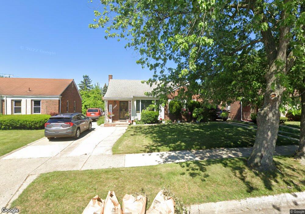
20415 Lesure St Unit Bldg-Unit Detroit, MI 48235
Schaefer 7-8 Lodge NeighborhoodEstimated Value: $137,000 - $171,489
--
Bed
2
Baths
1,487
Sq Ft
$106/Sq Ft
Est. Value
About This Home
This home is located at 20415 Lesure St Unit Bldg-Unit, Detroit, MI 48235 and is currently estimated at $157,122, approximately $105 per square foot. 20415 Lesure St Unit Bldg-Unit is a home located in Wayne County with nearby schools including Vernor Elementary School, Charles L. Spain Elementary-Middle School, and Edward 'Duke' Ellington Conservatory of Music and Art.
Ownership History
Date
Name
Owned For
Owner Type
Purchase Details
Closed on
Jan 19, 2018
Sold by
The Mahala R Slay Trust
Bought by
Cobb Delaci M
Current Estimated Value
Home Financials for this Owner
Home Financials are based on the most recent Mortgage that was taken out on this home.
Original Mortgage
$15,000
Interest Rate
4.38%
Mortgage Type
New Conventional
Purchase Details
Closed on
Oct 29, 2007
Sold by
Slay Mahala and Slay Lorenzo
Bought by
Mahala R Slay Trust
Create a Home Valuation Report for This Property
The Home Valuation Report is an in-depth analysis detailing your home's value as well as a comparison with similar homes in the area
Home Values in the Area
Average Home Value in this Area
Purchase History
| Date | Buyer | Sale Price | Title Company |
|---|---|---|---|
| Cobb Delaci M | $74,000 | Liberty Title | |
| Mahala R Slay Trust | -- | None Available |
Source: Public Records
Mortgage History
| Date | Status | Borrower | Loan Amount |
|---|---|---|---|
| Previous Owner | Cobb Delaci M | $15,000 |
Source: Public Records
Tax History Compared to Growth
Tax History
| Year | Tax Paid | Tax Assessment Tax Assessment Total Assessment is a certain percentage of the fair market value that is determined by local assessors to be the total taxable value of land and additions on the property. | Land | Improvement |
|---|---|---|---|---|
| 2025 | $1,600 | $78,000 | $0 | $0 |
| 2024 | $1,600 | $66,900 | $0 | $0 |
| 2023 | $1,553 | $53,500 | $0 | $0 |
| 2022 | $1,723 | $43,500 | $0 | $0 |
| 2021 | $1,794 | $30,100 | $0 | $0 |
| 2020 | $1,653 | $27,300 | $0 | $0 |
| 2019 | $1,625 | $21,400 | $0 | $0 |
| 2018 | $986 | $17,900 | $0 | $0 |
| 2017 | $274 | $16,700 | $0 | $0 |
| 2016 | $1,252 | $16,800 | $0 | $0 |
| 2015 | $1,680 | $16,800 | $0 | $0 |
| 2013 | $2,468 | $24,684 | $0 | $0 |
| 2010 | -- | $36,189 | $1,310 | $34,879 |
Source: Public Records
Map
Nearby Homes
- 20475 Tracey St
- 20426 Tracey St
- 20177 Stansbury Ave
- 20522 Ardmore St
- 20110 Lesure St
- 20032 Stansbury St
- 20220 Mark Twain St
- 20196 Hartwell St
- 20155 Mark Twain St
- 19978 Tracey St
- 20124 Snowden St
- 20447 Strathmoor St
- 19925 Schaefer Hwy
- 14024 Pembroke Ave
- 20133 Strathmoor St
- 20154 Hubbell St
- 19909 Hartwell St
- 20157 Cheyenne St
- 13517 Pembroke Ave
- 20167 Ward St
- 20415 Lesure St
- 20427 Lesure St
- 20405 Lesure St
- 20437 Lesure St
- 20410 Stansbury St
- 20410 Stansbury St
- 20420 Stansbury St
- 20400 Stansbury St
- 20428 Stansbury St Unit Bldg-Unit
- 20428 Stansbury St
- 20447 Lesure St
- 20235 Lesure St
- 20436 Stansbury St
- 20412 Lesure St
- 20420 Lesure St
- 20236 Stansbury St
- 20457 Lesure St
- 20428 Lesure St
- 20402 Lesure St Unit Bldg-Unit
- 20402 Lesure St