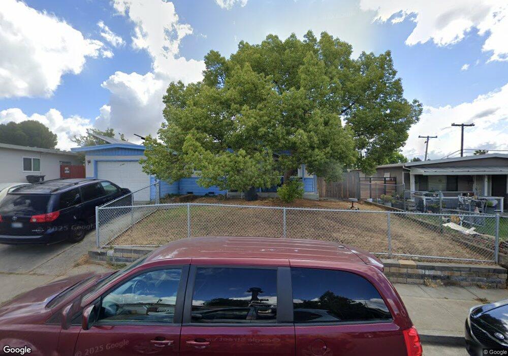
2042 Bristol Ln Fairfield, CA 94533
Estimated Value: $400,000 - $466,000
3
Beds
1
Bath
1,038
Sq Ft
$417/Sq Ft
Est. Value
About This Home
This home is located at 2042 Bristol Ln, Fairfield, CA 94533 and is currently estimated at $432,436, approximately $416 per square foot. 2042 Bristol Ln is a home located in Solano County with nearby schools including David Weir Preparatory Academy, Grange Middle School, and Fairfield High School.
Ownership History
Date
Name
Owned For
Owner Type
Purchase Details
Closed on
Apr 14, 1994
Sold by
Mckee Steven
Bought by
Sparks Benjamin Earl and Sparks Mona Lisa
Current Estimated Value
Home Financials for this Owner
Home Financials are based on the most recent Mortgage that was taken out on this home.
Original Mortgage
$96,900
Interest Rate
7.79%
Create a Home Valuation Report for This Property
The Home Valuation Report is an in-depth analysis detailing your home's value as well as a comparison with similar homes in the area
Home Values in the Area
Average Home Value in this Area
Purchase History
| Date | Buyer | Sale Price | Title Company |
|---|---|---|---|
| Sparks Benjamin Earl | $102,000 | North American Title Co Inc |
Source: Public Records
Mortgage History
| Date | Status | Borrower | Loan Amount |
|---|---|---|---|
| Closed | Sparks Benjamin Earl | $96,900 |
Source: Public Records
Tax History Compared to Growth
Tax History
| Year | Tax Paid | Tax Assessment Tax Assessment Total Assessment is a certain percentage of the fair market value that is determined by local assessors to be the total taxable value of land and additions on the property. | Land | Improvement |
|---|---|---|---|---|
| 2025 | $7,978 | $181,806 | $67,985 | $113,821 |
| 2024 | $7,978 | $178,242 | $66,652 | $111,590 |
| 2023 | $7,916 | $174,748 | $65,346 | $109,402 |
| 2022 | $7,891 | $171,322 | $64,065 | $107,257 |
| 2021 | $1,865 | $167,963 | $62,809 | $105,154 |
| 2020 | $1,821 | $166,241 | $62,165 | $104,076 |
| 2019 | $1,775 | $162,983 | $60,947 | $102,036 |
| 2018 | $1,831 | $159,788 | $59,752 | $100,036 |
| 2017 | $1,745 | $156,656 | $58,581 | $98,075 |
| 2016 | $1,724 | $153,585 | $57,433 | $96,152 |
| 2015 | $1,609 | $151,279 | $56,571 | $94,708 |
| 2014 | $1,593 | $148,316 | $55,463 | $92,853 |
Source: Public Records
Map
Nearby Homes
- 2207 Cunningham Dr
- 1301 Sunningdale Ln
- Bryce Plan at Brighton Place
- Cora Plan at Brighton Place
- 1300 Sunningdale Ln
- 1305 Sunningdale Ln
- 1331 Canterbury Dr
- 1309 Sunningdale Ln
- 1308 Sunningdale Ln
- 937 Pacific Ave
- 954 Coventry Ln
- 799 Tabor Ave
- 751 Hillcrest Ct
- 81 Del Prado Cir
- 2256 Dorset Ln
- 2284 Wiltshire Ct
- 2289 Rutland Ct
- 1661 Fairfield Ave
- 1737 Alford Dr
- 2051 Barbour Dr
- 2048 Bristol Ln
- 2036 Bristol Ln
- 2079 Bristol Ln
- 2043 Bristol Ln
- 2085 Bristol Ln
- 2037 Bristol Ln
- 2049 Bristol Ln
- 2025 Cambridge Dr
- 2072 Bristol Ln
- 2019 Cambridge Dr
- 2031 Cambridge Dr
- 2078 Bristol Ln
- 2066 Bristol Ln
- 2091 Bristol Ln
- 2055 Bristol Ln
- 2060 Bristol Ln
- 2037 Cambridge Dr
- 2013 Cambridge Dr
- 2090 Bristol Ln