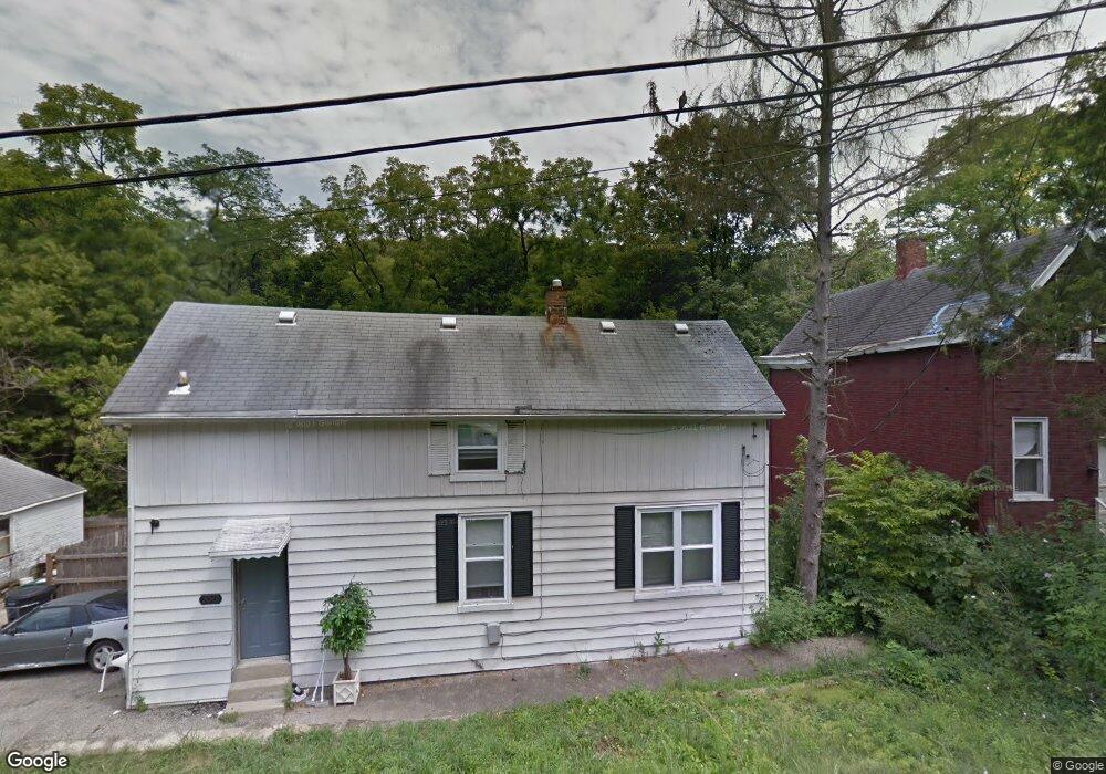
2042 Harkness St Cincinnati, OH 45225
North Fairmount NeighborhoodEstimated Value: $93,970 - $158,000
3
Beds
2
Baths
904
Sq Ft
$127/Sq Ft
Est. Value
About This Home
This home is located at 2042 Harkness St, Cincinnati, OH 45225 and is currently estimated at $114,743, approximately $126 per square foot. 2042 Harkness St is a home located in Hamilton County with nearby schools including Western Hills High School, Gilbert A. Dater High School, and Robert A. Taft Information Technology High School.
Ownership History
Date
Name
Owned For
Owner Type
Purchase Details
Closed on
Feb 11, 2015
Sold by
Walton Tisa
Bought by
Berman Shelley E
Current Estimated Value
Purchase Details
Closed on
Dec 11, 2006
Sold by
Phelon Bridgette
Bought by
Walton Tisa
Home Financials for this Owner
Home Financials are based on the most recent Mortgage that was taken out on this home.
Original Mortgage
$55,000
Interest Rate
10.85%
Mortgage Type
Unknown
Purchase Details
Closed on
Dec 5, 2005
Sold by
Deutsche Bank National Trust Co
Bought by
Phelon Bridgette
Purchase Details
Closed on
Aug 19, 2005
Sold by
Brown Linda
Bought by
Deutsche Bank National Trust Co and Bankers Trust Co Of California Na
Create a Home Valuation Report for This Property
The Home Valuation Report is an in-depth analysis detailing your home's value as well as a comparison with similar homes in the area
Home Values in the Area
Average Home Value in this Area
Purchase History
| Date | Buyer | Sale Price | Title Company |
|---|---|---|---|
| Berman Shelley E | $5,146 | None Available | |
| Walton Tisa | $55,000 | Chicago Title Ins Co | |
| Phelon Bridgette | -- | None Available | |
| Deutsche Bank National Trust Co | $54,000 | None Available |
Source: Public Records
Mortgage History
| Date | Status | Borrower | Loan Amount |
|---|---|---|---|
| Previous Owner | Walton Tisa | $55,000 |
Source: Public Records
Tax History
| Year | Tax Paid | Tax Assessment Tax Assessment Total Assessment is a certain percentage of the fair market value that is determined by local assessors to be the total taxable value of land and additions on the property. | Land | Improvement |
|---|---|---|---|---|
| 2025 | $831 | $12,131 | $1,673 | $10,458 |
| 2023 | $831 | $12,131 | $1,673 | $10,458 |
| 2022 | $366 | $4,302 | $1,169 | $3,133 |
| 2021 | $341 | $4,302 | $1,169 | $3,133 |
| 2020 | $342 | $4,302 | $1,169 | $3,133 |
| 2019 | $494 | $6,206 | $1,134 | $5,072 |
| 2018 | $495 | $6,206 | $1,134 | $5,072 |
| 2017 | $475 | $6,206 | $1,134 | $5,072 |
| 2016 | $567 | $7,270 | $2,135 | $5,135 |
| 2015 | $509 | $7,270 | $2,135 | $5,135 |
| 2014 | $489 | $7,270 | $2,135 | $5,135 |
| 2013 | $732 | $10,851 | $3,189 | $7,662 |
Source: Public Records
Map
Nearby Homes
- 2163 Baltimore Ave
- 1965 Baltimore Ave
- 2183 Westwood Northern Blvd
- 3384 Ninann Ct
- 1970 Westwood Northern Blvd
- 2085 N Teralta Cir
- 2043 E Teralta Cir
- 3295 Fyffe Ave
- 2114 Saint Leo Place
- 1859 Baltimore Ave
- 1808 Carll St
- 1797 Denham St
- 3312 Mchenry Ave
- 2711 Baker Ave
- 1793 Baltimore Ave
- 2109 Harrison Ave
- 2060 Bickel Ave
- 2962 Aquadale Ln
- 1781 Baltimore Ave
- 2729 Ruberg Ave
- 2040 Harkness St
- 2045 Harkness St
- 2039 Baltimore Ave
- 2028 Harkness St
- 2037 Baltimore Ave
- 2047 Harkness St
- 2041 Baltimore Ave
- 2035 Baltimore Ave
- 2031 Baltimore Ave
- 2024 Harkness St
- 2025 Harkness St
- 2029 Baltimore Ave
- 2042 Baltimore Ave
- 2044 Baltimore Ave
- 2022 Harkness St
- 2030 Baltimore Ave
- 2027 Baltimore Ave
- 2032 Yoast Ave
- 1993 Yoast Ave
- 2025 Baltimore Ave
Your Personal Tour Guide
Ask me questions while you tour the home.