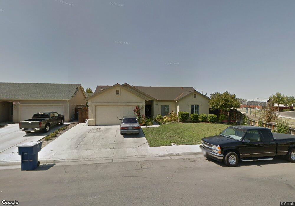
2042 Mctaggart Ave Dos Palos, CA 93620
Estimated Value: $240,000 - $381,000
3
Beds
2
Baths
1,325
Sq Ft
$245/Sq Ft
Est. Value
About This Home
This home is located at 2042 Mctaggart Ave, Dos Palos, CA 93620 and is currently estimated at $324,019, approximately $244 per square foot. 2042 Mctaggart Ave is a home located in Merced County with nearby schools including Bernhard Marks Elementary School, Dos Palos Elementary School, and Bryant Middle School.
Ownership History
Date
Name
Owned For
Owner Type
Purchase Details
Closed on
Jun 7, 2011
Sold by
Villa Augustine M and Villa Beatrice
Bought by
Acosta Arreola Ruben Sierra and Acosta De Sierra Florella
Current Estimated Value
Home Financials for this Owner
Home Financials are based on the most recent Mortgage that was taken out on this home.
Original Mortgage
$98,325
Interest Rate
4.46%
Mortgage Type
New Conventional
Purchase Details
Closed on
Jun 12, 2003
Sold by
Muir Estates Llc
Bought by
Villa Augustine M and Villa Beatrice
Home Financials for this Owner
Home Financials are based on the most recent Mortgage that was taken out on this home.
Original Mortgage
$164,618
Interest Rate
5.37%
Mortgage Type
VA
Create a Home Valuation Report for This Property
The Home Valuation Report is an in-depth analysis detailing your home's value as well as a comparison with similar homes in the area
Home Values in the Area
Average Home Value in this Area
Purchase History
| Date | Buyer | Sale Price | Title Company |
|---|---|---|---|
| Acosta Arreola Ruben Sierra | $95,000 | Transcounty Title Company | |
| Villa Augustine M | $161,500 | Fidelity Title Company |
Source: Public Records
Mortgage History
| Date | Status | Borrower | Loan Amount |
|---|---|---|---|
| Previous Owner | Acosta Arreola Ruben Sierra | $98,325 | |
| Previous Owner | Villa Augustine M | $164,618 |
Source: Public Records
Tax History Compared to Growth
Tax History
| Year | Tax Paid | Tax Assessment Tax Assessment Total Assessment is a certain percentage of the fair market value that is determined by local assessors to be the total taxable value of land and additions on the property. | Land | Improvement |
|---|---|---|---|---|
| 2025 | $1,255 | $121,695 | $12,163 | $109,532 |
| 2024 | $1,255 | $119,310 | $11,925 | $107,385 |
| 2023 | $1,213 | $116,972 | $11,692 | $105,280 |
| 2022 | $1,160 | $114,679 | $11,463 | $103,216 |
| 2021 | $1,162 | $112,432 | $11,239 | $101,193 |
| 2020 | $1,149 | $111,280 | $11,124 | $100,156 |
| 2019 | $1,129 | $109,099 | $10,906 | $98,193 |
| 2018 | $1,102 | $106,961 | $10,693 | $96,268 |
| 2017 | $1,080 | $104,865 | $10,484 | $94,381 |
| 2016 | $1,063 | $102,810 | $10,279 | $92,531 |
| 2015 | $1,050 | $101,267 | $10,125 | $91,142 |
| 2014 | $1,027 | $99,284 | $9,927 | $89,357 |
Source: Public Records
Map
Nearby Homes
- 1951 McDonald Ave
- 2021 Madera Ave
- 1830 Valeria St
- 1734 Golden Gate Ave
- 1725 California Ave
- 0 Christian Ave Unit MC25192664
- 0 Christian Ave Unit MC25192705
- 0 Christian Ave Unit MC25192693
- 0 Christian Ave Unit MC25192654
- 37 Christian Ave
- 21188 Elgin Ave
- 1602 Lucerne Ave
- 1410 Frank Ave
- 1333 Frank Ave
- 1325 Norton Ave
- 2373 Olive St
- 1256 California Ave
- 1666 Oliver St
- 21627 State Highway 33
- 1274 Dos Palos Ave
- 2050 Mctaggart Ave
- 2050 S Mctaggart Ave
- 2043 Mccullough Ave
- 2051 Mccullough Ave
- 2074 Mcintyre St
- 2082 Mcintyre St
- 2043 Mctaggart Ave
- 2035 Mctaggart Ave
- 2051 Mctaggart Ave
- 2090 Mcintyre St
- 1999 S McDonald Ave
- 1999 McDonald Ave
- 1942 Cole St
- 2059 Mctaggart Ave
- 1934 Cole St
- 2110 Mccurdy St
- 1917 Cole St
- 2119 Mccurdy St
- 1991 McDonald Ave
- 2103 Mckenzie St