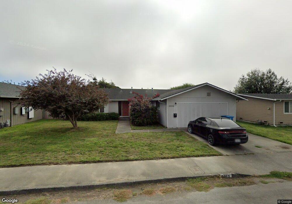
2042 Parton Ln Arcata, CA 95521
Estimated Value: $470,000 - $510,000
4
Beds
2
Baths
1,520
Sq Ft
$322/Sq Ft
Est. Value
About This Home
This home is located at 2042 Parton Ln, Arcata, CA 95521 and is currently estimated at $489,440, approximately $322 per square foot. 2042 Parton Ln is a home located in Humboldt County with nearby schools including Pacific Union Elementary School, Arcata High School, and Trillium Charter School.
Ownership History
Date
Name
Owned For
Owner Type
Purchase Details
Closed on
Oct 20, 2021
Sold by
Ann Leiderman Mary
Bought by
Leiderman Joshua R
Current Estimated Value
Home Financials for this Owner
Home Financials are based on the most recent Mortgage that was taken out on this home.
Original Mortgage
$76,000
Interest Rate
2.88%
Mortgage Type
New Conventional
Purchase Details
Closed on
Jan 9, 2020
Sold by
Leiderman Mary Ann
Bought by
Leiderman Mary Ann and Leiderman Joshua R
Create a Home Valuation Report for This Property
The Home Valuation Report is an in-depth analysis detailing your home's value as well as a comparison with similar homes in the area
Purchase History
We collect this data history from publicly available records. To have your information removed, we recommend requesting removal directly through your county’s website.
| Date | Buyer | Sale Price | Title Company |
|---|---|---|---|
| Leiderman Joshua R | -- | New Title Company Name | |
| Leiderman Mary Ann | $197,500 | None Available |
Source: Public Records
Mortgage History
We collect this data history from publicly available records. To have your information removed, we recommend requesting removal directly through your county’s website.
| Date | Status | Borrower | Loan Amount |
|---|---|---|---|
| Previous Owner | Leiderman Joshua R | $76,000 |
Source: Public Records
Tax History
| Year | Tax Paid | Tax Assessment Tax Assessment Total Assessment is a certain percentage of the fair market value that is determined by local assessors to be the total taxable value of land and additions on the property. | Land | Improvement |
|---|---|---|---|---|
| 2025 | $4,388 | $408,564 | $191,017 | $217,547 |
| 2024 | $4,388 | $400,554 | $187,272 | $213,282 |
| 2023 | $4,387 | $392,700 | $183,600 | $209,100 |
| 2022 | $2,444 | $207,270 | $74,974 | $132,296 |
| 2021 | $2,431 | $203,206 | $73,504 | $129,702 |
| 2020 | $2,324 | $201,124 | $72,751 | $128,373 |
| 2019 | $2,289 | $197,181 | $71,325 | $125,856 |
| 2018 | $2,142 | $193,316 | $69,927 | $123,389 |
| 2017 | $2,109 | $189,526 | $68,556 | $120,970 |
| 2016 | $2,074 | $185,811 | $67,212 | $118,599 |
| 2015 | $2,037 | $183,021 | $66,203 | $116,818 |
| 2014 | $2,008 | $179,437 | $64,907 | $114,530 |
Source: Public Records
Map
Nearby Homes
- 3735 Shetland Ln
- 2084 Mustang Ln
- 2074 Mustang Ln
- 2048 Appaloosa Ln
- 3659 Spear Ave
- 4349 Bay Meadows Ct
- 3028 Alliance Rd
- 1283 Poplar Dr
- 00 Mad River Pkwy
- 1082 Cedar Dr
- 2966 Janes Creek Dr
- 954 Courtyard Cir
- 3122 St Louis Rd
- 452 Tanglewood Rd
- 970 Courtyard Cir
- 448 Tanglewood Rd
- 1731 Stewart Ave
- 444 Tanglewood Rd
- 1437 Stromberg Ave
- 1390 Grant Ave
Your Personal Tour Guide
Ask me questions while you tour the home.