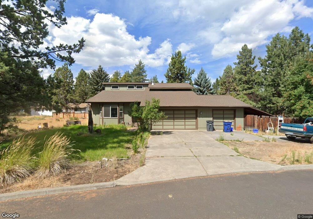
20420 Silver Tip Ct Bend, OR 97702
Old Farm District NeighborhoodEstimated Value: $723,000 - $768,000
3
Beds
3
Baths
1,881
Sq Ft
$397/Sq Ft
Est. Value
About This Home
This home is located at 20420 Silver Tip Ct, Bend, OR 97702 and is currently estimated at $746,141, approximately $396 per square foot. 20420 Silver Tip Ct is a home located in Deschutes County with nearby schools including R.E. Jewell Elementary School, High Desert Middle School, and Deschutes River Montessori School.
Ownership History
Date
Name
Owned For
Owner Type
Purchase Details
Closed on
Jan 12, 2022
Sold by
Charles Anderson Eric
Bought by
Eric C Anderson Revocable Trust
Current Estimated Value
Purchase Details
Closed on
Sep 19, 2006
Sold by
Anderson Eric Charles and Anderson Kathy M
Bought by
Anderson Eric C and Anderson Kathy M
Home Financials for this Owner
Home Financials are based on the most recent Mortgage that was taken out on this home.
Original Mortgage
$297,000
Interest Rate
6.51%
Mortgage Type
New Conventional
Create a Home Valuation Report for This Property
The Home Valuation Report is an in-depth analysis detailing your home's value as well as a comparison with similar homes in the area
Home Values in the Area
Average Home Value in this Area
Purchase History
| Date | Buyer | Sale Price | Title Company |
|---|---|---|---|
| Eric C Anderson Revocable Trust | -- | None Listed On Document | |
| Anderson Eric C | -- | Amerititle |
Source: Public Records
Mortgage History
| Date | Status | Borrower | Loan Amount |
|---|---|---|---|
| Previous Owner | Anderson Eric C | $297,000 |
Source: Public Records
Tax History Compared to Growth
Tax History
| Year | Tax Paid | Tax Assessment Tax Assessment Total Assessment is a certain percentage of the fair market value that is determined by local assessors to be the total taxable value of land and additions on the property. | Land | Improvement |
|---|---|---|---|---|
| 2025 | $4,996 | $295,680 | -- | -- |
| 2024 | $4,807 | $287,070 | -- | -- |
| 2023 | $4,456 | $278,710 | $0 | $0 |
| 2022 | $4,157 | $262,720 | $0 | $0 |
| 2021 | $4,163 | $255,070 | $0 | $0 |
| 2020 | $3,950 | $255,070 | $0 | $0 |
| 2019 | $3,840 | $247,650 | $0 | $0 |
| 2018 | $3,732 | $240,440 | $0 | $0 |
| 2017 | $3,622 | $233,440 | $0 | $0 |
| 2016 | $3,454 | $226,650 | $0 | $0 |
| 2015 | $3,359 | $220,050 | $0 | $0 |
| 2014 | $3,260 | $213,650 | $0 | $0 |
Source: Public Records
Map
Nearby Homes
- 61217 SE Wagyu Dr Unit 151
- 61221 SE Wagyu Dr Unit Lot 152
- 61168 SE Wagyu Dr Unit Lot 120
- 20607 SE Boer Place SE
- 20619 SE Boer Place SE Unit Lot 131
- 61194 SE Berkshire Way Unit Lot 135
- The Jackson Plan at Countryside
- The Cascade Plan at Countryside
- 61178 SE Berkshire Way Unit Lot 110
- 61174 SE Berkshire Way Unit Lot 109
- 20457 Aberdeen Dr
- 20414 Murphy Rd
- 20450 Jacklight Ln
- 61147 Splendor Ln
- 61159 Splendor Ln
- 61160 Splendor Ln
- 61172 Splendor Ln
- 61280 Parrell Rd Unit 10
- 20260 Gaines Ct
- Hawthorne Plan at Monrovia
- 20419 Rae Rd
- 20415 Rae Rd
- 20434 Silver Tip Ct
- 20427 Silver Tip Ct
- 20421 Rae Rd
- 61174 Wildwood Dr
- 20435 Silver Tip Ct
- 61215 Wildwood Dr
- 20432 Rae Rd
- 20440 Silver Tip Ct
- 20426 Rae Rd
- 20405 Rae Rd
- 20430 Rocky Top Ct
- 20416 Rae Rd
- 20443 Rae Rd
- 20439 Silver Tip Ct
- 20420 Rocky Top Ct
- 20442 Rae Rd
- 20397 Rae Rd