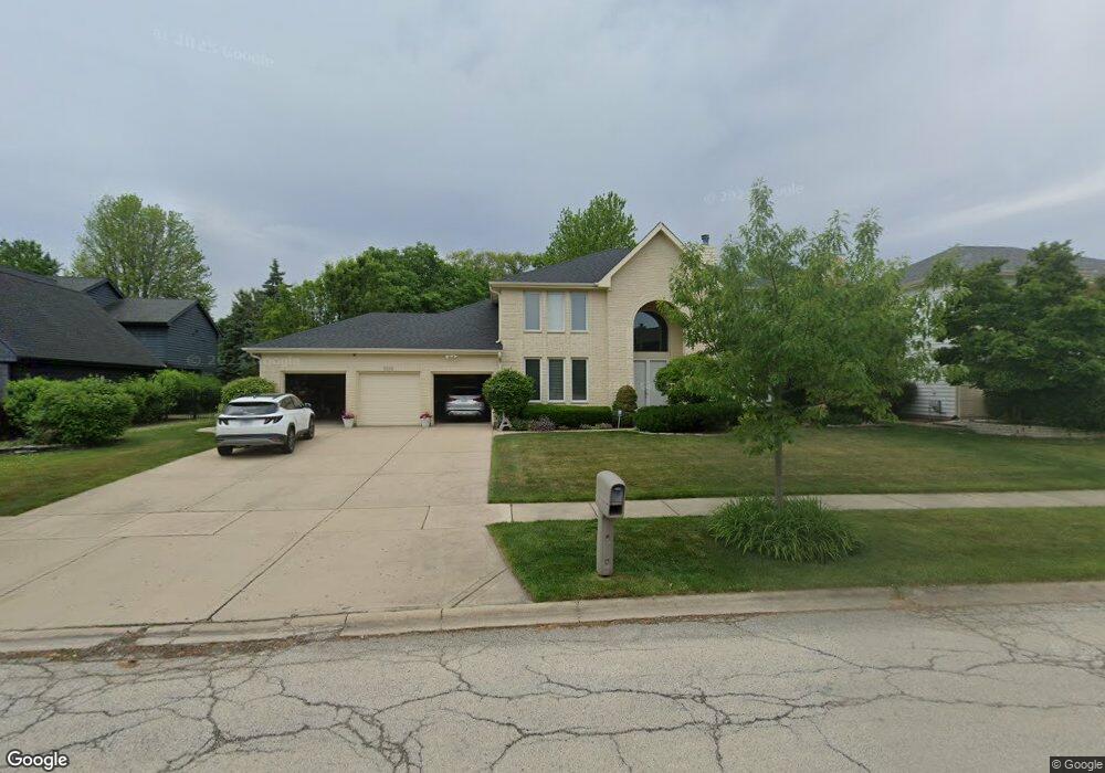
2043 Sheridan Rd Buffalo Grove, IL 60089
Rolling Hills NeighborhoodEstimated Value: $851,000 - $923,000
--
Bed
3
Baths
3,332
Sq Ft
$266/Sq Ft
Est. Value
About This Home
This home is located at 2043 Sheridan Rd, Buffalo Grove, IL 60089 and is currently estimated at $886,134, approximately $265 per square foot. 2043 Sheridan Rd is a home located in Lake County with nearby schools including Ivy Hall Elementary School, Twin Groves Middle School, and Adlai E Stevenson High School.
Ownership History
Date
Name
Owned For
Owner Type
Purchase Details
Closed on
Dec 4, 1997
Sold by
Wein Sharon F and Wein Philip M
Bought by
Wein Sharon F and Sharon F Wein Trust
Current Estimated Value
Purchase Details
Closed on
Jul 2, 1996
Sold by
Wein Philip M and Wein Sharon F
Bought by
Wein Sharon F and Sharon F Wein Trust
Purchase Details
Closed on
Feb 22, 1996
Sold by
Wein Sharon F
Bought by
Wein Philip M and Wein Sharon F
Purchase Details
Closed on
Sep 12, 1995
Sold by
Wein Philip M and Wein Sharon F
Bought by
Wein Sharon F and Sharon F Wein Trust
Purchase Details
Closed on
Mar 23, 1995
Sold by
American National Bk & Tr Co Of Chicago
Bought by
Wein Philip M and Wein Sharon F
Home Financials for this Owner
Home Financials are based on the most recent Mortgage that was taken out on this home.
Original Mortgage
$125,000
Interest Rate
8.5%
Create a Home Valuation Report for This Property
The Home Valuation Report is an in-depth analysis detailing your home's value as well as a comparison with similar homes in the area
Home Values in the Area
Average Home Value in this Area
Purchase History
| Date | Buyer | Sale Price | Title Company |
|---|---|---|---|
| Wein Sharon F | -- | -- | |
| Wein Sharon F | -- | -- | |
| Wein Philip M | -- | -- | |
| Wein Sharon F | -- | -- | |
| Wein Philip M | $414,500 | Chicago Title Insurance Co |
Source: Public Records
Mortgage History
| Date | Status | Borrower | Loan Amount |
|---|---|---|---|
| Previous Owner | Wein Philip M | $125,000 |
Source: Public Records
Tax History Compared to Growth
Tax History
| Year | Tax Paid | Tax Assessment Tax Assessment Total Assessment is a certain percentage of the fair market value that is determined by local assessors to be the total taxable value of land and additions on the property. | Land | Improvement |
|---|---|---|---|---|
| 2024 | $20,545 | $242,490 | $55,010 | $187,480 |
| 2023 | $20,545 | $217,911 | $49,434 | $168,477 |
| 2022 | $19,592 | $202,864 | $46,021 | $156,843 |
| 2021 | $19,460 | $200,677 | $45,525 | $155,152 |
| 2020 | $19,079 | $201,361 | $45,680 | $155,681 |
| 2019 | $18,617 | $200,619 | $45,512 | $155,107 |
| 2018 | $19,584 | $213,074 | $49,477 | $163,597 |
| 2017 | $18,971 | $208,100 | $48,322 | $159,778 |
| 2016 | $19,268 | $209,519 | $46,272 | $163,247 |
| 2015 | $18,870 | $195,940 | $43,273 | $152,667 |
| 2014 | $18,875 | $192,907 | $46,474 | $146,433 |
| 2012 | $18,655 | $196,640 | $46,567 | $150,073 |
Source: Public Records
Map
Nearby Homes
- 1998 Sheridan Ct
- 5255 Danbury Ct
- 1903 Sheridan Rd
- 1901 Brandywyn Ln
- 486 Satinwood Terrace Unit 11
- 5328 Oak Grove Dr
- 333 Didier Ct
- 538 Lasalle Ct
- 268 Hoffmann Dr
- 361 Hoffmann Dr
- 890 Knollwood Dr
- 327 Lasalle Ln
- 361 Willow Pkwy Unit 234
- 2770 Sandalwood Rd Unit 3
- 259 Willow Pkwy Unit 403
- 896 Chaucer Way Unit 2
- 1265 Devonshire Rd
- 5107 N Arlington Heights Rd
- 2033 Olive Hill Dr
- 4143 3 Lakes Ct
- 2039 Sheridan Rd
- 2047 Sheridan Rd
- 2031 Sheridan Rd
- 2051 Sheridan Rd
- 2035 Sheridan Rd
- 2035 Sheridan Rd
- 2035 Sheridan Rd
- 2030 Sheridan Rd
- 2034 Sheridan Rd
- 2026 Sheridan Ct
- 2055 Sheridan Rd
- 2027 Sheridan Rd
- 2022 Sheridan Ct
- 810 Edgemere Rd
- 2038 Sheridan Rd
- 2059 Sheridan Rd
- 1986 Sheridan Rd
- 1990 Sheridan Ct
- 1990 Sheridan Rd
- 1994 Sheridan Ct