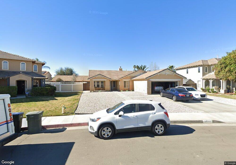
2044 Tamarind Dr Perris, CA 92571
Central Perris NeighborhoodEstimated Value: $532,884 - $545,000
4
Beds
2
Baths
1,636
Sq Ft
$329/Sq Ft
Est. Value
About This Home
This home is located at 2044 Tamarind Dr, Perris, CA 92571 and is currently estimated at $537,471, approximately $328 per square foot. 2044 Tamarind Dr is a home located in Riverside County with nearby schools including Triple Crown Elementary School, Lakeside Middle School, and Rancho Verde High School.
Ownership History
Date
Name
Owned For
Owner Type
Purchase Details
Closed on
Dec 3, 2024
Sold by
Kirkpatrick Leberta
Bought by
Kirkpatrick Living Trust and Kirkpatrick
Current Estimated Value
Purchase Details
Closed on
May 17, 2006
Sold by
Kirkpatrick Leberta A and Charles Eula B
Bought by
Charles Edwin E and Charles Judy B
Home Financials for this Owner
Home Financials are based on the most recent Mortgage that was taken out on this home.
Original Mortgage
$125,000
Interest Rate
6.55%
Mortgage Type
Fannie Mae Freddie Mac
Purchase Details
Closed on
Aug 9, 1999
Sold by
Perris Meadows Lp
Bought by
Kirkpatrick Leberta A and Charles Eula B
Home Financials for this Owner
Home Financials are based on the most recent Mortgage that was taken out on this home.
Original Mortgage
$123,340
Interest Rate
7.95%
Mortgage Type
FHA
Create a Home Valuation Report for This Property
The Home Valuation Report is an in-depth analysis detailing your home's value as well as a comparison with similar homes in the area
Home Values in the Area
Average Home Value in this Area
Purchase History
We collect this data history from publicly available records. To have your information removed, we recommend requesting removal directly through your county’s website.
| Date | Buyer | Sale Price | Title Company |
|---|---|---|---|
| Kirkpatrick Living Trust | -- | None Listed On Document | |
| Charles Edwin E | $250,000 | Ticor Title | |
| Kirkpatrick Leberta A | $124,000 | First American Title Co |
Source: Public Records
Mortgage History
We collect this data history from publicly available records. To have your information removed, we recommend requesting removal directly through your county’s website.
| Date | Status | Borrower | Loan Amount |
|---|---|---|---|
| Previous Owner | Charles Edwin E | $125,000 | |
| Previous Owner | Kirkpatrick Leberta A | $123,340 | |
| Closed | Kirkpatrick Leberta A | $3,705 |
Source: Public Records
Tax History
| Year | Tax Paid | Tax Assessment Tax Assessment Total Assessment is a certain percentage of the fair market value that is determined by local assessors to be the total taxable value of land and additions on the property. | Land | Improvement |
|---|---|---|---|---|
| 2025 | $5,412 | $509,795 | $152,938 | $356,857 |
| 2023 | $5,412 | $436,035 | $98,108 | $337,927 |
| 2022 | $4,778 | $396,395 | $89,189 | $307,206 |
| 2021 | $4,124 | $335,928 | $75,584 | $260,344 |
| 2020 | $3,699 | $299,936 | $67,486 | $232,450 |
| 2019 | $3,455 | $291,200 | $65,520 | $225,680 |
| 2018 | $3,345 | $280,000 | $63,000 | $217,000 |
| 2017 | $3,406 | $254,000 | $57,000 | $197,000 |
| 2016 | $3,250 | $236,000 | $53,000 | $183,000 |
| 2015 | $3,180 | $228,000 | $51,000 | $177,000 |
| 2014 | $3,115 | $220,000 | $49,000 | $171,000 |
Source: Public Records
Map
Nearby Homes
- 560 Coudures Way
- 507 Coudures Way
- 462 Coudures Way
- 1947 Neptune Dr
- 2292 Tiger Lilly Way
- 377 Aurora Dr
- 1832 Havasu St
- 2355 Stonybrook Way
- 2338 Willowbrook Ln
- 274 Morning Sky Dr
- 2412 Forest Grove Ln
- 2248 Ridge Ct
- 2247 Firebrand Ave
- 1102 Moraga Ave
- 2036 Cherrytree Dr
- 21500 Orange Creek Rd
- 2242 Autumn Ct
- 1152 Anza Ct
- 2498 Majestic Prince Ct
- 1510 Ashbury Way
- 2052 Tamarind Dr
- 2036 Tamarind Dr
- 2043 Wilson Ave
- 2060 Tamarind Dr
- 2035 Wilson Ave
- 2051 Wilson Ave
- 2027 Wilson Ave
- 659 Cornflower Way
- 2059 Wilson Ave
- 2068 Tamarind Dr
- 2045 Tamarind Dr
- 2053 Tamarind Dr
- 2019 Wilson Ave
- 2061 Tamarind Dr
- 2067 Wilson Ave
- 665 Cornflower Way
- 2076 Tamarind Dr
- 572 Coudures Way
- 2069 Tamarind Dr
- 575 Granite View Dr
Your Personal Tour Guide
Ask me questions while you tour the home.