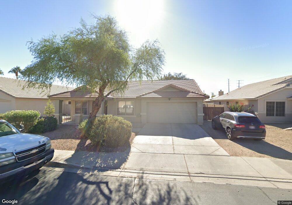
2045 E Smoke Tree Rd Gilbert, AZ 85296
East Gilbert NeighborhoodEstimated Value: $1,136,000 - $1,713,000
Studio
3
Baths
3,174
Sq Ft
$465/Sq Ft
Est. Value
About This Home
This home is located at 2045 E Smoke Tree Rd, Gilbert, AZ 85296 and is currently estimated at $1,477,359, approximately $465 per square foot. 2045 E Smoke Tree Rd is a home located in Maricopa County with nearby schools including Finley Farms Elementary School, Greenfield Junior High School, and American Leadership Academy Gilbert North 7-12.
Ownership History
Date
Name
Owned For
Owner Type
Purchase Details
Closed on
Dec 1, 2010
Sold by
Peterson Lester G
Bought by
Peterson Lester G and Peterson Mary
Current Estimated Value
Home Financials for this Owner
Home Financials are based on the most recent Mortgage that was taken out on this home.
Original Mortgage
$584,000
Outstanding Balance
$384,854
Interest Rate
4.17%
Mortgage Type
New Conventional
Estimated Equity
$1,092,505
Purchase Details
Closed on
May 12, 2003
Sold by
Peterson Lester G
Bought by
Peterson Lester G and Peterson Mary
Home Financials for this Owner
Home Financials are based on the most recent Mortgage that was taken out on this home.
Original Mortgage
$638,000
Interest Rate
5.71%
Purchase Details
Closed on
Nov 13, 2002
Sold by
Peterson Lester G
Bought by
Peterson Lester G and Peterson Mary M
Home Financials for this Owner
Home Financials are based on the most recent Mortgage that was taken out on this home.
Original Mortgage
$629,800
Interest Rate
5.95%
Purchase Details
Closed on
Nov 5, 2002
Sold by
Peterson Lester G
Bought by
Peterson Lester G and Peterson Mary M
Home Financials for this Owner
Home Financials are based on the most recent Mortgage that was taken out on this home.
Original Mortgage
$629,800
Interest Rate
5.95%
Purchase Details
Closed on
Sep 8, 1999
Sold by
Peterson Lester G
Bought by
Peterson Lester G and Peterson Mary M
Purchase Details
Closed on
Dec 26, 1996
Sold by
Nijdl Nicole
Bought by
Peterson Lester G and Peterson Mary M
Home Financials for this Owner
Home Financials are based on the most recent Mortgage that was taken out on this home.
Original Mortgage
$650,000
Interest Rate
7.12%
Purchase Details
Closed on
Nov 29, 1995
Sold by
Nijdl Nicole
Bought by
Peterson Lester and Peterson Mary M
Home Financials for this Owner
Home Financials are based on the most recent Mortgage that was taken out on this home.
Original Mortgage
$650,000
Interest Rate
7.47%
Mortgage Type
Small Business Administration
Create a Home Valuation Report for This Property
The Home Valuation Report is an in-depth analysis detailing your home's value as well as a comparison with similar homes in the area
Home Values in the Area
Average Home Value in this Area
Purchase History
| Date | Buyer | Sale Price | Title Company |
|---|---|---|---|
| Peterson Lester G | -- | Accommodation | |
| Peterson Lester G | -- | Accommodation | |
| Peterson Lester G | -- | -- | |
| Peterson Lester G | -- | Security Title Agency | |
| Peterson Lester G | -- | -- | |
| Peterson Lester G | -- | Stewart Title & Trust | |
| Peterson Lester G | -- | -- | |
| Peterson Lester G | -- | Security Title Agency | |
| Peterson Lester | -- | Security Title Agency | |
| Nijdl Nicole | -- | Security Title Agency |
Source: Public Records
Mortgage History
| Date | Status | Borrower | Loan Amount |
|---|---|---|---|
| Open | Peterson Lester G | $584,000 | |
| Previous Owner | Peterson Lester G | $638,000 | |
| Previous Owner | Peterson Lester G | $629,800 | |
| Previous Owner | Peterson Lester G | $650,000 | |
| Previous Owner | Peterson Lester | $650,000 |
Source: Public Records
Tax History
| Year | Tax Paid | Tax Assessment Tax Assessment Total Assessment is a certain percentage of the fair market value that is determined by local assessors to be the total taxable value of land and additions on the property. | Land | Improvement |
|---|---|---|---|---|
| 2025 | $3,742 | $97,343 | -- | -- |
| 2024 | $3,524 | $92,707 | -- | -- |
| 2023 | $3,524 | $100,010 | $20,000 | $80,010 |
| 2022 | $3,474 | $85,550 | $17,110 | $68,440 |
| 2021 | $3,873 | $85,900 | $17,180 | $68,720 |
| 2020 | $3,818 | $84,620 | $16,920 | $67,700 |
| 2019 | $3,703 | $80,670 | $16,130 | $64,540 |
| 2018 | $3,564 | $78,250 | $15,650 | $62,600 |
| 2017 | $3,436 | $78,620 | $15,720 | $62,900 |
| 2016 | $3,417 | $71,870 | $14,370 | $57,500 |
| 2015 | $3,233 | $59,760 | $11,950 | $47,810 |
Source: Public Records
Map
Nearby Homes
- 2062 E Palomino Dr
- 1866 E Sagebrush St
- 1894 E Palomino Dr
- 2062 E Arabian Dr
- 2222 E Arabian Dr
- 2069 E Sierra Madre Ave
- 1735 E Saratoga St
- 557 S Lemon Ct
- 652 S Bahama Dr
- 1678 E Rawhide St
- 1645 E Orangewood St
- 1644 E Orangewood St
- 1648 E Palomino Dr
- 1745 E Cheyenne St
- 2056 E San Tan Ct
- 2177 E Ranch Ct
- 952 S Canal Dr
- 335 S Red Rock St
- 2333 E Finley St
- 633 S Parkcrest St
- 2045 E Smoke Tree Rd
- 2055 E Smoke Tree Rd
- 2035 E Smoke Tree Rd
- 2048 E Saratoga St
- 2042 E Saratoga St
- 2046 E Smoke Tree Rd
- 2025 E Smoke Tree Rd
- 2065 E Smoke Tree Rd
- 2032 E Saratoga St
- 2042 E Smoke Tree Rd
- 2064 E Saratoga St
- 2052 E Smoke Tree Rd
- 2026 E Saratoga St
- 2032 E Smoke Tree Rd
- 2032 E Smoke Tree Rd
- 2062 E Smoke Tree Rd
- 2003 E Smoke Tree Rd
- 2015 E Smoke Tree Rd
- 2075 E Smoke Tree Rd
- 2072 E Saratoga St
Your Personal Tour Guide
Ask me questions while you tour the home.