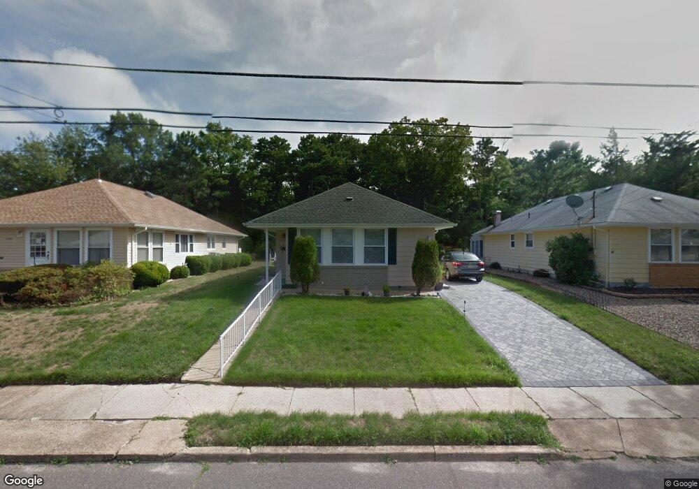
2045 Hovsons Blvd Toms River, NJ 08753
Estimated Value: $219,000 - $279,000
2
Beds
2
Baths
1,072
Sq Ft
$238/Sq Ft
Est. Value
About This Home
This home is located at 2045 Hovsons Blvd, Toms River, NJ 08753 and is currently estimated at $254,715, approximately $237 per square foot. 2045 Hovsons Blvd is a home located in Ocean County with nearby schools including Ocean County Christian Academy.
Ownership History
Date
Name
Owned For
Owner Type
Purchase Details
Closed on
Jul 22, 2014
Sold by
Dougherty Carol and Stofan Veronica
Bought by
Stofan Veronica
Current Estimated Value
Purchase Details
Closed on
May 2, 2014
Sold by
Dougherty Carol
Bought by
Stofan Veronica
Home Financials for this Owner
Home Financials are based on the most recent Mortgage that was taken out on this home.
Original Mortgage
$64,850
Interest Rate
4.19%
Mortgage Type
New Conventional
Purchase Details
Closed on
Nov 24, 2009
Sold by
Brzyski Renata and Brzyski Walter
Bought by
Dougherty Carol and Stofan Veronica
Home Financials for this Owner
Home Financials are based on the most recent Mortgage that was taken out on this home.
Original Mortgage
$69,900
Interest Rate
4.92%
Mortgage Type
New Conventional
Purchase Details
Closed on
Mar 19, 1998
Sold by
Poole Helen L
Bought by
Brzyski Barbara
Create a Home Valuation Report for This Property
The Home Valuation Report is an in-depth analysis detailing your home's value as well as a comparison with similar homes in the area
Home Values in the Area
Average Home Value in this Area
Purchase History
| Date | Buyer | Sale Price | Title Company |
|---|---|---|---|
| Stofan Veronica | -- | Ocean Title Service Inc | |
| Stofan Veronica | -- | None Available | |
| Dougherty Carol | $94,900 | Lawyers Title Insurance Corp | |
| Brzyski Barbara | $63,750 | Lawyers Title Insurance Corp |
Source: Public Records
Mortgage History
| Date | Status | Borrower | Loan Amount |
|---|---|---|---|
| Previous Owner | Stofan Veronica | $64,850 | |
| Previous Owner | Dougherty Carol | $69,900 |
Source: Public Records
Tax History Compared to Growth
Tax History
| Year | Tax Paid | Tax Assessment Tax Assessment Total Assessment is a certain percentage of the fair market value that is determined by local assessors to be the total taxable value of land and additions on the property. | Land | Improvement |
|---|---|---|---|---|
| 2025 | $2,857 | $156,800 | $47,000 | $109,800 |
| 2024 | $2,714 | $156,800 | $47,000 | $109,800 |
| 2023 | $2,615 | $156,800 | $47,000 | $109,800 |
| 2022 | $2,615 | $156,800 | $47,000 | $109,800 |
| 2021 | $1,461 | $66,400 | $20,000 | $46,400 |
| 2020 | $1,651 | $66,400 | $20,000 | $46,400 |
| 2019 | $1,580 | $66,400 | $20,000 | $46,400 |
| 2018 | $1,564 | $66,400 | $20,000 | $46,400 |
| 2017 | $1,553 | $66,400 | $20,000 | $46,400 |
| 2016 | $1,517 | $66,400 | $20,000 | $46,400 |
| 2015 | $1,462 | $66,400 | $20,000 | $46,400 |
| 2014 | $1,390 | $66,400 | $20,000 | $46,400 |
Source: Public Records
Map
Nearby Homes
- 16 Catskill Ct
- 23 Niagara Dr
- 1973 Yorktowne Blvd
- 10 Caribbean Ct
- 1920 Kenilworth Ct
- 2145 Hovsons Blvd
- 2164 Hovsons Blvd
- 2024 Mount Carmel Blvd
- 1902 Hovsons Blvd
- 1853 Yorktowne Blvd
- 1925 Mount Carmel Blvd
- 23 Yellowstone Dr
- 1814 Yorktowne Blvd
- 2430-2438 Church Rd
- 2208 Hovsons Blvd
- 72 Mount Matterhorn Ln
- 1183B Clydebank Ct Unit 1183B
- 1729 Yorktowne Blvd
- 1178A Clydebank Ct
- 2252 Hovsons Blvd
- 2049 Hovsons Blvd
- 2053 Hovsons Blvd
- 2037 Hovsons Blvd
- 2057 Hovsons Blvd
- 2046 Hovsons Blvd
- 2050 Hovsons Blvd
- 2033 Hovsons Blvd
- 2054 Hovsons Blvd
- 8 Palisades Dr
- 2061 Hovsons Blvd
- 2058 Hovsons Blvd
- 12 Palisades Dr
- 2029 Hovsons Blvd
- 9 Palisades Dr
- 2065 Hovsons Blvd
- 2062 Hovsons Blvd
- 2030 Hovsons Blvd
- 16 Palisades Dr
- 2025 Hovsons Blvd
- 13 Palisades Dr