Estimated Value: $147,961
--
Bed
--
Bath
1,504
Sq Ft
$98/Sq Ft
Est. Value
About This Home
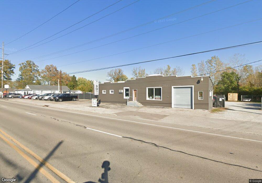
This home is located at 2045 S Co Road 25a, Troy, OH 45373 and is currently estimated at $147,961, approximately $98 per square foot. 2045 S Co Road 25a is a home located in Miami County with nearby schools including Kyle Elementary School, Van Cleve Elementary School, and Troy Junior High School.
Ownership History
Date
Name
Owned For
Owner Type
Purchase Details
Closed on
Apr 1, 2025
Sold by
Spencer Jamie N
Bought by
Ontop Towing Llc
Current Estimated Value
Home Financials for this Owner
Home Financials are based on the most recent Mortgage that was taken out on this home.
Original Mortgage
$114,400
Outstanding Balance
$113,269
Interest Rate
6.85%
Mortgage Type
Credit Line Revolving
Estimated Equity
$34,692
Purchase Details
Closed on
Jun 28, 2024
Sold by
Burton Douglas J and Burton Stacey
Bought by
Spencer Jamie N
Create a Home Valuation Report for This Property
The Home Valuation Report is an in-depth analysis detailing your home's value as well as a comparison with similar homes in the area
Home Values in the Area
Average Home Value in this Area
Purchase History
| Date | Buyer | Sale Price | Title Company |
|---|---|---|---|
| Ontop Towing Llc | $143,000 | None Listed On Document | |
| Spencer Jamie N | $130,000 | Vantage Land Title |
Source: Public Records
Mortgage History
| Date | Status | Borrower | Loan Amount |
|---|---|---|---|
| Open | Ontop Towing Llc | $114,400 |
Source: Public Records
Tax History Compared to Growth
Tax History
| Year | Tax Paid | Tax Assessment Tax Assessment Total Assessment is a certain percentage of the fair market value that is determined by local assessors to be the total taxable value of land and additions on the property. | Land | Improvement |
|---|---|---|---|---|
| 2024 | $1,262 | $20,660 | $10,190 | $10,470 |
| 2023 | $1,262 | $20,660 | $10,190 | $10,470 |
| 2022 | $1,148 | $20,660 | $10,190 | $10,470 |
| 2021 | $1,161 | $20,660 | $10,190 | $10,470 |
| 2020 | $1,149 | $20,660 | $10,190 | $10,470 |
| 2019 | $1,151 | $20,660 | $10,190 | $10,470 |
| 2018 | $992 | $17,680 | $15,930 | $1,750 |
| 2017 | $991 | $17,680 | $15,930 | $1,750 |
| 2016 | $1,072 | $17,680 | $15,930 | $1,750 |
| 2015 | $975 | $17,680 | $15,930 | $1,750 |
| 2014 | $975 | $17,680 | $15,930 | $1,750 |
| 2013 | $973 | $17,680 | $15,930 | $1,750 |
Source: Public Records
Map
Nearby Homes
- 2065 S Co Road 25a
- 0 Lincolnshire Unit 939331
- 2765 Silver Maple Ct
- 2015 Merrimont Dr
- 2215 Merrimont Dr
- 650 Swailes Rd
- 1550 Creekwood Dr
- 1002 S Market St
- 660 Wisteria Dr
- 917 S Clay St
- 1215 Maple St
- 1124 Race Dr
- 814 S Clay St
- 385 W Ross St
- 345 W Ross St
- 230 Floral Ave
- 512 Peters Ave
- 804 S Walnut St
- 1127 Honeydew Dr
- 2125 S County Road 25a
- 2019 S County Road 25a
- 2050 S County Road 25a
- 2015 S County Road 25a
- 2015 S County Road 25a
- 2153 S Co Road 25a
- 2010 S County Road 25a
- 1964 S County Road 25a
- 1938 S County Road 25a
- 1920 S County Road 25a
- 1900 S Co Road 25a
- 1900 S County Road 25a
- 1882 S Co Road 25a
- 1882 S County Road 25a
- 1870 S County Road 25a
- 1850 S County Road 25a
- 1850 S County Road 25a Unit 18
- 1865 S County Road 25a
- 1865 S County Road 25a
- 1820 S County Road 25a