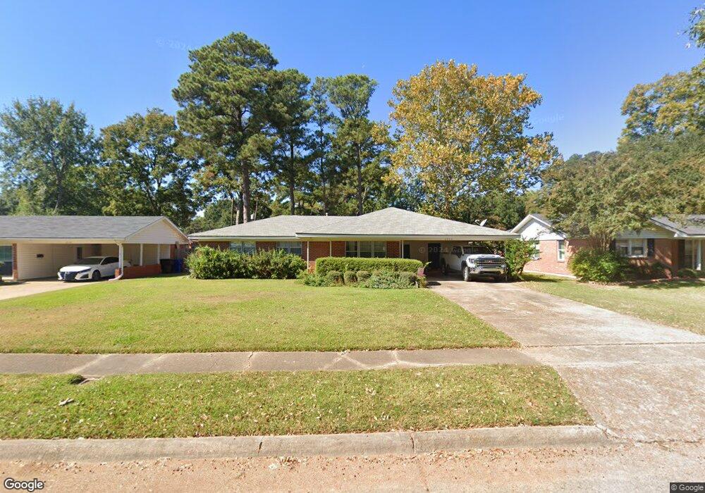
2046 Bermuda St Shreveport, LA 71105
Broadmoor/Anderson Island/Shreve Isle NeighborhoodEstimated Value: $176,661 - $211,000
3
Beds
2
Baths
1,865
Sq Ft
$105/Sq Ft
Est. Value
About This Home
This home is located at 2046 Bermuda St, Shreveport, LA 71105 and is currently estimated at $195,415, approximately $104 per square foot. 2046 Bermuda St is a home located in Caddo Parish with nearby schools including Fairfield Magnet School, Judson Fundamental Elementary School, and Eden Gardens Fundamental Elementary School.
Ownership History
Date
Name
Owned For
Owner Type
Purchase Details
Closed on
Jun 2, 2005
Sold by
Nolan Inc
Bought by
Burns Donald Craig and Burns Dee Lynn Endicott
Current Estimated Value
Home Financials for this Owner
Home Financials are based on the most recent Mortgage that was taken out on this home.
Original Mortgage
$72,300
Outstanding Balance
$37,794
Interest Rate
5.78%
Mortgage Type
Commercial
Estimated Equity
$157,621
Create a Home Valuation Report for This Property
The Home Valuation Report is an in-depth analysis detailing your home's value as well as a comparison with similar homes in the area
Home Values in the Area
Average Home Value in this Area
Purchase History
| Date | Buyer | Sale Price | Title Company |
|---|---|---|---|
| Burns Donald Craig | $60,626 | None Available |
Source: Public Records
Mortgage History
| Date | Status | Borrower | Loan Amount |
|---|---|---|---|
| Open | Burns Donald Craig | $72,300 |
Source: Public Records
Tax History Compared to Growth
Tax History
| Year | Tax Paid | Tax Assessment Tax Assessment Total Assessment is a certain percentage of the fair market value that is determined by local assessors to be the total taxable value of land and additions on the property. | Land | Improvement |
|---|---|---|---|---|
| 2024 | $2,016 | $12,931 | $2,678 | $10,253 |
| 2023 | $1,881 | $11,800 | $2,550 | $9,250 |
| 2022 | $1,881 | $11,800 | $2,550 | $9,250 |
| 2021 | $1,852 | $11,800 | $2,550 | $9,250 |
| 2020 | $1,852 | $11,800 | $2,550 | $9,250 |
| 2019 | $1,919 | $11,869 | $2,550 | $9,319 |
| 2018 | $563 | $11,869 | $2,550 | $9,319 |
| 2017 | $1,950 | $11,869 | $2,550 | $9,319 |
| 2015 | $526 | $11,560 | $2,550 | $9,010 |
| 2014 | $530 | $11,560 | $2,550 | $9,010 |
| 2013 | -- | $11,560 | $2,550 | $9,010 |
Source: Public Records
Map
Nearby Homes
- 2045 Horton Ave
- 502 Mockingbird Ln
- 1923 Bermuda St
- 2049 River Rd
- 636 Pelican Place
- 1919 Audubon Place
- 2013 E Kings Hwy
- 2005 E Kings Hwy
- 306 Oriole Ln
- 1810 Captain Shreve Dr
- 5108 Dixie Garden Dr
- 5822 River Rd
- 1836 Bryan Place
- 5707 Anniston Ave
- 156 Charles Ave
- 5737 Anniston Ave
- 142 Lynn Ave
- 163 Charles Ave
- 1615 Captain Shreve Dr
- 506 Americana Dr
- 2050 Bermuda St
- 2042 Bermuda St
- 2054 Bermuda St
- 2038 Bermuda St
- 2049 Horton Ave
- 2051 Bermuda St
- 2047 Bermuda St
- 2053 Horton Ave
- 2055 Bermuda St
- 2034 Bermuda St
- 2043 Bermuda St
- 2059 Bermuda St
- 2057 Horton Ave
- 2033 Horton Ave
- 2039 Bermuda St
- 2030 Bermuda St
- 2063 Bermuda St
- 2035 Bermuda St
- 2029 Horton Ave
- 2029 Horton Ave