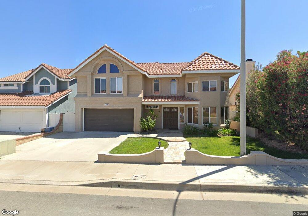
20468 Ermine St Canyon Country, CA 91351
Estimated Value: $879,184 - $1,006,000
4
Beds
3
Baths
2,373
Sq Ft
$401/Sq Ft
Est. Value
About This Home
This home is located at 20468 Ermine St, Canyon Country, CA 91351 and is currently estimated at $950,546, approximately $400 per square foot. 20468 Ermine St is a home located in Los Angeles County with nearby schools including Skyblue Mesa Elementary School, Sierra Vista Junior High School, and Canyon High School.
Ownership History
Date
Name
Owned For
Owner Type
Purchase Details
Closed on
Mar 29, 2024
Sold by
Powell John and Powell Sandra
Bought by
Charrua Revocable Living Trust and Powell
Current Estimated Value
Purchase Details
Closed on
Aug 4, 1997
Sold by
Home Svgs Of America Fsb
Bought by
Powell John and Powell Sandra
Home Financials for this Owner
Home Financials are based on the most recent Mortgage that was taken out on this home.
Original Mortgage
$196,600
Interest Rate
7.45%
Purchase Details
Closed on
Jun 19, 1997
Sold by
Covarrubias Ernie R and Home Svgs Of America Fsb
Bought by
Home Svgs Of America Fsb
Home Financials for this Owner
Home Financials are based on the most recent Mortgage that was taken out on this home.
Original Mortgage
$196,600
Interest Rate
7.45%
Purchase Details
Closed on
Mar 21, 1995
Sold by
Covarrubias Ernie R
Bought by
Covarrubias Sue
Create a Home Valuation Report for This Property
The Home Valuation Report is an in-depth analysis detailing your home's value as well as a comparison with similar homes in the area
Home Values in the Area
Average Home Value in this Area
Purchase History
| Date | Buyer | Sale Price | Title Company |
|---|---|---|---|
| Charrua Revocable Living Trust | -- | None Listed On Document | |
| Powell John | $207,000 | Investors Title Company | |
| Home Svgs Of America Fsb | $175,500 | Fidelity National Title Ins | |
| Covarrubias Sue | -- | Southern California Title |
Source: Public Records
Mortgage History
| Date | Status | Borrower | Loan Amount |
|---|---|---|---|
| Previous Owner | Powell John | $196,600 |
Source: Public Records
Tax History Compared to Growth
Tax History
| Year | Tax Paid | Tax Assessment Tax Assessment Total Assessment is a certain percentage of the fair market value that is determined by local assessors to be the total taxable value of land and additions on the property. | Land | Improvement |
|---|---|---|---|---|
| 2025 | $5,524 | $391,555 | $98,668 | $292,887 |
| 2024 | $5,524 | $383,879 | $96,734 | $287,145 |
| 2023 | $5,268 | $376,353 | $94,838 | $281,515 |
| 2022 | $5,291 | $368,975 | $92,979 | $275,996 |
| 2021 | $5,198 | $361,741 | $91,156 | $270,585 |
| 2019 | $5,014 | $351,013 | $88,453 | $262,560 |
| 2018 | $4,850 | $344,131 | $86,719 | $257,412 |
| 2016 | $4,563 | $330,769 | $83,352 | $247,417 |
| 2015 | $4,392 | $325,801 | $82,100 | $243,701 |
| 2014 | $4,321 | $319,420 | $80,492 | $238,928 |
Source: Public Records
Map
Nearby Homes
- 20523 Stella Place
- 20312 Dorothy St
- 20264 Dorothy St
- 20256 Dorothy St
- 28002 Kenny Ln
- 27636 Camellia Dr
- 27642 Camellia Dr
- 20533 Martingale Place
- 20535 Martingale Place
- 20543 Martingale Place
- 0 Vac Vic Oracle Hills Dusty Unit SR24027628
- 0 Vac Diamond View Ln Vic Summit Unit BB23229948
- 0 Vac Godde Hill Rd Wic Vic Ave Unit SR25026848
- 27667 Camellia Dr
- 20361 Julia Ln
- 20208 Northcliff Dr
- 20552 Galloway Dr
- 20544 Galloway Dr
- 20053 Northcliff Dr
- 27806 Meadowcreek Rd
- 20474 Ermine St
- 20462 Ermine St
- 27523 Label Ave
- 20478 Ermine St
- 27519 Label Ave
- 20463 Ermine St
- 20469 Ermine St
- 27517 Label Ave
- 27515 Label Ave
- 20477 Ermine St
- 20452 Ermine St
- 27520 Label Ave
- 20455 Ermine St
- 27509 Label Ave
- 20446 Ermine St
- 27507 Label Ave
- 27524 Label Ave
- 20447 Ermine St
- 27514 Label Ave
- 20440 Ermine St