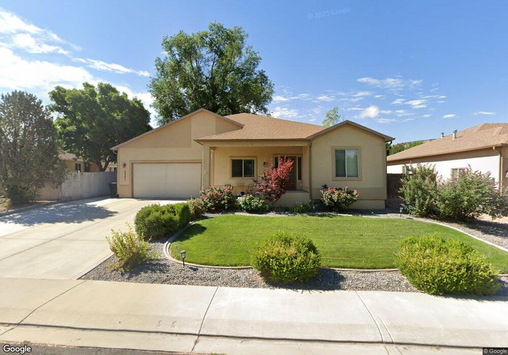
2047 Conestoga Dr Grand Junction, CO 81507
Redlands NeighborhoodEstimated Value: $680,686 - $758,000
3
Beds
2
Baths
1,967
Sq Ft
$361/Sq Ft
Est. Value
About This Home
This home is located at 2047 Conestoga Dr, Grand Junction, CO 81507 and is currently estimated at $710,672, approximately $361 per square foot. 2047 Conestoga Dr is a home located in Mesa County with nearby schools including Wingate Elementary School, Redlands Middle School, and Fruita 8/9 School.
Ownership History
Date
Name
Owned For
Owner Type
Purchase Details
Closed on
Feb 23, 2005
Sold by
Fisher Albert Michael
Bought by
Griffith Kirk A and Griffith Kathleen C
Current Estimated Value
Home Financials for this Owner
Home Financials are based on the most recent Mortgage that was taken out on this home.
Original Mortgage
$223,600
Outstanding Balance
$104,939
Interest Rate
4.5%
Mortgage Type
New Conventional
Estimated Equity
$605,734
Purchase Details
Closed on
Dec 6, 2004
Sold by
Fisher Michael Ray and Fisher Cindy Rose
Bought by
Fisher Albert Michael
Purchase Details
Closed on
Dec 7, 2001
Sold by
Schwartz Fred B and Shwartz Winona B
Bought by
Fisher Michael Ray and Fisher Cindy Rose
Home Financials for this Owner
Home Financials are based on the most recent Mortgage that was taken out on this home.
Original Mortgage
$185,000
Interest Rate
8%
Mortgage Type
Seller Take Back
Create a Home Valuation Report for This Property
The Home Valuation Report is an in-depth analysis detailing your home's value as well as a comparison with similar homes in the area
Home Values in the Area
Average Home Value in this Area
Purchase History
| Date | Buyer | Sale Price | Title Company |
|---|---|---|---|
| Griffith Kirk A | $279,500 | First American Heritage Titl | |
| Fisher Albert Michael | -- | -- | |
| Fisher Michael Ray | $195,000 | Meridian Land Title Llc |
Source: Public Records
Mortgage History
| Date | Status | Borrower | Loan Amount |
|---|---|---|---|
| Open | Griffith Kirk A | $223,600 | |
| Previous Owner | Fisher Michael Ray | $185,000 | |
| Closed | Griffith Kirk A | $41,925 |
Source: Public Records
Tax History Compared to Growth
Tax History
| Year | Tax Paid | Tax Assessment Tax Assessment Total Assessment is a certain percentage of the fair market value that is determined by local assessors to be the total taxable value of land and additions on the property. | Land | Improvement |
|---|---|---|---|---|
| 2024 | $2,454 | $34,730 | $12,110 | $22,620 |
| 2023 | $2,454 | $34,730 | $12,110 | $22,620 |
| 2022 | $1,985 | $27,650 | $6,950 | $20,700 |
| 2021 | $2,052 | $28,440 | $7,150 | $21,290 |
| 2020 | $1,926 | $27,640 | $6,080 | $21,560 |
| 2019 | $1,806 | $27,640 | $6,080 | $21,560 |
| 2018 | $1,833 | $25,370 | $5,760 | $19,610 |
| 2017 | $1,829 | $25,370 | $5,760 | $19,610 |
| 2016 | $1,467 | $22,780 | $5,570 | $17,210 |
| 2015 | $1,479 | $22,780 | $5,570 | $17,210 |
| 2014 | $1,059 | $16,310 | $5,170 | $11,140 |
Source: Public Records
Map
Nearby Homes
- 2035 Wrangler Way
- 2034 Rodeo Way
- 677 Roundup Dr
- 2057 Sienna Creek Ct
- 630 Margarita Dr
- 2057 Ferree Dr
- 693 Roundup Dr
- 630 Manzanita Dr
- 631 Margarita Dr
- 605 Manzanita Dr
- 606 Manzanita Dr
- 634 Manzanita Dr
- 624 Manzanita Dr
- 632 Manzanita Dr
- 604 Manzanita Dr
- 714 Malachi St
- 633 Margarita Dr
- 700 Roundup Dr
- 636 Margarita Dr
- 608 Manzanita Dr
- 2045 Conestoga Dr
- 2049 Conestoga Dr
- 0 Conestoga Dr Unit 643867
- 2043 Conestoga Dr
- 2048 Conestoga Dr
- 651 20 1/2 Rd
- 2041 Conestoga Dr
- 641 20 1/2 Rd
- 20 1/2 Road
- 657 20 1/2 Rd
- 657 20 1 2 Rd
- 640 Terrace Dr
- 652 20 1/2 Rd
- 658 Stepher Ct
- 2044 N Surrey Ct
- 2046 N Surrey Ct
- 657 Stepher Ct
- 2039 Conestoga Dr
- 660 Stepher Ct
- 2042 N Surrey Ct