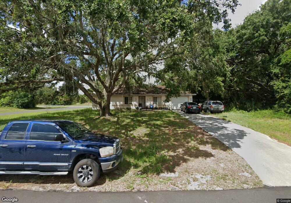
2047 Jeronimo Rd Labelle, FL 33935
Port LaBelle NeighborhoodEstimated Value: $203,364 - $287,000
3
Beds
2
Baths
1,076
Sq Ft
$214/Sq Ft
Est. Value
About This Home
This home is located at 2047 Jeronimo Rd, Labelle, FL 33935 and is currently estimated at $229,841, approximately $213 per square foot. 2047 Jeronimo Rd is a home located in Hendry County with nearby schools including International Christian Academy of Labelle.
Ownership History
Date
Name
Owned For
Owner Type
Purchase Details
Closed on
Apr 14, 2005
Sold by
Technologia Inc
Bought by
Wright Toni M
Current Estimated Value
Home Financials for this Owner
Home Financials are based on the most recent Mortgage that was taken out on this home.
Original Mortgage
$106,400
Outstanding Balance
$54,046
Interest Rate
5.74%
Mortgage Type
Fannie Mae Freddie Mac
Estimated Equity
$175,795
Purchase Details
Closed on
Nov 19, 2004
Sold by
Bratter Michael and Brown Dana
Bought by
Technologia Inc
Purchase Details
Closed on
Nov 1, 1998
Sold by
Lee William James and Lee Florence Letitia
Bought by
Wood Lee William Sean and Wood Lee Sara
Create a Home Valuation Report for This Property
The Home Valuation Report is an in-depth analysis detailing your home's value as well as a comparison with similar homes in the area
Home Values in the Area
Average Home Value in this Area
Purchase History
| Date | Buyer | Sale Price | Title Company |
|---|---|---|---|
| Wright Toni M | $133,000 | Labelle True Title & Trust L | |
| Technologia Inc | $17,000 | -- | |
| Bratter Michael | $9,000 | -- | |
| Wood Lee William Sean | -- | -- |
Source: Public Records
Mortgage History
| Date | Status | Borrower | Loan Amount |
|---|---|---|---|
| Open | Wright Toni M | $106,400 | |
| Closed | Wright Toni M | $26,600 |
Source: Public Records
Tax History
| Year | Tax Paid | Tax Assessment Tax Assessment Total Assessment is a certain percentage of the fair market value that is determined by local assessors to be the total taxable value of land and additions on the property. | Land | Improvement |
|---|---|---|---|---|
| 2025 | $1,142 | $45,805 | -- | -- |
| 2024 | $938 | $44,514 | -- | -- |
| 2023 | $938 | $43,218 | $0 | $0 |
| 2022 | $930 | $41,959 | $0 | $0 |
| 2021 | $836 | $40,736 | $0 | $0 |
| 2020 | $751 | $40,174 | $0 | $0 |
| 2019 | $746 | $39,271 | $0 | $0 |
| 2018 | $732 | $38,539 | $0 | $0 |
| 2017 | $725 | $37,746 | $0 | $0 |
| 2016 | $579 | $36,970 | $0 | $0 |
| 2015 | $570 | $36,710 | $0 | $0 |
| 2014 | $559 | $36,420 | $0 | $0 |
Source: Public Records
Map
Nearby Homes
- 2008 Alliance Ln
- 2001 Schooner Dr
- 2009 Inglewood Cir
- 2007 Schooner Dr
- 2011 Granada Rd
- 2039 Detroit Dr
- 2003 Granada Rd
- 2014 Odessa Cir
- 2028 Schooner Dr
- 2005 N Montana Cir
- 4040 S Edgewater Cir
- 4003 S Edgewater Cir
- 4005 Cascade Ln
- 4021 W Palomar Cir
- 4077 S Edgewater Cir
- 4006 S Edgewater Cir
- 3019 N Tulip Rd
- 2049 S Montana Cir
- 2059 S Montana Cir
- 4006 Beaumont Ln
- 2026 Granada Rd
- 2026 Jeronimo Rd
- 2033 Granada Rd
- 2020 Granada Rd
- 2018 Mainstay St
- 2027 Granada Rd
- 2033 Jeronimo Rd
- 2016 Mainstay St
- 2002 Mariner Ct
- 2014 Mainstay St
- 2004 Mariner Ct
- 2015 Jeronimo Rd
- 2012 Mainstay St
- 2009 Mainstay St
- 2021 Granada Rd
- 2006 Mariner Ct
- 2031 Jeronimo Rd
- 2005 Alliance Ln
- 2008 Alliance Ln Unit 2
- 2003 Alliance Ln
Your Personal Tour Guide
Ask me questions while you tour the home.