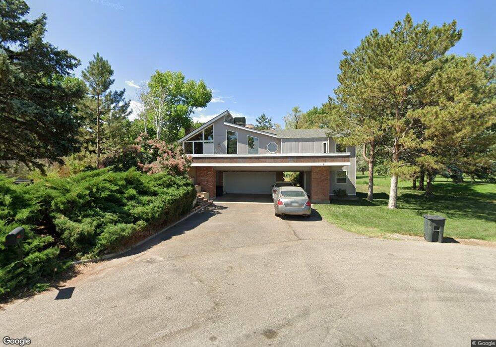
2047 Low Ball Ct Grand Junction, CO 81507
Redlands NeighborhoodEstimated Value: $643,000 - $768,000
3
Beds
3
Baths
2,302
Sq Ft
$304/Sq Ft
Est. Value
About This Home
This home is located at 2047 Low Ball Ct, Grand Junction, CO 81507 and is currently estimated at $699,292, approximately $303 per square foot. 2047 Low Ball Ct is a home located in Mesa County with nearby schools including Wingate Elementary School, Redlands Middle School, and Fruita 8/9 School.
Ownership History
Date
Name
Owned For
Owner Type
Purchase Details
Closed on
Jun 15, 2011
Sold by
Canter William T
Bought by
Miller Michael
Current Estimated Value
Home Financials for this Owner
Home Financials are based on the most recent Mortgage that was taken out on this home.
Original Mortgage
$242,250
Outstanding Balance
$167,237
Interest Rate
4.66%
Mortgage Type
New Conventional
Estimated Equity
$532,055
Purchase Details
Closed on
Apr 11, 2008
Sold by
Mcfarland Robert P and Mcfarland Ann Elizabeth
Bought by
Canter William T
Home Financials for this Owner
Home Financials are based on the most recent Mortgage that was taken out on this home.
Original Mortgage
$280,000
Interest Rate
6.19%
Mortgage Type
Purchase Money Mortgage
Purchase Details
Closed on
Jun 28, 2000
Sold by
Beshai Kathleen M
Bought by
Mcfarland Robert P and Mcfarland Ann Elizabeth
Home Financials for this Owner
Home Financials are based on the most recent Mortgage that was taken out on this home.
Original Mortgage
$10
Interest Rate
8.66%
Purchase Details
Closed on
Oct 17, 1994
Sold by
Beshai Amir Z
Bought by
Miller Michael
Purchase Details
Closed on
Mar 4, 1994
Sold by
Long Harry S
Bought by
Miller Michael
Create a Home Valuation Report for This Property
The Home Valuation Report is an in-depth analysis detailing your home's value as well as a comparison with similar homes in the area
Home Values in the Area
Average Home Value in this Area
Purchase History
| Date | Buyer | Sale Price | Title Company |
|---|---|---|---|
| Miller Michael | $285,000 | Fidelity National Title Insu | |
| Canter William T | $380,000 | Abstract & Title Company Of | |
| Mcfarland Robert P | $184,000 | Abstract & Title Company | |
| Miller Michael | -- | -- | |
| Miller Michael | $155,000 | -- |
Source: Public Records
Mortgage History
| Date | Status | Borrower | Loan Amount |
|---|---|---|---|
| Open | Miller Michael | $242,250 | |
| Previous Owner | Canter William T | $280,000 | |
| Previous Owner | Mcfarland Robert P | $10 |
Source: Public Records
Tax History Compared to Growth
Tax History
| Year | Tax Paid | Tax Assessment Tax Assessment Total Assessment is a certain percentage of the fair market value that is determined by local assessors to be the total taxable value of land and additions on the property. | Land | Improvement |
|---|---|---|---|---|
| 2024 | $2,491 | $35,250 | $12,740 | $22,510 |
| 2023 | $2,491 | $35,250 | $12,740 | $22,510 |
| 2022 | $2,099 | $29,240 | $8,340 | $20,900 |
| 2021 | $2,170 | $30,080 | $8,580 | $21,500 |
| 2020 | $1,846 | $26,480 | $7,870 | $18,610 |
| 2019 | $1,730 | $26,480 | $7,870 | $18,610 |
| 2018 | $1,570 | $21,740 | $7,200 | $14,540 |
| 2017 | $1,526 | $21,740 | $7,200 | $14,540 |
| 2016 | $1,526 | $23,690 | $7,960 | $15,730 |
| 2015 | $1,538 | $23,690 | $7,960 | $15,730 |
| 2014 | $1,383 | $21,300 | $7,160 | $14,140 |
Source: Public Records
Map
Nearby Homes
- 507 S Broadway Unit B
- 2023 S Broadway
- 517 Liberty Cap Ct
- 2071 Shamsi Dr
- 2069 Shamsi Dr
- 2070 Shamsi Dr
- 564 Five View Ln
- 2068 Shamsi Dr
- 566 Five View Ln
- 2071 Thomas Ivy Ln
- 2069 Thomas Ivy Ln
- 2059 S Broadway Unit C
- 2061 S Broadway Unit 402
- 2061 S Broadway Unit 202
- 1994 Bison Ct
- 2085 E 1 2 Rd
- 2022 Eagle Ct
- 587 20 3 4 Rd
- 584 20 Rd
- 2108 Desert Hill Rd