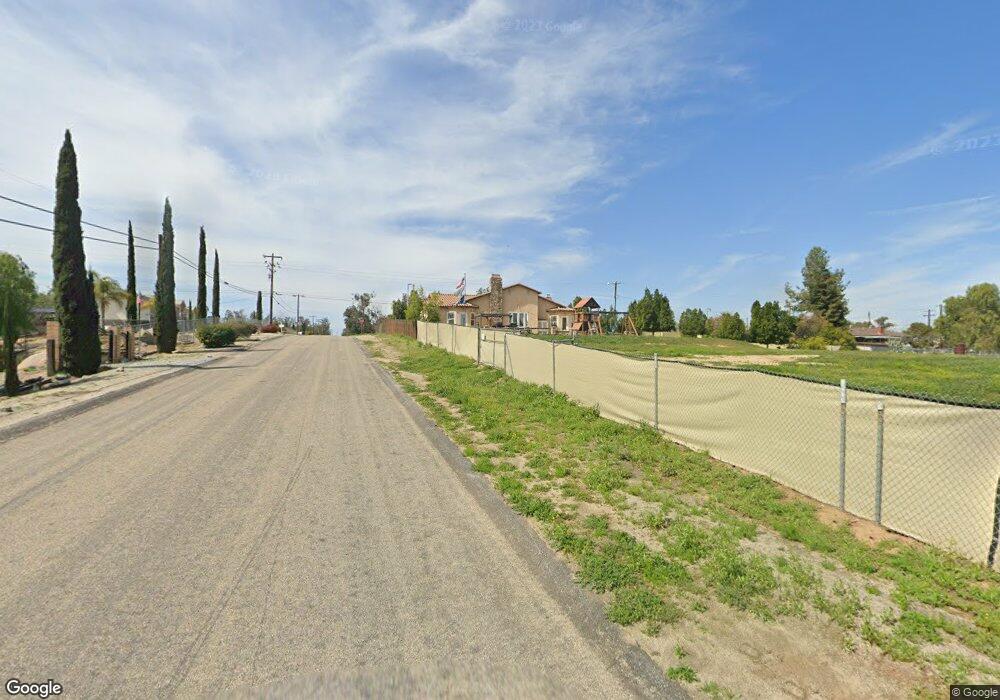
20476 Haines St Perris, CA 92570
Estimated Value: $793,245 - $1,076,000
3
Beds
3
Baths
3,057
Sq Ft
$295/Sq Ft
Est. Value
About This Home
This home is located at 20476 Haines St, Perris, CA 92570 and is currently estimated at $901,561, approximately $294 per square foot. 20476 Haines St is a home located in Riverside County with nearby schools including Columbia Elementary School, Tomas Rivera Middle School, and Citrus Hill High School.
Ownership History
Date
Name
Owned For
Owner Type
Purchase Details
Closed on
Jan 8, 2009
Sold by
Us Bank National Association
Bought by
Sandoval Ernesto Alonso
Current Estimated Value
Home Financials for this Owner
Home Financials are based on the most recent Mortgage that was taken out on this home.
Original Mortgage
$332,679
Outstanding Balance
$208,704
Interest Rate
5.04%
Mortgage Type
FHA
Estimated Equity
$692,857
Purchase Details
Closed on
Oct 15, 2008
Sold by
Torrez Martin L and Torrez Joy J
Bought by
Us Bank Na
Purchase Details
Closed on
Dec 30, 2004
Sold by
Patillo Loria and Green Darvin
Bought by
Torrez Martin L and Torrez Joy J
Create a Home Valuation Report for This Property
The Home Valuation Report is an in-depth analysis detailing your home's value as well as a comparison with similar homes in the area
Home Values in the Area
Average Home Value in this Area
Purchase History
| Date | Buyer | Sale Price | Title Company |
|---|---|---|---|
| Sandoval Ernesto Alonso | $338,000 | Lsi Title Agency | |
| Sandoval Ernesto Alonso | -- | Lsi Title Agency | |
| Us Bank Na | $392,060 | Lsi Title Company Ca | |
| Torrez Martin L | $140,000 | Orange Coast Title Company L |
Source: Public Records
Mortgage History
| Date | Status | Borrower | Loan Amount |
|---|---|---|---|
| Open | Sandoval Ernesto Alonso | $332,679 |
Source: Public Records
Tax History Compared to Growth
Tax History
| Year | Tax Paid | Tax Assessment Tax Assessment Total Assessment is a certain percentage of the fair market value that is determined by local assessors to be the total taxable value of land and additions on the property. | Land | Improvement |
|---|---|---|---|---|
| 2025 | $4,806 | $435,242 | $128,766 | $306,476 |
| 2023 | $4,806 | $418,343 | $123,767 | $294,576 |
| 2022 | $4,666 | $410,141 | $121,341 | $288,800 |
| 2021 | $4,575 | $402,100 | $118,962 | $283,138 |
| 2020 | $4,528 | $397,978 | $117,743 | $280,235 |
| 2019 | $4,252 | $390,176 | $115,435 | $274,741 |
| 2018 | $4,192 | $382,526 | $113,172 | $269,354 |
| 2017 | $4,093 | $375,026 | $110,953 | $264,073 |
| 2016 | $4,046 | $367,674 | $108,778 | $258,896 |
| 2015 | $3,985 | $362,153 | $107,145 | $255,008 |
| 2014 | $3,937 | $355,062 | $105,048 | $250,014 |
Source: Public Records
Map
Nearby Homes
- 21994 Mack St
- 20243 Lee Rd
- 0 Old Elsinore Rd Unit CV25117444
- 21840 Orange Ave
- 21031 Old Elsinore Rd
- 0 Campos Rd Unit IV24176919
- 0 Marquez Rd
- 20415 Myron St
- 20561 Hunter St
- 21780 Sawgo Dr
- 21402 Shortridge Ave
- 0 Marie Rd
- 20320 Roads End Dr
- 21277 Kinney St
- 20920 Sawgo Dr
- 20541 Moore St
- 21781 Rogers Rd
- 0 Day St Unit CV24223167
- 20748 Martin St
- 18759 Clark St
- 20430 Haines St
- 20525 Haines St
- 20560 Haines St
- 20555 Haines St
- 20392 Haines St
- 20596 Haines St
- 20585 Haines St
- 20421 Clark St
- 20455 Clark St
- 21450 Mack St
- 20553 Clark St
- 20383 Clark St
- 20595 Clark St
- 20615 Haines St
- 20462 Lee Dr
- 20420 Lee Dr
- 20462 Lee Rd
- 20339 Clark St
- 0 Smoketree Unit SW18187274
- 0 Smoketree Unit I12077271