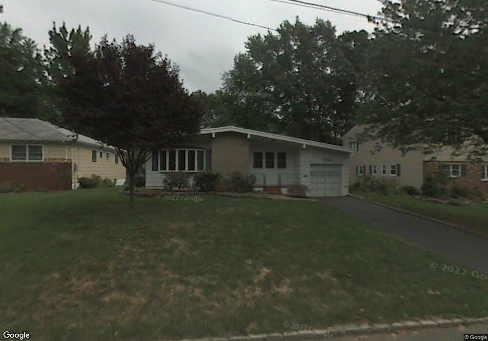
2048 Algonquin Dr Scotch Plains, NJ 07076
Estimated Value: $674,096 - $892,000
--
Bed
--
Bath
1,574
Sq Ft
$499/Sq Ft
Est. Value
About This Home
This home is located at 2048 Algonquin Dr, Scotch Plains, NJ 07076 and is currently estimated at $785,274, approximately $498 per square foot. 2048 Algonquin Dr is a home located in Union County with nearby schools including William J. McGinn Elementary School, Terrill Middle School, and Scotch Plains-Fanwood High School.
Ownership History
Date
Name
Owned For
Owner Type
Purchase Details
Closed on
Jul 25, 2008
Sold by
Lopez Omar Daniel
Bought by
Lebrun Ross and Lebrun Debra
Current Estimated Value
Home Financials for this Owner
Home Financials are based on the most recent Mortgage that was taken out on this home.
Original Mortgage
$415,972
Outstanding Balance
$272,809
Interest Rate
6.4%
Mortgage Type
FHA
Estimated Equity
$512,465
Purchase Details
Closed on
Oct 11, 2005
Sold by
Campbell Colin R
Bought by
Lopez Omar Daniel
Home Financials for this Owner
Home Financials are based on the most recent Mortgage that was taken out on this home.
Original Mortgage
$348,000
Interest Rate
5.79%
Mortgage Type
New Conventional
Purchase Details
Closed on
Jun 10, 1998
Sold by
Hanigan Dorothy M
Bought by
Campbell Colin R and Campbell Lisa S
Home Financials for this Owner
Home Financials are based on the most recent Mortgage that was taken out on this home.
Original Mortgage
$189,000
Interest Rate
7.11%
Create a Home Valuation Report for This Property
The Home Valuation Report is an in-depth analysis detailing your home's value as well as a comparison with similar homes in the area
Home Values in the Area
Average Home Value in this Area
Purchase History
| Date | Buyer | Sale Price | Title Company |
|---|---|---|---|
| Lebrun Ross | $422,500 | Multiple | |
| Lopez Omar Daniel | $435,000 | -- | |
| Campbell Colin R | $210,000 | -- |
Source: Public Records
Mortgage History
| Date | Status | Borrower | Loan Amount |
|---|---|---|---|
| Open | Lebrun Ross | $415,972 | |
| Previous Owner | Lopez Omar Daniel | $348,000 | |
| Previous Owner | Campbell Colin R | $189,000 |
Source: Public Records
Tax History Compared to Growth
Tax History
| Year | Tax Paid | Tax Assessment Tax Assessment Total Assessment is a certain percentage of the fair market value that is determined by local assessors to be the total taxable value of land and additions on the property. | Land | Improvement |
|---|---|---|---|---|
| 2025 | $12,827 | $109,000 | $28,100 | $80,900 |
| 2024 | $12,449 | $109,000 | $28,100 | $80,900 |
| 2023 | $12,449 | $109,000 | $28,100 | $80,900 |
| 2022 | $12,301 | $109,000 | $28,100 | $80,900 |
| 2021 | $12,280 | $109,000 | $28,100 | $80,900 |
| 2020 | $12,221 | $109,000 | $28,100 | $80,900 |
| 2019 | $12,131 | $109,000 | $28,100 | $80,900 |
| 2018 | $11,927 | $109,000 | $28,100 | $80,900 |
| 2017 | $11,266 | $105,300 | $28,100 | $77,200 |
| 2016 | $11,049 | $105,300 | $28,100 | $77,200 |
| 2015 | $10,868 | $105,300 | $28,100 | $77,200 |
| 2014 | $10,510 | $105,300 | $28,100 | $77,200 |
Source: Public Records
Map
Nearby Homes
- 2116 Newark Ave
- 2212 Shady Ln
- 345 La Grande Ave
- 2219 North Ave Unit 6
- 21 Old South Ave
- 120 S Martine Ave
- 1933 Mary Ellen Ln
- 2314 Longfellow Ave
- 40 1st St
- 1933 W Broad St
- 187 King St
- 5 Robin Rd
- 9 Timberline Dr
- 2286 Stocker Ln
- 2154 W Broad St
- 36 2nd St
- 119 Lamberts Mill Rd
- 4 Lois Place
- 193 South Ave
- 2 Brookside Ct
- 2054 Algonquin Dr
- 2042 Algonquin Dr
- 2057 Maple View Ct
- 2051 Maple View Ct
- 2060 Algonquin Dr
- 2061 Maple View Ct
- 2045 Maple View Ct
- 2053 Algonquin Dr
- 1072 Highview Ct
- 2066 Algonquin Dr
- 2067 Maple View Ct
- 2059 Algonquin Dr
- 2072 Algonquin Dr
- 2065 Algonquin Dr
- 2050 Princeton Ave
- 2073 Maple View Ct
- 2056 Maple View Ct
- 2058 Princeton Ave
- 2062 Maple View Ct
- 2050 Maple View Ct