Estimated Value: $103,401 - $143,000
3
Beds
1
Bath
960
Sq Ft
$135/Sq Ft
Est. Value
About This Home
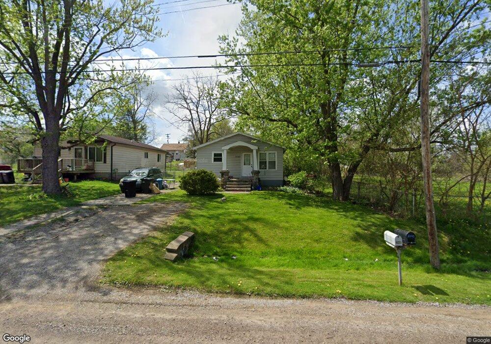
This home is located at 2048 Monaco St Unit Bldg-Unit, Flint, MI 48532 and is currently estimated at $129,600, approximately $135 per square foot. 2048 Monaco St Unit Bldg-Unit is a home located in Genesee County with nearby schools including Carman-Ainsworth High School, Genesee STEM Academy, and St. Paul Lutheran School.
Ownership History
Date
Name
Owned For
Owner Type
Purchase Details
Closed on
May 14, 2018
Sold by
Future Holdings Llc
Bought by
Lane Kevin T and Lane Mallory D
Current Estimated Value
Home Financials for this Owner
Home Financials are based on the most recent Mortgage that was taken out on this home.
Original Mortgage
$71,579
Outstanding Balance
$61,632
Interest Rate
4.4%
Mortgage Type
FHA
Estimated Equity
$67,968
Purchase Details
Closed on
Jan 24, 2017
Sold by
Newvine Thomas and Newvine Devon
Bought by
Future Holding Llc
Purchase Details
Closed on
Jun 12, 2006
Sold by
Wycoff Matthew S and Wycoff Pamela
Bought by
Newvine Thomas and Newvine Devon
Purchase Details
Closed on
Mar 8, 2002
Sold by
Wedel Susan L and Sisovsky Joseph J
Bought by
Wycoff Matthew S
Create a Home Valuation Report for This Property
The Home Valuation Report is an in-depth analysis detailing your home's value as well as a comparison with similar homes in the area
Home Values in the Area
Average Home Value in this Area
Purchase History
| Date | Buyer | Sale Price | Title Company |
|---|---|---|---|
| Lane Kevin T | $72,900 | None Available | |
| Future Holding Llc | $22,000 | None Available | |
| Newvine Thomas | $87,000 | Guaranty Title Company | |
| Wycoff Matthew S | $66,800 | Metropolitan Title Company |
Source: Public Records
Mortgage History
| Date | Status | Borrower | Loan Amount |
|---|---|---|---|
| Open | Lane Kevin T | $71,579 |
Source: Public Records
Tax History Compared to Growth
Tax History
| Year | Tax Paid | Tax Assessment Tax Assessment Total Assessment is a certain percentage of the fair market value that is determined by local assessors to be the total taxable value of land and additions on the property. | Land | Improvement |
|---|---|---|---|---|
| 2025 | $1,149 | $48,300 | $0 | $0 |
| 2024 | $538 | $43,100 | $0 | $0 |
| 2023 | $513 | $34,800 | $0 | $0 |
| 2022 | $549 | $31,400 | $0 | $0 |
| 2021 | $1,014 | $29,000 | $0 | $0 |
| 2020 | $461 | $24,200 | $0 | $0 |
| 2019 | $455 | $20,400 | $0 | $0 |
| 2018 | $1,195 | $25,400 | $0 | $0 |
| 2017 | $1,757 | $25,400 | $0 | $0 |
| 2016 | $1,434 | $23,200 | $0 | $0 |
| 2015 | $1,258 | $22,500 | $0 | $0 |
| 2014 | $513 | $21,500 | $0 | $0 |
| 2012 | -- | $25,100 | $25,100 | $0 |
Source: Public Records
Map
Nearby Homes
- 18.41 Taft Rd
- 1540 Pound Dr
- 10 Acres T A Mansour Blvd
- 4474 Corunna Rd
- 4480 Corunna Rd
- 1455 S Linden Rd
- 0 Charter Dr Unit 50153638
- 1260 Gilbert St
- 3.9 Acres W Court St
- 2 Charter Dr
- 3277 Whitney Ave
- 1193 Normandy Terrace Dr
- 3321 Hogarth Ave
- 2470 Tandy Dr
- 2468 Ketzler Dr
- 1600 Houran St
- 1574 Houran St
- 3493 Ridgecliffe Dr
- 3320 Timberview St
- 2496 Ketzler Dr
- 2048 Monaco St
- 2052 Monaco St
- 2031 Diamond Ave
- 2045 Diamond Ave
- 2051 Diamond Ave
- 2037 Diamond Ave
- 2055 Diamond Ave
- 4172 Brown St
- 2045 Monaco St
- 2024 Monaco St
- 2066 Monaco St
- 2029 Monaco St
- 2067 Diamond Ave
- 4173 Brown St
- 2052 Diamond St
- 2017 Diamond Ave
- 2017 Diamond Ave
- 2017 Diamond St
- 2040 Diamond Ave
- 2036 Anoka St