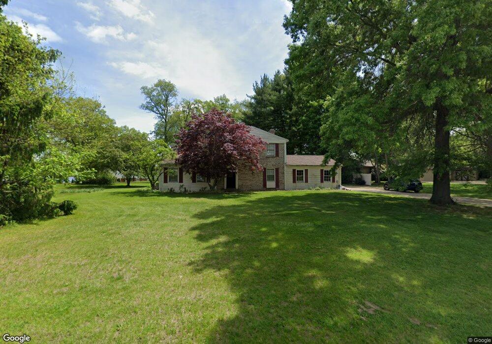
2048 Sandy Cove Dr Kalamazoo, MI 49048
Estimated Value: $290,000 - $327,000
3
Beds
2
Baths
1,888
Sq Ft
$164/Sq Ft
Est. Value
About This Home
This home is located at 2048 Sandy Cove Dr, Kalamazoo, MI 49048 and is currently estimated at $308,911, approximately $163 per square foot. 2048 Sandy Cove Dr is a home located in Kalamazoo County with nearby schools including Comstock Elementary School, Comstock Middle School, and Comstock High School.
Ownership History
Date
Name
Owned For
Owner Type
Purchase Details
Closed on
Feb 2, 2010
Sold by
Access First Federal Credit Union
Bought by
Connor Scott Joseph and Connor Terri Sue
Current Estimated Value
Home Financials for this Owner
Home Financials are based on the most recent Mortgage that was taken out on this home.
Original Mortgage
$108,000
Outstanding Balance
$71,692
Interest Rate
5.09%
Mortgage Type
New Conventional
Estimated Equity
$237,219
Purchase Details
Closed on
Apr 9, 2009
Sold by
Carl James A and Carl Elizabeth D
Bought by
Access First Federal Credit Union
Purchase Details
Closed on
May 10, 2005
Sold by
Dunfield Hiram A
Bought by
Carl James A and Carl Elizabeth D
Home Financials for this Owner
Home Financials are based on the most recent Mortgage that was taken out on this home.
Original Mortgage
$171,632
Interest Rate
6.05%
Mortgage Type
Fannie Mae Freddie Mac
Create a Home Valuation Report for This Property
The Home Valuation Report is an in-depth analysis detailing your home's value as well as a comparison with similar homes in the area
Home Values in the Area
Average Home Value in this Area
Purchase History
| Date | Buyer | Sale Price | Title Company |
|---|---|---|---|
| Connor Scott Joseph | $135,000 | Devon Title | |
| Access First Federal Credit Union | $235,305 | None Available | |
| Carl James A | $171,632 | Devon Title |
Source: Public Records
Mortgage History
| Date | Status | Borrower | Loan Amount |
|---|---|---|---|
| Open | Connor Scott Joseph | $108,000 | |
| Previous Owner | Carl James A | $171,632 |
Source: Public Records
Tax History Compared to Growth
Tax History
| Year | Tax Paid | Tax Assessment Tax Assessment Total Assessment is a certain percentage of the fair market value that is determined by local assessors to be the total taxable value of land and additions on the property. | Land | Improvement |
|---|---|---|---|---|
| 2025 | $4,448 | $127,800 | $0 | $0 |
| 2024 | $2,421 | $144,600 | $0 | $0 |
| 2023 | $2,308 | $128,700 | $0 | $0 |
| 2022 | $3,988 | $103,700 | $0 | $0 |
| 2021 | $3,879 | $114,400 | $0 | $0 |
| 2020 | $3,641 | $105,000 | $0 | $0 |
| 2019 | $3,367 | $99,600 | $0 | $0 |
| 2018 | $3,248 | $95,300 | $0 | $0 |
| 2017 | $0 | $90,200 | $0 | $0 |
| 2016 | -- | $89,200 | $0 | $0 |
| 2015 | -- | $79,800 | $12,600 | $67,200 |
| 2014 | -- | $79,800 | $0 | $0 |
Source: Public Records
Map
Nearby Homes
- 5581 E Main St
- 5452 Lucerne Ave
- 5590 Elaine Ave
- 2888 Clarice St
- 3016 Lyon Ave
- 5570 Angelo Ave
- 1226 Merry Brook St
- 5159 E Main St
- 1187 Merry Brook Dr
- 3052 Clarice St
- 5346 E H Ave
- 2612 Hunters Point
- 665 Shields St
- 2680 Hunters Point
- 3101 Sunnycrest Dr
- 2626 Hunters Point
- 2648 Hunters Point
- 2669 Hunters Bluff Unit L23
- 2924 Hunters Hill
- 2931 Hunters Hill
- 2064 Sandy Cove Dr
- 2016 Sandy Cove Dr
- 2016 Sandy Cove Dr
- 1980 Sandy Cove Dr
- 2077 Sandy Cove Dr
- 5890 Forest Harbor Dr
- 2083 Sandy Cove Dr
- 2015 Sandy Cove Dr
- 1983 Sandy Cove Dr
- 1942 Sandy Cove Dr
- 5843 Forest Harbor Dr
- 5800 Forest Harbor Dr
- 5889 Forest Harbor Dr
- 5867 Forest Harbor Dr
- 1951 Sandy Cove Dr
- 5855 Forest Harbor Dr
- 5833 Forest Harbor Dr
- 22 Forest Harbor Dr
- 1964 N 26th St
- 2050 N 26th St