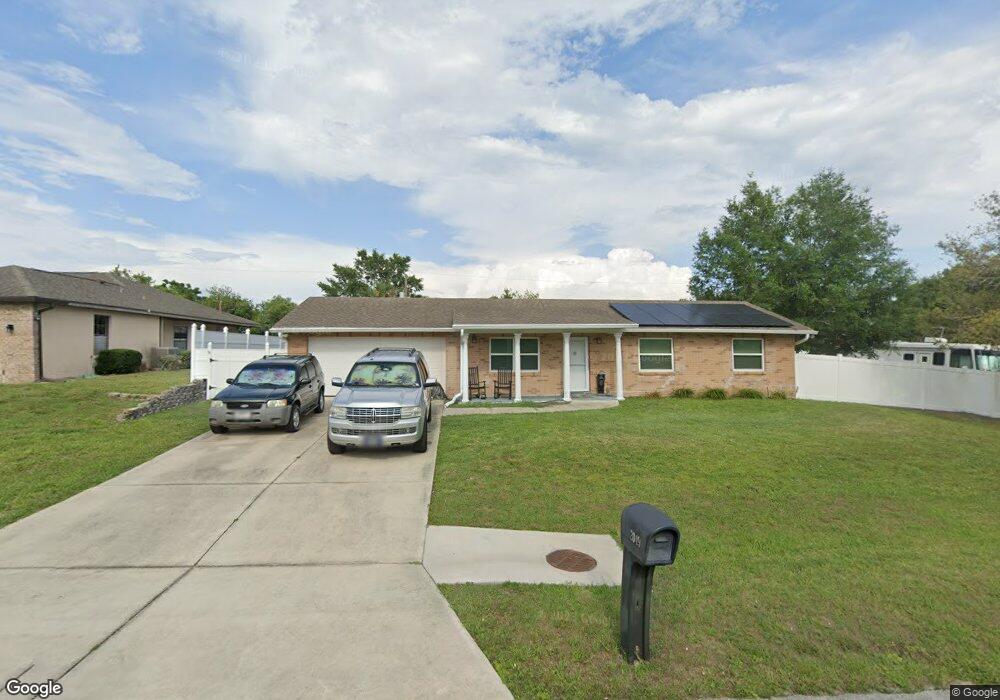
2049 Dalton Ave Deltona, FL 32725
Estimated Value: $248,000 - $279,000
3
Beds
2
Baths
1,050
Sq Ft
$251/Sq Ft
Est. Value
About This Home
This home is located at 2049 Dalton Ave, Deltona, FL 32725 and is currently estimated at $263,091, approximately $250 per square foot. 2049 Dalton Ave is a home located in Volusia County with nearby schools including Spirit Elementary School, Deltona Middle School, and Deltona High School.
Ownership History
Date
Name
Owned For
Owner Type
Purchase Details
Closed on
Jul 15, 1990
Bought by
Franklin Kenneth M and Franklin Patricia
Current Estimated Value
Purchase Details
Closed on
Dec 15, 1980
Bought by
Franklin Kenneth M and Franklin Patricia
Purchase Details
Closed on
Feb 15, 1978
Bought by
Franklin Kenneth M and Franklin Patricia
Purchase Details
Closed on
Oct 15, 1977
Bought by
Franklin Kenneth M and Franklin Patricia
Purchase Details
Closed on
Jun 15, 1971
Bought by
Franklin Kenneth M and Franklin Patricia
Create a Home Valuation Report for This Property
The Home Valuation Report is an in-depth analysis detailing your home's value as well as a comparison with similar homes in the area
Home Values in the Area
Average Home Value in this Area
Purchase History
| Date | Buyer | Sale Price | Title Company |
|---|---|---|---|
| Franklin Kenneth M | $75,000 | -- | |
| Franklin Kenneth M | $44,000 | -- | |
| Franklin Kenneth M | $28,200 | -- | |
| Franklin Kenneth M | $2,200 | -- | |
| Franklin Kenneth M | $1,200 | -- |
Source: Public Records
Tax History Compared to Growth
Tax History
| Year | Tax Paid | Tax Assessment Tax Assessment Total Assessment is a certain percentage of the fair market value that is determined by local assessors to be the total taxable value of land and additions on the property. | Land | Improvement |
|---|---|---|---|---|
| 2025 | $685 | $88,192 | -- | -- |
| 2024 | $685 | $85,707 | -- | -- |
| 2023 | $685 | $83,211 | $0 | $0 |
| 2022 | $593 | $66,844 | $0 | $0 |
| 2021 | $604 | $64,897 | $0 | $0 |
| 2020 | $605 | $64,001 | $0 | $0 |
| 2019 | $974 | $62,562 | $0 | $0 |
| 2018 | $963 | $61,395 | $0 | $0 |
| 2017 | $950 | $60,132 | $0 | $0 |
| 2016 | $937 | $58,895 | $0 | $0 |
| 2015 | $955 | $58,486 | $0 | $0 |
| 2014 | $931 | $58,022 | $0 | $0 |
Source: Public Records
Map
Nearby Homes
- 1108 Sherbrook Dr
- 918 N Atmore Cir
- 1025 Sullivan St
- 1019 Sullivan St
- 1030 Blue Horizon Dr
- 1022 Blue Horizon Dr
- 0 Elkcam Blvd Unit MFRV4942623
- 1170 Elkcam Blvd Unit 100
- 1171 Elkcam Blvd
- 1991 Tilburg Ave
- 2091 Oldham Ave
- 1940 Viking Ave
- 2030 Deborah Terrace
- 2040 Deborah Terrace
- 2050 Deborah Terrace
- 2250 E Union Cir
- 1245 Coronado Terrace
- 2297 E Fairbanks Dr
- 1940 S Old Mill Dr
- 1936 S Old Mill Dr
- 2053 Dalton Ave
- 2074 Dearing Ave
- 2068 Dearing Ave
- 2057 Dalton Ave
- 2041 Dalton Ave
- 2062 Dearing Ave
- 2054 Dalton Ave
- 2080 Dearing Ave
- 1018 Top Ct
- 2037 Dalton Ave Unit 8
- 2062 Dalton Ave
- 2061 Dalton Ave
- 2056 Dearing Ave
- 2046 Dalton Ave
- 2066 Dalton Ave
- 2067 Dearing Ave
- 2033 Dalton Ave
- 2073 Dearing Ave
- 2097 E Atmore Cir
- 2091 E Atmore Cir