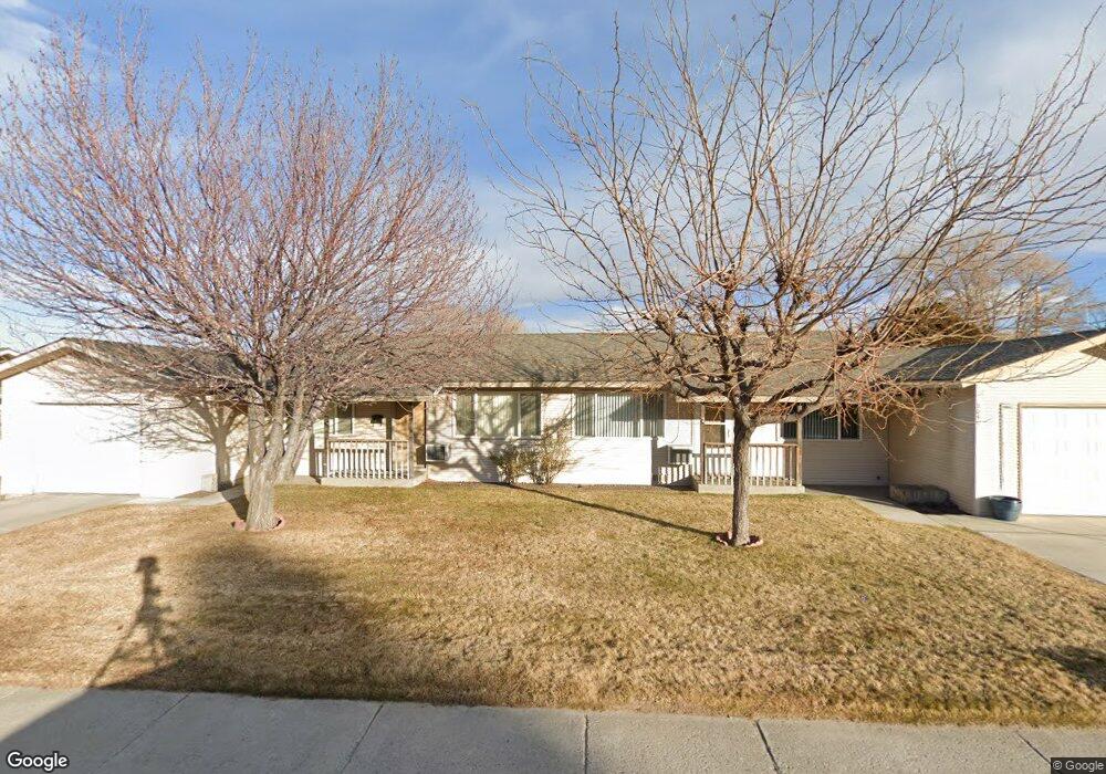
2049 S Roop St Carson City, NV 89701
Colorado Street NeighborhoodEstimated Value: $371,335 - $520,000
4
Beds
2
Baths
1,512
Sq Ft
$299/Sq Ft
Est. Value
About This Home
This home is located at 2049 S Roop St, Carson City, NV 89701 and is currently estimated at $451,584, approximately $298 per square foot. 2049 S Roop St is a home located in Carson City with nearby schools including J.C. Fremont Elementary School, Carson Middle School, and Carson High School.
Ownership History
Date
Name
Owned For
Owner Type
Purchase Details
Closed on
Dec 21, 2009
Sold by
Rapid Real Estate Solutions Llc
Bought by
Hiruak Bat Llc
Current Estimated Value
Purchase Details
Closed on
Aug 25, 2007
Sold by
Bringmann Gina Ginnetti
Bought by
Anaclario Timothy
Home Financials for this Owner
Home Financials are based on the most recent Mortgage that was taken out on this home.
Original Mortgage
$177,000
Interest Rate
7.75%
Mortgage Type
Purchase Money Mortgage
Create a Home Valuation Report for This Property
The Home Valuation Report is an in-depth analysis detailing your home's value as well as a comparison with similar homes in the area
Home Values in the Area
Average Home Value in this Area
Purchase History
| Date | Buyer | Sale Price | Title Company |
|---|---|---|---|
| Hiruak Bat Llc | $396,000 | Stewart Title Of Nevada | |
| Anaclario Timothy | $236,000 | First Centennial Title Co Nv |
Source: Public Records
Mortgage History
| Date | Status | Borrower | Loan Amount |
|---|---|---|---|
| Previous Owner | Anaclario Timothy | $177,000 |
Source: Public Records
Tax History Compared to Growth
Tax History
| Year | Tax Paid | Tax Assessment Tax Assessment Total Assessment is a certain percentage of the fair market value that is determined by local assessors to be the total taxable value of land and additions on the property. | Land | Improvement |
|---|---|---|---|---|
| 2025 | $1,246 | $41,704 | $22,050 | $19,654 |
| 2024 | $1,210 | $42,117 | $22,050 | $20,067 |
| 2023 | $1,175 | $39,181 | $22,050 | $17,131 |
| 2022 | $1,141 | $35,692 | $19,600 | $16,092 |
| 2021 | $1,057 | $34,036 | $18,550 | $15,486 |
| 2020 | $1,057 | $31,293 | $16,450 | $14,843 |
| 2019 | $982 | $30,887 | $16,450 | $14,437 |
| 2018 | $937 | $29,589 | $15,925 | $13,664 |
| 2017 | $900 | $27,828 | $14,700 | $13,128 |
| 2016 | $877 | $26,388 | $13,300 | $13,088 |
| 2015 | $875 | $25,414 | $12,320 | $13,094 |
| 2014 | $848 | $23,941 | $11,200 | $12,741 |
Source: Public Records
Map
Nearby Homes
- 612 Armory Ln
- 2600 Silver Sage Dr
- 901 Rolando Way
- 2281 Meadowbrook Ln
- 2369 Pintail Dr
- 1230 Quail Run Dr
- 1309 Quail Run Dr
- 3033 Doubletree Ln
- 125 Lake Glen Dr
- 1244 Fleetwood Ave
- 1475 Teal Dr
- 410 Dublin St
- 1001 Sonoma St
- 2454 Eastwood Dr
- 00 Sonoma St
- 1143 Fleetwood Ave
- 142 Lake Glen Dr
- 1140 S Curry St
- 850 Travis Dr Unit A
- 1120 S Curry St
- 2048 Hawaii Cir
- 2046 Hawaii Cir
- 2077 S Roop St
- 2021 S Roop St
- 2074 Hawaii Cir
- 2020 Hawaii Cir
- 2018 2020 Hawaii
- 2079 Sheffield Manor E
- 495 Industrial Park Dr
- 2045 Hawaii Cir
- 2073 Hawaii Cir
- 2101 S Roop St
- 2017 and 2019 Hawaii Cir
- 2017 Hawaii Cir
- 2074 Sheffield Manor E
- 2073 Sheffield Manor E
- 2102 S Roop St
- 467 Industrial Park Dr
- 465 Industrial Park Dr
- 2050 Utah St