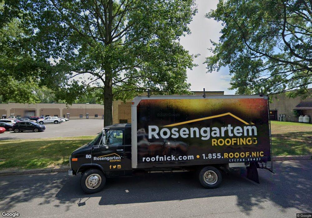
2049 Stout Dr Unit A5 Warminster, PA 18974
Estimated Value: $446,170
--
Bed
--
Bath
3,648
Sq Ft
$122/Sq Ft
Est. Value
About This Home
This home is located at 2049 Stout Dr Unit A5, Warminster, PA 18974 and is currently estimated at $446,170, approximately $122 per square foot. 2049 Stout Dr Unit A5 is a home located in Bucks County with nearby schools including Warwick Elementary School, Holicong Middle School, and Central Bucks High School - East.
Ownership History
Date
Name
Owned For
Owner Type
Purchase Details
Closed on
Oct 10, 2023
Sold by
Beaver Realty Investments Llc
Bought by
2049A5 Llc
Current Estimated Value
Home Financials for this Owner
Home Financials are based on the most recent Mortgage that was taken out on this home.
Original Mortgage
$150,000
Interest Rate
7.12%
Mortgage Type
Seller Take Back
Purchase Details
Closed on
Jul 8, 2022
Sold by
Anatol Nisen
Bought by
Beaver Realty Investments Llc
Purchase Details
Closed on
Dec 15, 1995
Sold by
Christopher Swank William and Christopher Descarennes
Bought by
Nisen Anatol and Nisen Natalia
Create a Home Valuation Report for This Property
The Home Valuation Report is an in-depth analysis detailing your home's value as well as a comparison with similar homes in the area
Home Values in the Area
Average Home Value in this Area
Purchase History
| Date | Buyer | Sale Price | Title Company |
|---|---|---|---|
| 2049A5 Llc | $399,000 | My Title Pro | |
| Beaver Realty Investments Llc | $310,000 | Land Services Usa | |
| Nisen Anatol | $135,000 | -- |
Source: Public Records
Mortgage History
| Date | Status | Borrower | Loan Amount |
|---|---|---|---|
| Closed | 2049A5 Llc | $150,000 | |
| Open | 2049A5 Llc | $260,000 |
Source: Public Records
Tax History Compared to Growth
Tax History
| Year | Tax Paid | Tax Assessment Tax Assessment Total Assessment is a certain percentage of the fair market value that is determined by local assessors to be the total taxable value of land and additions on the property. | Land | Improvement |
|---|---|---|---|---|
| 2025 | $5,702 | $32,760 | -- | $32,760 |
| 2024 | $5,702 | $32,760 | $0 | $32,760 |
| 2023 | $5,521 | $32,760 | $0 | $32,760 |
| 2022 | $5,460 | $32,760 | $0 | $32,760 |
| 2021 | $5,399 | $32,760 | $0 | $32,760 |
| 2020 | $5,399 | $32,760 | $0 | $32,760 |
| 2019 | $5,366 | $32,760 | $0 | $32,760 |
| 2018 | $5,366 | $32,760 | $0 | $32,760 |
| 2017 | $5,325 | $32,760 | $0 | $32,760 |
| 2016 | $5,325 | $32,760 | $0 | $32,760 |
| 2015 | -- | $32,760 | $0 | $32,760 |
| 2014 | -- | $32,760 | $0 | $32,760 |
Source: Public Records
Map
Nearby Homes
- 902 Hamilton Way
- 921 Nathaniel Trail
- 934 Nathaniel Trail
- 950 Nathaniel Trail
- 451 Twin Streams Dr
- 115 Grandview Dr
- 1008 Julian Dr W Unit W
- 202 Strawberry Ct Unit 249
- 1306 Gabriel Ln
- 1229 Manor Dr
- 1240 June Rd
- 9 Spring Mill Dr
- 11 Spring Mill Dr
- 1252 Dahlia Rd
- 667 Arbor Ln
- 8 Lacey Ln
- 21 Spring Mill Dr Unit 12
- 18 Lacey Ln
- 875 W Bristol Rd
- The Addis Plan at The Reserve at Spring Mill
- 2049 Stout Dr Unit B1
- 2049 Stout Dr Unit B2&B3
- 2049 Stout Dr Unit A4
- 2049 Stout Dr Unit B2
- 2049 Stout Dr Unit B3
- 2049 Stout Dr Unit BI
- 680 Sycamore Dr
- 1635 Mearns Rd
- 1730 Stout Dr Unit 4
- 1730 Stout Dr
- 1979 Stout Dr Unit 2
- 1979 Stout Dr Unit 6
- 1979 Stout Dr Unit 4
- 1701 Mearns Rd
- 1965 Stout Dr
- 1550 Mearns Rd
- 1759 Stout Dr
- 1804 Stout Dr
- 1900 Stout Dr Unit 4
- 1796 Stout Dr
