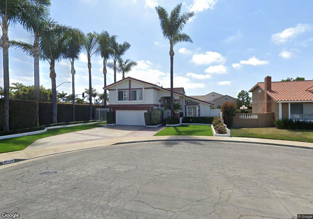
20491 Castle Rock Cir Huntington Beach, CA 92646
Southeast NeighborhoodEstimated Value: $1,455,275 - $1,666,000
4
Beds
3
Baths
1,939
Sq Ft
$826/Sq Ft
Est. Value
About This Home
This home is located at 20491 Castle Rock Cir, Huntington Beach, CA 92646 and is currently estimated at $1,601,319, approximately $825 per square foot. 20491 Castle Rock Cir is a home located in Orange County with nearby schools including Ralph E. Hawes Elementary School, Isaac L. Sowers Middle School, and Edison High School.
Ownership History
Date
Name
Owned For
Owner Type
Purchase Details
Closed on
Aug 27, 2015
Sold by
Shea Douglas M
Bought by
Shea Douglas M and The Douglas Michael Shea Living Trust
Current Estimated Value
Purchase Details
Closed on
Aug 15, 1997
Sold by
Naff George J and Naff Delphine Delphine
Bought by
Shea Douglas M
Home Financials for this Owner
Home Financials are based on the most recent Mortgage that was taken out on this home.
Original Mortgage
$220,000
Outstanding Balance
$32,137
Interest Rate
7.25%
Estimated Equity
$1,569,182
Purchase Details
Closed on
Feb 19, 1997
Sold by
Naff George J and Naff Delphine Delphine
Bought by
Naff George J and Naff Delphine
Create a Home Valuation Report for This Property
The Home Valuation Report is an in-depth analysis detailing your home's value as well as a comparison with similar homes in the area
Home Values in the Area
Average Home Value in this Area
Purchase History
| Date | Buyer | Sale Price | Title Company |
|---|---|---|---|
| Shea Douglas M | -- | None Available | |
| Shea Douglas M | $275,000 | Benefit Land Title Company | |
| Naff George J | -- | -- |
Source: Public Records
Mortgage History
| Date | Status | Borrower | Loan Amount |
|---|---|---|---|
| Open | Shea Douglas M | $220,000 | |
| Closed | Shea Douglas M | $27,500 |
Source: Public Records
Tax History Compared to Growth
Tax History
| Year | Tax Paid | Tax Assessment Tax Assessment Total Assessment is a certain percentage of the fair market value that is determined by local assessors to be the total taxable value of land and additions on the property. | Land | Improvement |
|---|---|---|---|---|
| 2025 | $3,266 | $439,094 | $270,406 | $168,688 |
| 2024 | $3,266 | $430,485 | $265,104 | $165,381 |
| 2023 | $3,249 | $422,045 | $259,906 | $162,139 |
| 2022 | $3,250 | $413,770 | $254,810 | $158,960 |
| 2021 | $3,186 | $405,657 | $249,813 | $155,844 |
| 2020 | $3,195 | $401,498 | $247,251 | $154,247 |
| 2019 | $4,636 | $393,626 | $242,403 | $151,223 |
| 2018 | $4,564 | $385,908 | $237,650 | $148,258 |
| 2017 | $4,502 | $378,342 | $232,991 | $145,351 |
| 2016 | $4,306 | $370,924 | $228,423 | $142,501 |
| 2015 | $4,263 | $365,353 | $224,992 | $140,361 |
| 2014 | $4,172 | $358,197 | $220,585 | $137,612 |
Source: Public Records
Map
Nearby Homes
- 9522 Yellowstone Dr
- 9812 La Cresta Cir
- 20862 Lancelot Ln
- 20392 Redwood Ln
- 20071 Moontide Cir
- 20111 Marina Ln
- 20258 Lantana Dr
- 10101 Theseus Dr
- 9695 Adams Ave
- 19901 Burnley Ln
- 9221 Belcaro Dr
- 9667 Durham Dr
- 8932 Amador Cir Unit 1309B
- 9001 Oceanwood Dr
- 10172 Stonybrook Dr
- 19846 Lures Ln
- 19854 Leighton Ln
- 9745 Cornwall Dr
- 9594 Pettswood Dr Unit 4
- 20442 Craimer Ln
- 20471 Castle Rock Cir
- 20461 Castle Rock Cir
- 20492 Castle Rock Cir
- 9511 Caithness Dr
- 20472 Castle Rock Cir
- 9521 Caithness Dr
- 20462 Castle Rock Cir
- 20451 Castle Rock Cir
- 20502 Montauk Cir
- 20452 Castle Rock Cir
- 9531 Caithness Dr
- 20491 Clearwood Cir
- 20471 Clearwood Cir
- 9472 Coastland Dr
- 20441 Castle Rock Cir
- 20522 Montauk Cir
- 20461 Clearwood Cir
- 20442 Castle Rock Cir
- 9541 Caithness Dr
- 9452 Coastland Dr