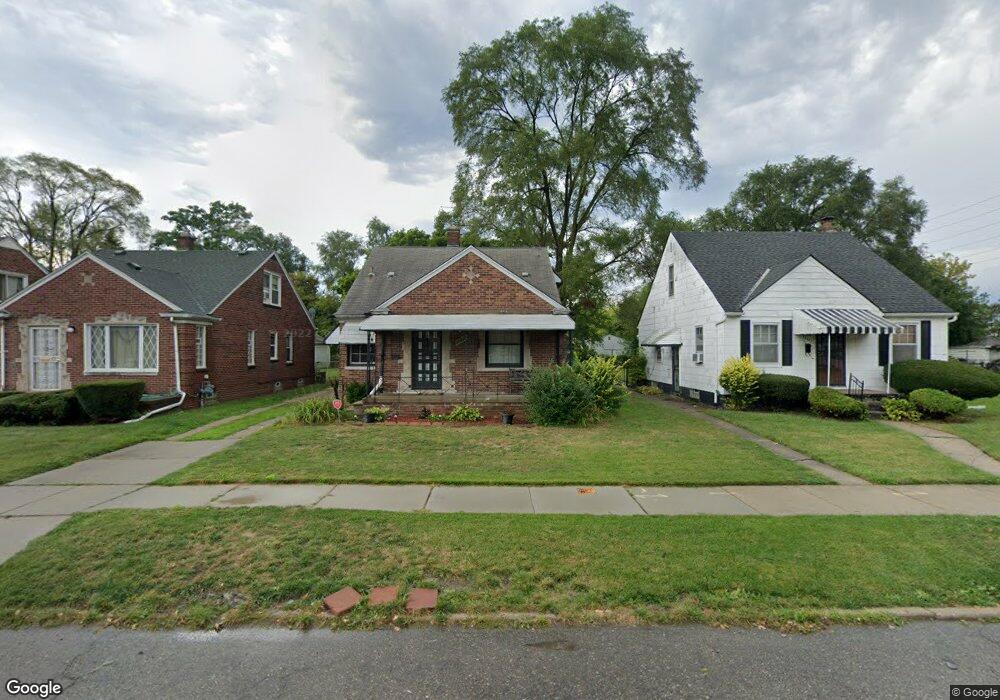
20491 Rogge St Detroit, MI 48234
Sherwood NeighborhoodEstimated Value: $64,000 - $96,000
--
Bed
1
Bath
1,154
Sq Ft
$71/Sq Ft
Est. Value
About This Home
This home is located at 20491 Rogge St, Detroit, MI 48234 and is currently estimated at $81,907, approximately $70 per square foot. 20491 Rogge St is a home located in Wayne County with nearby schools including Marion Law Academy, Edward 'Duke' Ellington Conservatory of Music and Art, and Charles L. Spain Elementary-Middle School.
Ownership History
Date
Name
Owned For
Owner Type
Purchase Details
Closed on
Jul 29, 1994
Sold by
Est Bernice Michals
Bought by
Ronald Riggs
Current Estimated Value
Home Financials for this Owner
Home Financials are based on the most recent Mortgage that was taken out on this home.
Original Mortgage
$29,350
Interest Rate
8.53%
Mortgage Type
New Conventional
Create a Home Valuation Report for This Property
The Home Valuation Report is an in-depth analysis detailing your home's value as well as a comparison with similar homes in the area
Home Values in the Area
Average Home Value in this Area
Purchase History
| Date | Buyer | Sale Price | Title Company |
|---|---|---|---|
| Ronald Riggs | $30,900 | -- |
Source: Public Records
Mortgage History
| Date | Status | Borrower | Loan Amount |
|---|---|---|---|
| Closed | Ronald Riggs | $29,350 |
Source: Public Records
Tax History Compared to Growth
Tax History
| Year | Tax Paid | Tax Assessment Tax Assessment Total Assessment is a certain percentage of the fair market value that is determined by local assessors to be the total taxable value of land and additions on the property. | Land | Improvement |
|---|---|---|---|---|
| 2025 | $1,000 | $37,300 | $0 | $0 |
| 2024 | $1,000 | $31,600 | $0 | $0 |
| 2023 | $970 | $25,500 | $0 | $0 |
| 2022 | $1,030 | $20,800 | $0 | $0 |
| 2021 | $1,129 | $15,000 | $0 | $0 |
| 2020 | $941 | $14,400 | $0 | $0 |
| 2019 | $1,264 | $11,300 | $0 | $0 |
| 2018 | $877 | $9,800 | $0 | $0 |
| 2017 | $154 | $8,100 | $0 | $0 |
| 2016 | $1,477 | $25,300 | $0 | $0 |
| 2015 | $1,640 | $16,400 | $0 | $0 |
| 2013 | $1,634 | $20,422 | $0 | $0 |
| 2010 | -- | $29,941 | $1,080 | $28,861 |
Source: Public Records
Map
Nearby Homes
- 20400 Packard St
- 20485 Helen St
- 7052 Rivard Ave
- 20185 Carrie St
- 20170 Carrie St
- 20466 Spencer St
- 20514 Concord St
- 20151 Carrie St
- 7003 Rivard Ave
- 20161 Helen St
- 20215 Stotter St
- 7029 Jackson Ave
- 20043 Packard St
- 20124 Spencer St
- 20035 Carrie St
- 7534 Fisher Ave
- 19987 Carrie St
- 7028 Yacht Ave
- 20000 Concord St
- 20009 Concord St
- 20501 Rogge St
- 20509 Rogge St
- 20483 Rogge St
- 20475 Rogge St
- 20515 Rogge St
- 20490 Carrie St
- 20484 Carrie St
- 20500 Carrie St
- 20467 Rogge St
- 20459 Rogge St
- 20525 Rogge St
- 20474 Carrie St
- 20508 Carrie St
- 20488 Rogge St
- 20494 Rogge St
- 20466 Carrie St
- 20516 Carrie St
- 20500 Rogge St
- 20451 Rogge St
- 20531 Rogge St