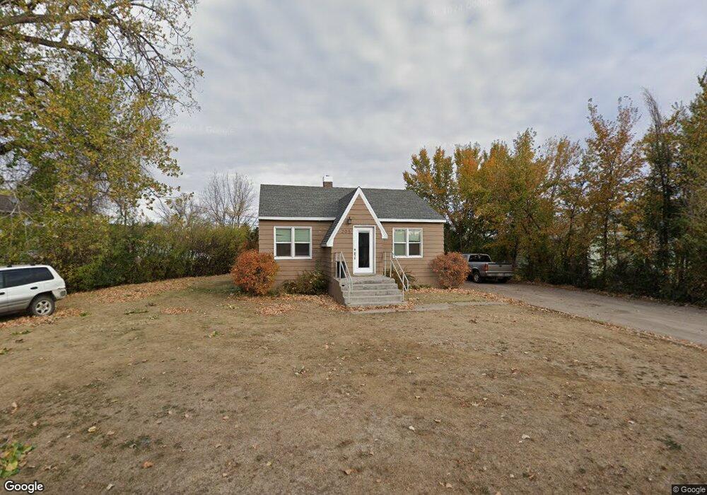
205 10th Ave SW Great Falls, MT 59404
Estimated Value: $181,000 - $257,033
2
Beds
1
Bath
1,722
Sq Ft
$135/Sq Ft
Est. Value
About This Home
This home is located at 205 10th Ave SW, Great Falls, MT 59404 and is currently estimated at $233,008, approximately $135 per square foot. 205 10th Ave SW is a home located in Cascade County with nearby schools including West Elementary School, North Middle School, and C.M. Russell High School.
Ownership History
Date
Name
Owned For
Owner Type
Purchase Details
Closed on
May 11, 2018
Sold by
Carpenter Ronald M
Bought by
Cooper Christine and Cooper Patrick E
Current Estimated Value
Home Financials for this Owner
Home Financials are based on the most recent Mortgage that was taken out on this home.
Original Mortgage
$99,000
Outstanding Balance
$86,145
Interest Rate
4.87%
Mortgage Type
Adjustable Rate Mortgage/ARM
Estimated Equity
$146,863
Create a Home Valuation Report for This Property
The Home Valuation Report is an in-depth analysis detailing your home's value as well as a comparison with similar homes in the area
Home Values in the Area
Average Home Value in this Area
Purchase History
| Date | Buyer | Sale Price | Title Company |
|---|---|---|---|
| Cooper Christine | -- | Chicago Title |
Source: Public Records
Mortgage History
| Date | Status | Borrower | Loan Amount |
|---|---|---|---|
| Open | Cooper Christine | $99,000 |
Source: Public Records
Tax History Compared to Growth
Tax History
| Year | Tax Paid | Tax Assessment Tax Assessment Total Assessment is a certain percentage of the fair market value that is determined by local assessors to be the total taxable value of land and additions on the property. | Land | Improvement |
|---|---|---|---|---|
| 2025 | $1,082 | $205,100 | $0 | $0 |
| 2024 | $1,980 | $182,600 | $0 | $0 |
| 2023 | $1,937 | $182,600 | $0 | $0 |
| 2022 | $1,663 | $139,300 | $0 | $0 |
| 2021 | $1,473 | $139,300 | $0 | $0 |
| 2020 | $1,492 | $119,500 | $0 | $0 |
| 2019 | $1,428 | $119,500 | $0 | $0 |
| 2018 | $1,317 | $107,100 | $0 | $0 |
| 2017 | $1,252 | $107,100 | $0 | $0 |
| 2016 | $1,187 | $107,400 | $0 | $0 |
| 2015 | $1,032 | $107,400 | $0 | $0 |
| 2014 | $1,056 | $48,919 | $0 | $0 |
Source: Public Records
Map
Nearby Homes
- 1536 Meadowlark Dr Unit 9B
- 1536 Meadowlark Dr Unit 10B
- 1536 Meadowlark Dr Unit 1B
- TBD U S Highway 89
- 1540 Meadowlark Dr Unit A42
- 513 4th St S
- 319 3rd Ave SW
- 222 13th Ave S Unit 4
- 300 14th Ave S Unit 2
- 15 18th Ave S
- 424 8th Ave S
- 711 4th Ave SW
- 236 17th Ave S
- 421 1st Ave SW
- 726 2nd Ave SW
- 1927 Elm Ct
- 625 5th Ave S
- 110 9th St SW
- 320 20th Ave S Unit A
- 2212 Beech Dr
- 203 10th Ave SW
- 207 10th Ave SW
- 202 10th Ave SW
- 201 10th Ave SW
- 208 10th Ave SW
- 204 10th Ave SW
- 211 10th Avenue South W
- 211 10th Ave SW
- 910 2nd St SW
- 313 10th Ave SW
- 927 2nd St SW
- 310 10th Ave SW
- 212 10th Ave SW
- 200 10th Ave SW
- 200 10th Ave SW
- 200-200.1 10th Ave SW
- 900 2nd St SW
- 915 2nd St SW
- 300 9th Ave SW