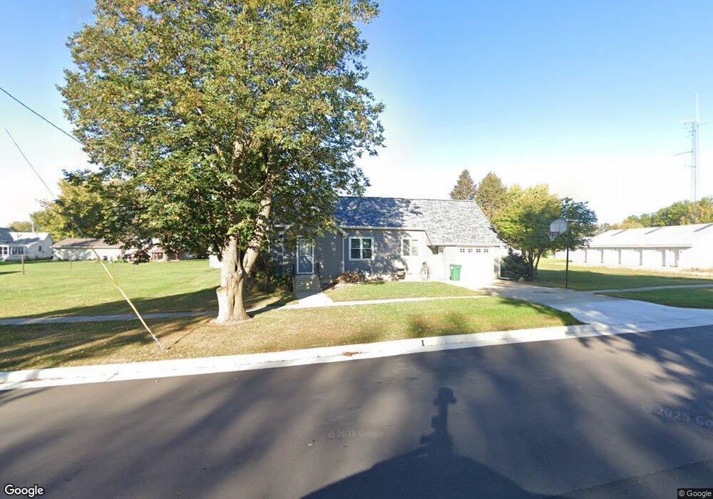
205 1st St SW Grand Meadow, MN 55936
Estimated Value: $173,726 - $221,000
3
Beds
2
Baths
1,464
Sq Ft
$128/Sq Ft
Est. Value
About This Home
This home is located at 205 1st St SW, Grand Meadow, MN 55936 and is currently estimated at $187,182, approximately $127 per square foot. 205 1st St SW is a home located in Mower County with nearby schools including Grand Meadow Middle School.
Ownership History
Date
Name
Owned For
Owner Type
Purchase Details
Closed on
Apr 20, 2021
Sold by
Davis Linda L
Bought by
Reeves Gregory W
Current Estimated Value
Home Financials for this Owner
Home Financials are based on the most recent Mortgage that was taken out on this home.
Original Mortgage
$121,500
Outstanding Balance
$109,700
Interest Rate
3%
Mortgage Type
New Conventional
Estimated Equity
$77,482
Purchase Details
Closed on
Sep 14, 2010
Sold by
Davis Raymond F and Davis Linda L
Bought by
Davis Raymond F and Davis Linda L
Create a Home Valuation Report for This Property
The Home Valuation Report is an in-depth analysis detailing your home's value as well as a comparison with similar homes in the area
Home Values in the Area
Average Home Value in this Area
Purchase History
| Date | Buyer | Sale Price | Title Company |
|---|---|---|---|
| Reeves Gregory W | $135,000 | None Available | |
| Davis Raymond F | -- | None Available |
Source: Public Records
Mortgage History
| Date | Status | Borrower | Loan Amount |
|---|---|---|---|
| Open | Reeves Gregory W | $121,500 |
Source: Public Records
Tax History Compared to Growth
Tax History
| Year | Tax Paid | Tax Assessment Tax Assessment Total Assessment is a certain percentage of the fair market value that is determined by local assessors to be the total taxable value of land and additions on the property. | Land | Improvement |
|---|---|---|---|---|
| 2025 | $3,286 | $132,300 | $35,000 | $97,300 |
| 2024 | $3,286 | $146,600 | $35,000 | $111,600 |
| 2023 | $3,256 | $159,700 | $35,000 | $124,700 |
| 2022 | $1,406 | $140,500 | $35,000 | $105,500 |
| 2021 | $926 | $102,100 | $21,900 | $80,200 |
| 2020 | $932 | $69,500 | $16,900 | $52,600 |
| 2018 | $400 | $65,000 | $16,900 | $48,100 |
| 2017 | $800 | $0 | $0 | $0 |
| 2016 | $790 | $0 | $0 | $0 |
| 2015 | $968 | $0 | $0 | $0 |
| 2012 | $968 | $0 | $0 | $0 |
Source: Public Records
Map
Nearby Homes
- 117 1st St NW
- 309 2nd Ct SE
- 304 1st St NW
- 213 2nd St NE
- TBD 1st Ave SE
- 213 5th St NE
- 405 4th St NE
- 119 Brittany Way SE
- 101 Brittany Way SE
- Blk 1 lot 7 Glynn Ave SE
- 527 Elliot Dr SE
- Block 2 Lot 6 Glynn Ave SE
- 25635 739th Ave
- XXX 257th St
- xxx 739th Ave
- xxx 265th St
- 79275 267th St
- xxx 785th Ave
- TBD N Pine St
- 28420 785th Ave
- 213 1st St SW
- 112 1st Ave SW
- 204 1st St SW
- 208 2nd St SW
- 116 1st Ave SW
- 116 1st Ave SW
- 212 2nd St SW
- 213 213 2nd-Street-sw
- 212 212 2nd-Street-sw
- 216 2nd St SW
- 221 221 2nd-Street-sw
- 217 2nd St SW
- 212 1st St SW
- 207 2nd St SW
- 213 2nd St SW
- 216 1st St SW
- 225 1st St SW
- 225 1st St SW
- 221 2nd St SW
- 225 2nd St SW