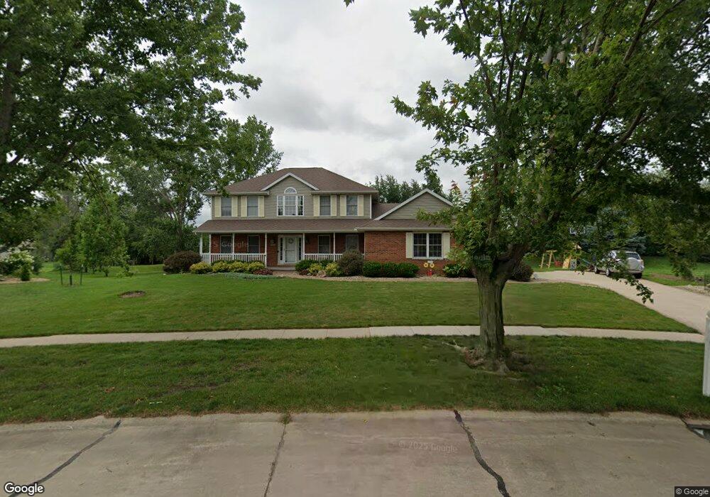
205 Amy Dr Robins, IA 52328
Estimated Value: $399,000 - $422,000
5
Beds
4
Baths
3,012
Sq Ft
$135/Sq Ft
Est. Value
About This Home
This home is located at 205 Amy Dr, Robins, IA 52328 and is currently estimated at $408,109, approximately $135 per square foot. 205 Amy Dr is a home located in Linn County with nearby schools including Nixon Elementary School, Harding Middle School, and John F. Kennedy High School.
Ownership History
Date
Name
Owned For
Owner Type
Purchase Details
Closed on
Jan 15, 2026
Sold by
Kaiser Haley D and Kaiser Kyle A
Bought by
Halverson Samantha N and Halverson William R
Current Estimated Value
Home Financials for this Owner
Home Financials are based on the most recent Mortgage that was taken out on this home.
Original Mortgage
$374,950
Outstanding Balance
$374,950
Interest Rate
6.21%
Mortgage Type
New Conventional
Estimated Equity
$33,159
Purchase Details
Closed on
Jun 24, 2020
Sold by
Richardson Diane M
Bought by
Kaiser Haley D and Kaiser Kyle A
Home Financials for this Owner
Home Financials are based on the most recent Mortgage that was taken out on this home.
Original Mortgage
$261,000
Interest Rate
3.2%
Mortgage Type
New Conventional
Purchase Details
Closed on
May 22, 2000
Sold by
Smith Delbert W and Smith Patricia M
Bought by
Richardson Diane M
Home Financials for this Owner
Home Financials are based on the most recent Mortgage that was taken out on this home.
Original Mortgage
$131,500
Interest Rate
8.13%
Purchase Details
Closed on
Jan 15, 1998
Sold by
Wood Donald E and Wood Constance P
Bought by
Smith Delbert W and Smith Patricia M
Create a Home Valuation Report for This Property
The Home Valuation Report is an in-depth analysis detailing your home's value as well as a comparison with similar homes in the area
Home Values in the Area
Average Home Value in this Area
Purchase History
| Date | Buyer | Sale Price | Title Company |
|---|---|---|---|
| Halverson Samantha N | $395,000 | River Ridge Escrow | |
| Kaiser Haley D | $290,000 | Hawkeye Escrow Company | |
| Richardson Diane M | -- | -- | |
| Richardson Diane M | $231,000 | -- | |
| Smith Delbert W | $215,500 | -- |
Source: Public Records
Mortgage History
| Date | Status | Borrower | Loan Amount |
|---|---|---|---|
| Open | Halverson Samantha N | $374,950 | |
| Previous Owner | Kaiser Haley D | $261,000 | |
| Previous Owner | Richardson Diane M | $131,500 | |
| Previous Owner | Richardson Diane M | $126,000 |
Source: Public Records
Tax History
| Year | Tax Paid | Tax Assessment Tax Assessment Total Assessment is a certain percentage of the fair market value that is determined by local assessors to be the total taxable value of land and additions on the property. | Land | Improvement |
|---|---|---|---|---|
| 2025 | $4,898 | $378,500 | $46,600 | $331,900 |
| 2024 | $5,128 | $377,600 | $46,600 | $331,000 |
| 2023 | $5,128 | $373,400 | $46,600 | $326,800 |
| 2022 | $5,460 | $345,400 | $46,600 | $298,800 |
| 2021 | $5,268 | $345,400 | $46,600 | $298,800 |
| 2020 | $5,268 | $309,700 | $46,600 | $263,100 |
| 2019 | $4,808 | $288,400 | $46,600 | $241,800 |
| 2018 | $4,726 | $288,400 | $46,600 | $241,800 |
| 2017 | $4,718 | $274,200 | $46,600 | $227,600 |
| 2016 | $4,718 | $274,200 | $46,600 | $227,600 |
| 2015 | $4,732 | $274,200 | $46,600 | $227,600 |
| 2014 | $4,582 | $274,200 | $46,600 | $227,600 |
| 2013 | $4,478 | $274,200 | $46,600 | $227,600 |
Source: Public Records
Map
Nearby Homes
- 39.69 Acres M L Center Point Rd
- 8.98 Acres M L N Center Point Rd
- 28.72 Acres N Center Point Rd
- 70.78 Acres M L Quass Rd
- 165 Timber Ln
- 345 Dutch Dr
- 625 Freeseway Dr
- 8932 Norway Dr NE
- 3230 N Center Point Rd Unit Lot 3
- 1105 Maple St
- 8809 Middlebury Ct NE
- 620 Hampton St
- 570 Hampton St
- 540 Hampton St
- 560 Hampton St
- 590 Hampton St
- 600 Hampton St
- 500 Hampton St
- 545 Hampton St
- 580 Hampton St
Your Personal Tour Guide
Ask me questions while you tour the home.