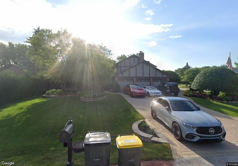
205 Brian Ln Prospect Heights, IL 60070
Estimated Value: $728,154 - $756,000
4
Beds
4
Baths
2,910
Sq Ft
$256/Sq Ft
Est. Value
About This Home
This home is located at 205 Brian Ln, Prospect Heights, IL 60070 and is currently estimated at $744,539, approximately $255 per square foot. 205 Brian Ln is a home located in Cook County with nearby schools including Frost Elementary School, Oliver W Holmes Middle School, and Wheeling High School.
Ownership History
Date
Name
Owned For
Owner Type
Purchase Details
Closed on
Nov 13, 1997
Sold by
Flood James P and Flood Julie A
Bought by
Flood Julie A and The Julie A Flood Trust
Current Estimated Value
Purchase Details
Closed on
Jul 29, 1997
Sold by
Pasco Carl E
Bought by
Flood James P and Flood Julie A
Home Financials for this Owner
Home Financials are based on the most recent Mortgage that was taken out on this home.
Original Mortgage
$387,000
Interest Rate
7.85%
Create a Home Valuation Report for This Property
The Home Valuation Report is an in-depth analysis detailing your home's value as well as a comparison with similar homes in the area
Home Values in the Area
Average Home Value in this Area
Purchase History
| Date | Buyer | Sale Price | Title Company |
|---|---|---|---|
| Flood Julie A | -- | -- | |
| Flood James P | $286,666 | Attorneys Natl Title Network |
Source: Public Records
Mortgage History
| Date | Status | Borrower | Loan Amount |
|---|---|---|---|
| Previous Owner | Flood James P | $387,000 |
Source: Public Records
Tax History Compared to Growth
Tax History
| Year | Tax Paid | Tax Assessment Tax Assessment Total Assessment is a certain percentage of the fair market value that is determined by local assessors to be the total taxable value of land and additions on the property. | Land | Improvement |
|---|---|---|---|---|
| 2024 | $16,547 | $47,617 | $16,246 | $31,371 |
| 2023 | $15,556 | $47,617 | $16,246 | $31,371 |
| 2022 | $15,556 | $47,617 | $16,246 | $31,371 |
| 2021 | $16,039 | $42,476 | $10,154 | $32,322 |
| 2020 | $15,653 | $42,476 | $10,154 | $32,322 |
| 2019 | $15,723 | $47,460 | $10,154 | $37,306 |
| 2018 | $19,087 | $51,785 | $8,630 | $43,155 |
| 2017 | $18,912 | $51,785 | $8,630 | $43,155 |
| 2016 | $18,017 | $51,785 | $8,630 | $43,155 |
| 2015 | $17,833 | $47,579 | $7,615 | $39,964 |
| 2014 | $17,620 | $47,579 | $7,615 | $39,964 |
| 2013 | $16,434 | $47,579 | $7,615 | $39,964 |
Source: Public Records
Map
Nearby Homes
- 703 Newcastle Ln
- 203 Coldren Dr
- 688 Glasgow Ln Unit 121133
- 109 Rob Roy Ln Unit C
- 206 E Camp Mcdonald Rd
- 509 Aberdeen Ln Unit C
- 501 Aberdeen Ln Unit C
- 212 Country Club Dr Unit 198
- 161 Lucerne Ct Unit 111713
- 302 Lonsdale Rd
- 1655 Geneva Dr Unit 43714
- 150 Lucerne Ct Unit 51713
- 505 N Maple St
- 603 Thistle Ln Unit 16185
- 763 Sussex Corner Ln Unit 15
- 1575 Sandpebble Dr Unit 226
- 1550 Sandpebble Dr Unit 209
- 1205 E Camp Mcdonald Rd
- 1214 N Crabtree Ln
- 1525 Sander Ct Unit 103